


novy03

 Visorando Member
 Premium user
 - Gender: man
Sign up:
Published route(s)
 Mont Seigne
 4.91 mi
 +722 ft
 -722 ft
 2h 55
2h 55
 Moderate
 Departure from Saint-Laurent-de-Lévézou (Aveyron)
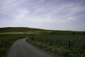
The Haut Lévézou seen from the summit of Mont Seigne (1121m). You will have a 360° view of the Monts d'Aubrac, Mont Lozère, the Cévennes, the Causses, the Monts de l'Espinouse... To get there, take the district roads and dirt tracks used by farmers and foresters. At the summit, an orientation table will give you all the information you need on a 360° view.
Le Gourcet stream route
 8.09 mi
+1,030 ft
-1,030 ft
4h 35
Moderate
Departure from Saint-Yorre (Allier)
8.09 mi
+1,030 ft
-1,030 ft
4h 35
Moderate
Departure from Saint-Yorre (Allier)
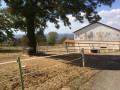
A very pleasant route in all seasons. You’ll walk through wooded sections at the bottom of the valley, accompanied by the babbling of the stream, as well as open sections offering views of the Monts Dômes to the west and the Montagne Bourbonnaise to the east.The sections near the monument to the 11 Martyrs of La Goutte Grandval and Busset Castle lend this route a historical charm.
Coupe-Gorge and Fonds de Fer route
 6.05 mi
+843 ft
-823 ft
3h 30
6.05 mi
+843 ft
-823 ft
3h 30
 Easy
Departure from Saint-Yorre (Allier)
Easy
Departure from Saint-Yorre (Allier)
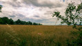
A lovely walk for those who enjoy combining walking with nature observation. Starting from Saint-Yorre, walk through the pleasant undergrowth following the course of the Andraux stream, then around the Coupe-Gorge and Fonts de Fer stream basins. Open views over the Monts Dômes, the Vichy plain and the Vernet hill.
Left bank of the Allier in the Saint-Priest-Bramefant plain
 5.93 mi
+16 ft
-16 ft
2h 45
Easy
Departure from Saint-Yorre (Allier)
5.93 mi
+16 ft
-16 ft
2h 45
Easy
Departure from Saint-Yorre (Allier)
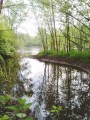
A very pleasant walk to do alone or with the family. If you enjoy observing nature and listening to its calm, you will be in your element. You will walk at varying distances from the course of the River Allier and its former meander, skirting a magnificent stretch of water with a variety of flora and fauna. Part of the route runs through cultivated land. There is no tarmac except for a few metres at the finish.