


Nalle

 Visorando Member
 Premium user
 Sign up:
Published route(s)
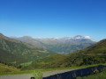
 Loop trail between the Aure and Louron valleys
 7.98 mi
 +1,535 ft
 -1,519 ft
 5h 00
5h 00
 Moderate
 Departure from Azet (Hautes-Pyrénées)
A simple hike with an almost continuous 360° view of the Aure and Louron valleys and the surrounding peaks (Arbizon, Lustou, Abeille, etc.). The quietest hikers are sure to spot squirrels, wild boars and birds of prey in the forest.
Accessible on foot, snowshoes or mountain bike, with a slight elevation gain (mainly on three short steep climbs).
No signposting but 90% of the route is on forest tracks and clean pastures. Crosses two small streams.
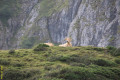
Circular from the Hourquette d'Ancizan
 8.01 mi
+1,946 ft
-1,949 ft
5h 25
Moderate
Departure from Ancizan (Hautes-Pyrénées)
8.01 mi
+1,946 ft
-1,949 ft
5h 25
Moderate
Departure from Ancizan (Hautes-Pyrénées)
An easy hike that takes you on a circular route around the Hourquette. Dominant position 70% of the time, some beautiful views, passage at Lac d'Arou (where the cows bathe) and crossing of a few streams.
Important: for this hike, it is best to use "Open Street Map Rando", which offers more trails than IGN. However, it is impossible to get lost as all the landmarks are visible while walking and serve as reference points.
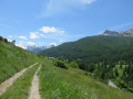
Circular from the canal to the hamlets of Prats
 5.42 mi
+955 ft
-988 ft
3h 20
5.42 mi
+955 ft
-988 ft
3h 20
 Easy
Departure from Molines-en-Queyras (Hautes-Alpes)
Easy
Departure from Molines-en-Queyras (Hautes-Alpes)
A simple, well-marked hike starting from Gaudissart. You follow the Pierre Dimanche canal and cross the hamlets of Prats (Hauts and Bas). Superb views of the Guil and Aigue Blanche valleys.
Mainly in the forest, on the south and west slopes (90%).
There is only one steep climb at the end, which can be made easier by returning along the road rather than cutting across the field.
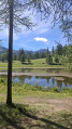
Loop around Lac de Roue and the hamlet of Souliers
 6.23 mi
+1,083 ft
-1,083 ft
3h 50
Moderate
Departure from Arvieux (Hautes-Alpes)
6.23 mi
+1,083 ft
-1,083 ft
3h 50
Moderate
Departure from Arvieux (Hautes-Alpes)
Easy hike. Little elevation gain, which is very gradual, except for a slightly steep 300m trail at the start and 500m at the end.
Mostly in the forest, with superb viewpoints over the Guil Valley, then the Souliers Valley and finally Arvieux.
50/50 forest track and trails.
The barns and chalets of Furfande
 5.98 mi
+1,752 ft
-1,762 ft
4h 15
Moderate
Departure from Arvieux (Hautes-Alpes)
5.98 mi
+1,752 ft
-1,762 ft
4h 15
Moderate
Departure from Arvieux (Hautes-Alpes)
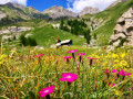
A must-do hike in Queyras! Furfande is only accessible on foot, snowshoes, skis or mountain bike, making it a village isolated from everything, like a small local "Mafate" (but only inhabited in summer and without the helicopters).
Departure from Col de Furfande, the highest point of the hike (2,500 m), accessible by car from mid-June to mid-November.
A shorter version is possible by turning left in Les Granges, towards the "Refuge de Furfande". This halves the distance and time.