


guyennet

 Visorando Member
 Premium user
 Sign up:
Published route(s)
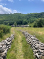
 Loop above Douch, Roc Noir, Col du Tirondel and Col de l'Airole
 1.52 mi
 +371 ft
 -348 ft
 1h 00
1h 00
 Easy
Easy
 Departure from Rosis (Hérault)
A bucolic circuit starting from Douch, passing through the Col de l'Airole and Col du Tirondel, offering beautiful views of the Gorges d'Héric and Gorges du Salis, and stunning panoramas of the hamlet and surrounding mountains (Roc Noir, Espinouse).
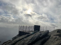
The tour of the Caroux plateau
 4.54 mi
+686 ft
-689 ft
2h 40
4.54 mi
+686 ft
-689 ft
2h 40
 Moderate
Departure from Rosis (Hérault)
Moderate
Departure from Rosis (Hérault)
This iconic hike on the Caroux plateau allows you to discover the diversity of the Haut Languedoc's flora and fauna at an altitude of 1,000 m: deciduous and coniferous forests, streams, peat bogs, orientation table, and heathland covered with broom and heather. You will enjoy sweeping panoramic views of the surrounding mountains and valleys.
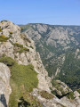
360° tour of the Roc de la Siejo via the Aiguilles and the Vires
 4.87 mi
+2,073 ft
-2,044 ft
4h 05
4.87 mi
+2,073 ft
-2,044 ft
4h 05
 Very difficult
Departure from Rosis (Hérault)
Very difficult
Departure from Rosis (Hérault)
Access from the village of Douch to the plateau and Roc du Caroux, then a semi-climbing route and balconies around Roc de la Siejo, to go around the peaks and enjoy a 360° view of the Héric Gorges below. Return via the plateau to the village.
⚠️ Poor mobile phone reception in the rocks of the peaks. The circuit is challenging, so make sure you tell your loved ones about your route.
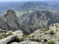
Climbing the Roc du Caroux
 4.44 mi
+935 ft
-915 ft
2h 50
Moderate
Departure from Rosis (Hérault)
4.44 mi
+935 ft
-915 ft
2h 50
Moderate
Departure from Rosis (Hérault)
A variation on the classic Caroux plateau hike, allowing you to discover the diversity of the Haut Languedoc's flora and fauna at an altitude of 1,000 metres: deciduous and coniferous forests, streams, peat bogs, and heathland covered in broom and heather. You can also take advantage of an orientation table and sweeping panoramic views of the surrounding mountains and valleys. During the second part of the hike, you will discover the mineral world of the north and west faces of the plateau, which are wilder and less frequented, near Roc Caroux and the mouflon populations.
From the sky to the sea: PR®-TF 10 from Cruz Del Carmen to Punta Del Hidalgo
 7.76 mi
+1,703 ft
-4,806 ft
5h 05
Moderate
Departure from Santa Cruz de Tenerife (Province de Las Palmas)
7.76 mi
+1,703 ft
-4,806 ft
5h 05
Moderate
Departure from Santa Cruz de Tenerife (Province de Las Palmas)
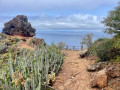
A hike, all downhill, from the Cruz del Carmen viewpoint, the starting point for many hikes in the heights of the Anaga Natural Park, to the ocean's edge, where a natural swimming pool rewards you for this technical hike rich in landscapes and emotions.
Le Caroux - east face
 6.15 mi
+2,270 ft
-2,290 ft
5 hrs
Very difficult
Departure from Rosis (Hérault)
6.15 mi
+2,270 ft
-2,290 ft
5 hrs
Very difficult
Departure from Rosis (Hérault)
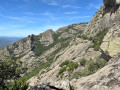
This is the first circuit in a "pentalogy" of routes along the slopes and cliffs of Caroux, offering superb panoramic views and cliffs in a very mineral environment consisting of ledges and ridges. The loop starts from the hamlet of La Fage and follows the upper part of the Colombières Gorges, before heading horizontally below the Caroux plateau, at the foot of the climbing cliffs. The climb back up to the plateau is near the orientation table, before returning via the south-eastern edge of the plateau.
Le Caroux - south face
 4.23 mi
+2,579 ft
-2,575 ft
4h 10
4.23 mi
+2,579 ft
-2,575 ft
4h 10
 Difficult
Departure from Saint-Martin-de-l'Arçon (Hérault)
Difficult
Departure from Saint-Martin-de-l'Arçon (Hérault)
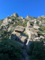
This is the third route in a series of five balcony trails on the slopes and cliffs of Caroux, offering superb panoramic views and cliffs in a very rocky landscape of ledges and ridges. An aerial, athletic and technical route, without being challenging or dangerous. Not to be attempted in wet weather, as the ground can be slippery in places, particularly on the large schist slabs. This circuit starts from the village of Saint-Martin-de-L'Arçon, climbs straight up the Saint-Martin ridge towards the summit of Caroux, to the orientation table, before descending, just as dry, via the Sentier des Gardes and the Sentier de Saint-Martin.
Le Caroux - south-west facing
 3.67 mi
+1,870 ft
-1,844 ft
3h 20
Difficult
Departure from Mons (Hérault) (Hérault)
3.67 mi
+1,870 ft
-1,844 ft
3h 20
Difficult
Departure from Mons (Hérault) (Hérault)
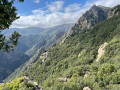
Fourth route of six balcony trails on the slopes and cliffs of Caroux, offering superb panoramic views and cliffs in a very rocky landscape of ledges and ridges.
An aerial, athletic and technical route, without being challenging or dangerous. Good physical condition is necessary, as this route offers no respite from sustained effort! Several sections involve semi-climbing, so you must not be prone to vertigo or afraid to put your hands on the rock. Not to be attempted in wet weather, as the ground can be slippery in places, especially around the boulders that need to be crossed.
This route starts from the hamlet of La Coste, climbs straight up the ridge of the same name towards Roc de Bartouyre, before continuing horizontally towards Col de l'Ours and Saut de l'Âne, then descends via a stony path towards Saint-Martin de l'Arçon, finally returning to the starting point in the neighbouring hamlet.
Le Caroux - south-east face
 3.33 mi
+2,224 ft
-2,211 ft
3h 30
Difficult
Departure from Saint-Martin-de-l'Arçon (Hérault)
3.33 mi
+2,224 ft
-2,211 ft
3h 30
Difficult
Departure from Saint-Martin-de-l'Arçon (Hérault)
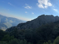
This is the second route in a series of six balcony trails on the slopes and cliffs of Caroux, offering superb panoramic views and cliffs in a very rocky landscape of ledges and ridges. The route is high up, challenging and technical, but not difficult or dangerous. Avoid in wet weather as the ground can be slippery in places, particularly on the large slabs of schist. This route starts from the hamlet of La Pomarède, climbs the ridge of the same name to the Portail des Cades, before descending via the Biterrois and Garel paths to the sublime Albine waterfall (30 m high) and back to the car in the valley.
Le Caroux - west side
 6.01 mi
+3,665 ft
-3,678 ft
5h 55
Very difficult
Departure from Mons (Hérault) (Hérault)
6.01 mi
+3,665 ft
-3,678 ft
5h 55
Very difficult
Departure from Mons (Hérault) (Hérault)
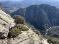
Fifth of six balcony routes on the slopes and cliffs of Caroux, offering superb panoramic views and cliffs in a very mineral environment consisting of ledges and ridges. Aerial, athletic and technical route, without being challenging or dangerous. Not to be attempted in wet weather, as the ground can be slippery in places, particularly around the boulders that need to be crossed. This route starts at the church in Mons, on a balcony in the Gorges d'Héric, facing west towards Bardou via the Piste supérieure du Cabalet, before descending via the Piste de la Réserve and crossing the river. It climbs back up opposite in the Cirque de Farrières via the Piste des Hirondelles, before continuing horizontally along the Piste des Aiguilles, Piste des Garroffes and Piste des Triangles, descending via the Sentier des Gardes to the river, and finally returning to Mons via the chestnut grove.
Le Caroux - north face
 3.21 mi
+2,657 ft
-2,664 ft
3h 50
Difficult
Departure from Rosis (Hérault)
3.21 mi
+2,657 ft
-2,664 ft
3h 50
Difficult
Departure from Rosis (Hérault)
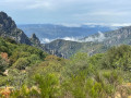
The last of six balcony routes, on the slopes and cliffs of Caroux, offering superb panoramic views and cliffs in a very rocky landscape of ledges and ridges. An aerial, athletic and technical route, without being challenging or dangerous. Not to be attempted in wet weather, as the ground can be slippery in places, particularly around the boulders that need to be crossed. This route starts from the hamlet of Héric, climbs to Roc Caroux via the Ravin des Hêtres, before descending to the Piste des Aiguilles via the Ravin du Rieutord, crossing the Col du Curé and Col de la Narquoise, before beginning the descent to Héric via the Piste du Pouce.
Le Roc Laurès starting from Douch
 2.52 mi
+751 ft
-761 ft
1h 50
Moderate
Departure from Rosis (Hérault)
2.52 mi
+751 ft
-761 ft
1h 50
Moderate
Departure from Rosis (Hérault)
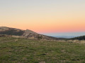
A circular bucolic route through the hills surrounding Douch: La Tourelle, La Combe d'Estrets, La Rousselle, and above all Roc Laurès, offering a view of the surrounding mountains from a height of over 1,000 metres.
Be careful, however, as there are no markings, so you have to follow the directions and the GPX track, which gives this route a bit of a fun/orienteering feel, without any major risk of getting lost for too long.
The Saint-Eutrope ridge starting from Andabre
 4.40 mi
+2,165 ft
-2,165 ft
3h 55
Difficult
Departure from Rosis (Hérault)
4.40 mi
+2,165 ft
-2,165 ft
3h 55
Difficult
Departure from Rosis (Hérault)
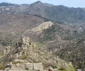
A superb circular route, climbing up to the Plo des Brus plateau via the Saint-Eutrope ridge, before descending via the Roquandouire Gate. Start at the foot of the Mare, the river that runs through Andabre. Head towards the Notre-Dame de Saint Eutrope chapel, then climb the ridge of the same name towards the plateau. Descend via the Serre de Majous to the Portail de Roquandouire, to reach the village of Andabre in the middle of the broom bushes. There are few markings in the middle of the hike => follow the GPX track carefully.
The Razigade Ridge starting from Castanet-le-Haut
 10.61 mi
+2,700 ft
-2,694 ft
7h 15
Difficult
Departure from Castanet-le-Haut (Hérault)
10.61 mi
+2,700 ft
-2,694 ft
7h 15
Difficult
Departure from Castanet-le-Haut (Hérault)
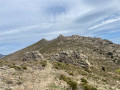
A superb circular route starting from Castanet-le-Haut: can be done in one day or over two days with a stopover at the bivouac in Caissenols-le-Haut. Ascent to the Plo des Brus plateau via the Razigade ridge, passing through the Col de l'Ourtigas, then descent to the abandoned hamlet of Caissenols-le-Haut. Continue towards the Roquandouire gate, heading towards Saint-Gervais along the ridge, before joining the GRP® de la Mare trail and following it upstream along the river towards Andabre and then Castanet-le-Haut.
The Héric Gorges at all levels
 8.73 mi
+3,937 ft
-3,950 ft
7h 25
Very difficult
Departure from Mons (Hérault) (Hérault)
8.73 mi
+3,937 ft
-3,950 ft
7h 25
Very difficult
Departure from Mons (Hérault) (Hérault)
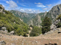
This is a lovely route that criss-crosses the Gorges d'Héric at all altitudes. You will enjoy superb panoramic views and mineral walls, while immersing yourself in the aquatic world of the torrent. The route is challenging and technical, without being difficult or dangerous.
The Roquandouire Gate at the start of the Ourtigas
 4.89 mi
+1,503 ft
-1,512 ft
3h 35
Moderate
Departure from Rosis (Hérault)
4.89 mi
+1,503 ft
-1,512 ft
3h 35
Moderate
Departure from Rosis (Hérault)
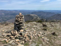
A lovely circular route starting from the Col de l'Ourtigas, with the Plo des Brus viewpoint and belvedere, the descent from the Serre de Majous, the Portail de Roquandouire pass, the return via the Casseloubre valley, the abandoned village of Caïssenols and the climb back up to the Ourtigas via the stream of the same name in the forest.
Tour of Montagne de Rosis via the Caramaus ridge
 6.87 mi
+2,408 ft
-2,372 ft
5h 15
Moderate
Departure from Rosis (Hérault)
6.87 mi
+2,408 ft
-2,372 ft
5h 15
Moderate
Departure from Rosis (Hérault)
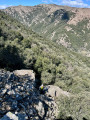
A lovely circular route starting from the hamlet of Rosis, which circles the mountain of the same name, featuring a wide variety of trails, alternating between ledges and viewpoints, gorges and torrents, and passing successively through the cols d’Aussière and de Vente-Vieille, the Mouscaillou ridge, the Serre d’Esparic, the Caramaus ridge, and the gorges of Aussières and Casselouvre. All this whilst passing through the pretty stone-built hamlets of Rosis and Cours-le-Haut.
Le Caroux from its north-eastern side
 4.50 mi
+915 ft
-928 ft
2h 50
Moderate
Departure from Rosis (Hérault)
4.50 mi
+915 ft
-928 ft
2h 50
Moderate
Departure from Rosis (Hérault)
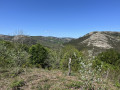
A circular route starting from Douch, crossing the surrounding hills to the east, on the heights of Perpignan de la Grave and La Fage, offering views overlooking the surrounding mountains and, in good weather, as far as the sea. Please note, however, that there are no signposts on thefirst half of the route, so be sure to follow the directions and the GPX track carefully; this adds a fun, orienteering-style element to the route, whilst still posing little risk of getting lost.