Circular route via Douch through the Colombières and Héric Gorges

A two-part walk, from the valley up to the plateau and then back again, with a stop in the charming hamlet of Douch.
No particular difficulties, but a long distance to cover and a significant elevation gain:
- Part 1: starting from the bottom of the Orb Valley in the village of Colombières, ascending via the Gorges de l’Orb path, arriving at the charming hamlet of La Fage, then joining the path to Douch.
- Section 2: starting from Douch, climb up to the Caroux plateau, descend via the ‘Sentier des Gardes’ towards the Héric Gorges, then return by following the valley floor, taking in the charming villages of La Coste, Saint-Martin-de-l’Arçon, La Pomarède and the upper part of Colombières.

Details

n°110235572
Creation:
Last update:
Last review:
–
  • Walking
    Activity: Walking
  • ↔
    Distance: 13.19 mi
  • ◔
    Average duration: 9h 25 
  • ▲
    Difficulty: Very difficult

  • ⚐
    Back to start: Yes
  • ↗
    Ascent: + 3,858 ft
  • ↘
    Descent: - 3,878 ft

  • ▲
    Highest point: 3,576 ft
  • ▼
    Lowest point: 541 ft

Photos

Description of the walk

Section 1 (9 km, 750 m ascent, 150 m descent)
Park at the Gorges car park in Colombières (next to the school).

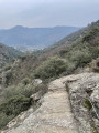
(S/E) Take the Chemin des Gorges, PR® (yellow markings), heading towards the top of the plateau. You’ll reach the houses in the hamlet of La Fage.

(1) Walk through the hamlet and look out for a multi-directional sign by the roadside; turn left. Take the GR®7, marked in white and red, to climb up to the Caroux plateau. Pass the Jasse de Bonnel crossroads, then continue to the La Tour crossroads.

(2) Leave the GR® and turn right, following the yellow markings, towards La Tour, the highest point of the plateau at an altitude of 1,091 metres. Head back down towards wider tracks. You’ll come to the junction with the DFCI track.

(3) Head down to the right along the winding track towards the walkers’ car park, continue for a few metres, then enter Douch.

Part 2 (12 km, 150 m ascent, 750 m descent)

(4) Take the GR® towards the Col de l’Airole, then turn left shortly afterwards, following the yellow PR® markings, to reach the top of the plateau through a deciduous forest. At the four-way junction, continue straight ahead along a flat, straight path. You will then reach the Font Salesse crossroads.

(5) Turn onto the path on the left and follow it until you reach the Barmelles orientation point.

(6) Turn right, follow the yellow PR® markings to reach the Font Salesse refuge.

(7) Turn left at almost a 180°, heading towards the Col de Lucet, which will allow a gentle descent from the plateau to the west, towards the Gorges d’Héric. Pass through a magnificent grassy undergrowth of conifers, then descend through a more rocky landscape, winding your way down until you reach the Carrefour Saint-Martin.

(8) Turn right onto the GRP® trail marked in yellow and red, also known as the Sentiers des Biterrois, and head for the Col de Bartouyre.

(9) Head down the winding Sentier des Gardes on the opposite side. Walk past the climbing spots at Bartouyre, the Rochers de Marre, the Roc de l’Homme and Beylot Ferrand. Emerge into the Gorges d’Héric at the Passerelle des Soupirs.

(10) Stay on the left bank of the Ruisseau d’Héric and follow the yellow PR® markings to reach the hamlet of La Coste.

(11) Continue along the road to reach the village of Saint-Martin-de-l’Arçon.

(12) Turn left, between the town hall and the cemetery, to reach the village of La Pomarède.

(13) Carry on and you’ll soon come to the junction with the D908.

(14) Turn left onto the D14E25; you’ll soon reach the Château de Colombières-le-Haut.

(15) Carry on straight ahead and you will then reach the Gorges car park in Colombières (S/E).

Waypoints

  1. S/E : mi 0 - alt. 751 ft - Gorges de Colombières car park
  2. 1 : mi 2.4 - alt. 2,507 ft - The hamlet of La Fage
  3. 2 : mi 3.65 - alt. 3,468 ft - Carrefour de la Tour
  4. 3 : mi 4.19 - alt. 3,481 ft - Top of the Caroux plateau
  5. 4 : mi 5.51 - alt. 2,943 ft - Église Sainte-Marie (Douch)
  6. 5 : mi 6.31 - alt. 3,442 ft - Font Salesse
  7. 6 : mi 7.08 - alt. 3,383 ft - Table d'orientation du Caroux
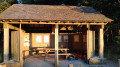
  8. 7 : mi 7.54 - alt. 3,425 ft - Refuge de Font Salesse
  9. 8 : mi 8.6 - alt. 2,287 ft - Saint-Martin crossroads
  10. 9 : mi 8.81 - alt. 2,208 ft - Col de Bartouyre (677m)
  11. 10 : mi 10.16 - alt. 636 ft - Passerelle des Soupirs - Héric (cours d'eau) - Affluent de l'Orb
  12. 11 : mi 10.68 - alt. 755 ft - La Coste
  13. 12 : mi 11.33 - alt. 846 ft - Église Saint-Martin (Saint-Martin-de-l'Arçon)
  14. 13 : mi 12.02 - alt. 676 ft - The hamlet of La Pomarède
  15. 14 : mi 12.39 - alt. 584 ft - D908 road
  16. 15 : mi 12.57 - alt. 686 ft - Colombières-le-Haut
  17. S/E : mi 13.19 - alt. 732 ft - Gorges de Colombières car park

Notes

(1) La Fage: a lovely spot to take a break by the river.
Water is available at the Place de Douch (4) and in the village of Saint-Martin-de-l’Arçon (12).
Please note: there is little mobile coverage along the route, so do remember to let your loved ones know your itinerary.

Worth a visit

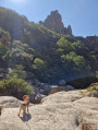
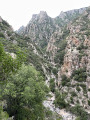
Between (S/E) and (1): Colombières Gorges.
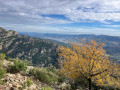
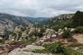
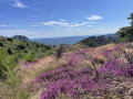
(3) Caroux Plateau.
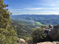
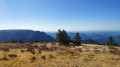
(6) Orientation point – enjoy the superb panoramic view.
(10) Héric Gorges.
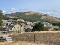
Along the route, the hamlets and villages: (1) La Fage, (4) Douch, (11) La Coste, (12) Saint-Martin-de-l’Arçon, (13) La Pomarède, and (15) Colombières-le-Haut.

Always be cautious and plan ahead when you're outdoors. Visorando and the author of this route cannot be held responsible for any accidents occurring on this route.

The GR® and PR® markings are the intellectual property of the Fédération Française de Randonnée Pédestre.

Other walks in the area

For more walks, use our search engine .

The GPS track and description are the property of this route's author. Please do not copy them without permission.