François0203

 Visorando Member
 Premium user
 - Location: Kingersheim (68260)
- Gender: man
Sign up:
Published route(s)
 From Rammersmatt to the Hundsruck Pass
 7.63 mi
 +1,529 ft
 -1,526 ft
 4h 50
4h 50
 Moderate
 Departure from Rammersmatt (Haut-Rhin)
A very accessible circuit starting from the Rammersmatt farm towards Bourbach-le-Haut, passing by the Hochburg chalet. A hike that everyone can follow at their own pace.
From Wittenheim to Ruelisheim
 5.37 mi
+20 ft
-20 ft
2h 30
5.37 mi
+20 ft
-20 ft
2h 30
 Easy
Departure from Wittenheim (Haut-Rhin)
Easy
Departure from Wittenheim (Haut-Rhin)
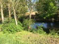
A short walk along the Dollerbaechlein.
The three waterways from Wittenheim to Ruelisheim
 7.07 mi
+36 ft
-36 ft
3h 15
Moderate
Departure from Wittenheim (Haut-Rhin)
7.07 mi
+36 ft
-36 ft
3h 15
Moderate
Departure from Wittenheim (Haut-Rhin)
Discover the three waterways from Wittenheim to Ruelisheim: the Ill, the Quatelbach and the Dollerbaechlein.