


BOBTHENEW

 Visorando Member
 Premium user
 - Location: Montfort-sur-Meu (35160)
- Gender: man
Sign up:
Published route(s)
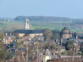
 The Porte de Brocéliande in Montfort-sur-Meu
 7.51 mi
 +341 ft
 -358 ft
 3h 45
3h 45
 Moderate
 Departure from Montfort-sur-Meu (Ille-et-Vilaine)
Montfort-sur-Meu, formerly Montfort La Cane, is a town steeped in history with a remarkable heritage located at the gateway to Brocéliande, with its mythical forest and Arthurian legends:
A medieval town under the Lords of Gaël-Montfort; a fortified town of which the Papegault Tower, the Châtelet and the remains of the ramparts still stand; a religious town with St-Jacques Abbey, the Ursuline Convent and the birthplace of Saint Louis Grignion de Montfort.
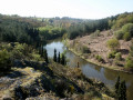
From La Chambre au Loup to Boutavent Castle in Brocéliande
 8.15 mi
+262 ft
-269 ft
4h 00
Moderate
Departure from Iffendic (Ille-et-Vilaine)
8.15 mi
+262 ft
-269 ft
4h 00
Moderate
Departure from Iffendic (Ille-et-Vilaine)
From Lake Trémelin: start with Les Landiers de Trémelin, then cross the Chambre au Loup valley with its woods and moors, followed by a visit to the ruins of Boutavent Castle, owned by the Lords of Gaël-Montfort in the 13th and 14th centuries, and return via the Putenoë woods to finish along the lake.
A hike from La Tête aux Pieds: nature, history and heritage.
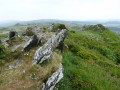
The Roc'h circuit in the Monts d'Arrée
 12.67 mi
+925 ft
-932 ft
6h 40
12.67 mi
+925 ft
-932 ft
6h 40
 Difficult
Departure from Plounéour-Ménez (Finistère)
Difficult
Departure from Plounéour-Ménez (Finistère)
Roc'h ar Feunteun, Roc'h Trédudon, Roc'h Trévézel, a line of jagged ridges.
In the heart of the Armorique Regional Nature Park, the Monts d'Arrée rise up in a landscape of moors, heather and gorse. These landscapes give off a surprising impression, marked by unreality, mystery and authenticity, which we know well in inland Brittany.
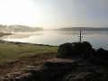
Walk between two ponds in Brocéliande in Iffendic
 9.10 mi
+131 ft
-138 ft
4h 20
Moderate
Departure from Iffendic (Ille-et-Vilaine)
9.10 mi
+131 ft
-138 ft
4h 20
Moderate
Departure from Iffendic (Ille-et-Vilaine)
The legendary Brocéliande is undoubtedly the most popular of all, but the natural Brocéliande is just as omnipresent.
It is the latter that you will discover on this hike, with Lake Trémelin, the Bois de la Roche Trébulente and Putenoë woods, and above all the Careil bird sanctuary... don't forget your binoculars!
The Néal Valley and the Lampouy alignments in Médréac
 8.90 mi
+404 ft
-410 ft
4h 25
Moderate
Departure from Médréac (Ille-et-Vilaine)
8.90 mi
+404 ft
-410 ft
4h 25
Moderate
Departure from Médréac (Ille-et-Vilaine)
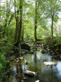
Médréac, a small village in Ille-et-Vilaine, on the border with Côtes d'Armor. The route is particularly attractive: the picturesque Néal valley with the cave of Gabillard, a local Chouan resistance fighter, the megalithic alignments of Lampouy, the railway station, its museum and its rail bike with two routes.
This hike follows theGR® 37 and part of thePR® "Circuit des mégalithes" (Megalith Circuit). The southern part of thisPR® has not been included as it is uninteresting and the paths are poorly maintained.