



Most stages of the walk start and end at train stations. Those that don’t are served either by the X40 express bus, which runs between Reading and Oxford or the X20 between Oxford and Aylesbury. This enables each stage to be completed in a day trip from all the towns en route. Intermediate stations and bus stops allow greater flexibility in the distances walked.
Railways and Waterways, between Oxford and London

A mainly level circular walk of about 150 miles along the waterways between Oxford and the London suburbs. It can be done in day trips by train or express bus from all the towns en route.
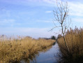
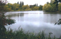
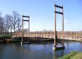
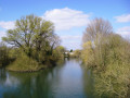
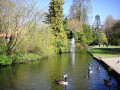
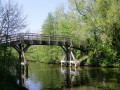
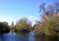
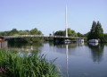
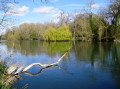
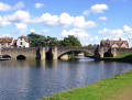
This circular long-distance path starts in rural Oxfordshire, then follows the Grand Union Canal, which has a close-knit narrowboat community, into the Chilterns before winding through the suburbs of London. It crosses the playing fields of Eton to join the Thames Path, which meanders all the way back to Oxford. The route passes over and under bridges of every kind, through country parks, idyllic villages with thatched cottages, grand estates and historic market towns like Aylesbury, Henley-on-Thames and Wallingford. The lakes, chalk rivers and water meadows are home to a diversity of wildlife, and traditional waterside pubs provide welcome refreshment.
Details
Erstelldatum:
Bearbeitungsdatum:
Letzte Bewertung:
–
–
-
 Aktivität: Zu Fuß
 -
 Distanz: 242,00 km
 -
 Durchschnittliche Dauer: 14 Tage
 -
 Schwierigkeitsgrad: Schwer
 -
-
 Zurück zum Start: Nein
 -
 Aufstieg: + 479 m
 -
 Abstieg: - 499 m
 -
-
 Höchster Punkt: 132 m
 -
 Niedrigster Punkt: 16 m
-
 Land:
Vereinigtes Königreich
Land:
Vereinigtes Königreich
-
 Gemeinde:
Forest Hill with Shotover
Gemeinde:
Forest Hill with Shotover -
 Start: N 51.762171° / W 1.181665°
 -
 Ziel: N 51.753333° / W 1.269678°
 -


 Stündliche Wettervorhersage
Etappen der Tour
Diese Wandertour ist auf mehrere Tage ausgelegt, hier die Details für jede Etappe.
Hinweise
Einen Besuch wert
Find more information about those walks on the Railways and Waterways Walk website.
Andere Wandertouren in dem Gebiet
Von Oxford nach Thame
 Visorando-Mitglied
 20,94 km
+87 m
-123 m
6:15 Std.
Schwer
Start in Forest Hill with Shotover (Oxfordshire)
20,94 km
+87 m
-123 m
6:15 Std.
Schwer
Start in Forest Hill with Shotover (Oxfordshire)
Dies ist die erste Etappe der mehrtägigen Route „Eisenbahnen und Wasserstraßen zwischen Oxford und London“.
Eine abwechslungsreiche Wanderung durch die Landschaft, die offenes Ackerland, gepflegte Parkanlagen und einen weltberühmten Golfplatz miteinander verbindet. Zu den Höhepunkten zählen das Waterperry House und die Gärten, der erste Blick auf den Fluss Thame an der Bow Bridge sowie die Rycote Chapel.
Wolvercote-Rundweg
10,00 km
+21 m
-21 m
2:55 Std.
 Leicht
Start in Oxford (Oxfordshire)
Leicht
Start in Oxford (Oxfordshire)
Eine fast ebene Rundwanderung entlang des Thames Path und des Oxford Green Way. Die Wanderung beginnt in Wolvercote, führt an der Godstow Abbey vorbei und folgt dann dem Ufer der Themse, wobei einige interessante Inseln und Wehre zu sehen sind. Der Rückweg führt an den Wytham Woods vorbei und über Felder, zurück über das Trout Inn, wo Sie sich am Ende der Wanderung eine wohlverdiente Erfrischung gönnen können.
Radley nach Oxford
 11,26 km
+11 m
-9 m
3:15 Std.
11,26 km
+11 m
-9 m
3:15 Std.
 Mittel
Start in Radley (Oxfordshire)
Mittel
Start in Radley (Oxfordshire)
Dies ist die vierzehnte und letzte Etappe der mehrtägigen Route „Eisenbahn und Wasserstraßen zwischen Oxford und London“.
Dieser Spaziergang am Flussufer führt sanft von ruhigen Auen vorbei an den Schleusen von Sandford und Iffley durch ein Naturschutzgebiet bis in die belebten Vororte von Oxford, wo die Bootshäuser der verschiedenen Oxford-Colleges von der starken Ruderkultur der Stadt zeugen.
Hampton Gay
 Verein/ Wanderführer/in4,80 km
+12 m
-12 m
1:25 Std.
Leicht
Start in Hampton Gay and Poyle (Oxfordshire)
Verein/ Wanderführer/in4,80 km
+12 m
-12 m
1:25 Std.
Leicht
Start in Hampton Gay and Poyle (Oxfordshire)
Spazieren Sie über die Wiesen zu einer abgelegenen Kirche und den Ruinen eines Herrenhauses aus dem 16. Jahrhundert.
Rundwanderung von Begbroke nach Bladon
7,92 km
+59 m
-52 m
2:25 Std.
Leicht
Start in Begbroke (Oxfordshire)
Eine Wanderung durch Oxfordshire, die typische Landschaften der Grafschaft zeigt. Die Kirche in Bladon ist auch die Grabstätte von Sir Winston Churchill. Die Route verläuft auf bestehenden Wegen.
Abingdon nach Steventon
15,32 km
+15 m
-8 m
4:25 Std.
Mittel
Start in Abingdon on Thames (Oxfordshire)
Von Abingdon nach Steventon entlang eines Teils des alten Berkshire- und Wiltshire-Kanals. Beginnen Sie auf dem Ock Valley Path durch Abingdon und gehen Sie dann nach Westen hinaus in die flachen Felder. Zu Beginn gibt es einige gute Wege, aber einige der Wege in den Feldern, wenn Sie sich Steventon nähern, sind nicht gut gepflegt. Auf den letzten Feldern vor Steventon bei Hill Farm weiden oft Rinder. Ich würde diese Wanderung generell bei trockenem Wetter empfehlen.
Der Fußweg aus den Vororten von Abingdon ist schlecht, daher habe ich die Route so angepasst, dass sie Straßen und Wegen folgt. Nachdem man unter der Eisenbahnbrücke auf der Ranch nach Steventon hindurchgegangen ist, sind die OS-Fußwege nicht mehr zuverlässig; an einer Stelle war der Weg gepflügt und mit Weizen bepflanzt, sodass ich eine Zeit lang am Feldrand entlangging.
Der Bus X2 verkehrt 7 Tage die Woche zwischen Abingdon und Steventon und kann daher genutzt werden, um die Runde zu schließen.
Rushbed Woods und Brill-Rundwanderung
7,69 km
+96 m
-96 m
2:30 Std.
Mittel
Start in Brill (Buckinghamshire)
Eine gemütliche Wanderung in der Nähe von Brill, einschließlich eines Naturschutzgebiets mit vielen Schmetterlingen (im Juni und Juli), Wäldern und einem Hügel.
Von Thame nach Stone
 14,50 km
+67 m
-32 m
4:20 Std.
Mittel
Start in Thame (Oxfordshire)
14,50 km
+67 m
-32 m
4:20 Std.
Mittel
Start in Thame (Oxfordshire)
Dies ist die zweite Etappe der mehrtägigen Route „Eisenbahnen und Wasserstraßen zwischen Oxford und London“.
Ein angenehmer Spaziergang durch die Auen des Thame-Tals, vorbei an Notley Abbey und durch malerische Dörfer bis zum historischen Torhaus des Eythrope Park, bevor es über eine ruhige Privatstraße zum Dorf Stone geht.
Bis zum Abschluss der Arbeiten an der HS2 endet diese Etappe in Stone, das nur eine kurze Busfahrt von Aylesbury entfernt liegt.
Für mehr Wandertouren, benutze unsere Suchmaschine .
Die Beschreibungen und GPX-Daten dieser Tour sind Eigentum des Autors/der Autorin. Bitte nicht ohne Genehmigung kopieren.