


- Weather: before setting off, check the Swiss Weather Service or Météo Blue
- Hiking gear, including good walking shoes.
- Before setting off, check the SuisseMobile websitefor any trail closures or diversions.
Tour of the Grosser Mythen


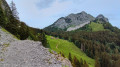
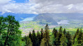
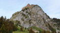
The circuit around the Grosser Mythen offers a variety of landscapes. The descent towards Mythenbad is very green. The climb up to the pass separating the two Mythen peaks (Zwüschet Mythen) is quite steep but very well maintained. Once you reach Zwüschet Mythen, you’ll be treated to a breathtaking view of the Mythen massif.
Details
Creation:
Last update:
Last review:
–
–
-
 Activity: Walking
 -
 Distance: 4.07 mi
 -
 Average duration: 3h 50
 -
 Difficulty: Difficult
 -
-
 Back to start: Yes
 -
 Ascent: + 2,254 ft
 -
 Descent: - 2,251 ft
 -
-
 Highest point: 4,754 ft
 -
 Lowest point: 2,969 ft
-
 Country:
Switzerland
Country:
Switzerland
-
 Area: Alps
 -
 City:
Schwyz
City:
Schwyz -
 Start/End: N 47.028757° / E 8.698332°
 -


 Hour-by-hour weather
Photos
Waypoints
- S/E : mi 0 - alt. 4,596 ft - Berggasthaus Holzegg
- 1 : mi 0.16 - alt. 4,413 ft - Start of the trail
- 2 : mi 0.73 - alt. 3,691 ft - Heading towards Schwyz
- 3 : mi 1.98 - alt. 3,409 ft - Hiking trail
- 4 : mi 2.27 - alt. 3,645 ft - Zwüschet Mythen
- 5 : mi 2.3 - alt. 3,681 ft - Junction
- S/E : mi 4.07 - alt. 4,600 ft - Berggasthaus Holzegg
Notes
Other walks in the area
The Grosser Mythen from Holzegg
 Visorando Member
 2.22 mi
+1,850 ft
-1,831 ft
2h 40
2.22 mi
+1,850 ft
-1,831 ft
2h 40
 Very difficult
 Departure from Schwyz (Canton of Schwyz)
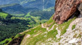
The Grosser Mythen is the iconic peak of the canton of Schwyz. The ascent, with its numerous hairpin bends, is quite steep all the way to the summit. This route is reserved for experienced hikers; it requires sure-footedness and a good level of fitness. Once at the summit, you’ll enjoy a superb view of the lakes of the Four Cantons, Zug and Ägeri, as well as the Alpine peaks.
Holzegg – Einsiedeln
11.78 mi
+1,926 ft
-3,507 ft
7h 05
Difficult
Departure from Schwyz (Canton of Schwyz)
This fifth stage will take you from Holzegg to Einsiedeln. This beautiful route passes through wetlands before reaching Halbegg via wooden steps. The hike continues with the steep ascent of the Furggelenstock. An orientation board shows the peaks visible on a clear day: the Pilatus, the Säntis and also Lake Zurich. After a steep descent and a series of ups and downs, you’ll reach Butziflue. As you descend towards Einsiedeln, you’ll look out over Lake Sihl. In the distance, you’ll catch sight of the imposing Einsiedeln Abbey.
Sattel – Holzegg
7.94 mi
+3,215 ft
-1,220 ft
6h 25
Difficult
Departure from Sattel (Canton of Schwyz)
This fourth stage will take you from Sattel to Holzegg. The route begins with a fairly steep climb up to Mostelberg. As you round the Angelstock and then follow the eastern slope of the Mythen, you’ll enjoy panoramic views of the lakes and mountains of Central Switzerland. In Holzegg, you’ll be at the foot of the Gross Mythen. A difficult and demanding trail leads up to this summit
Morschach - Vitznau
 11.12 mi
+2,457 ft
-3,045 ft
7h 15
Difficult
Departure from Canton of Schwyz
11.12 mi
+2,457 ft
-3,045 ft
7h 15
Difficult
Departure from Canton of Schwyz
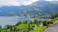
This second stage will take you from Morschach to Vitznau. As you cross Morschach, you can admire the Mythen, the two legendary peaks of the canton of Schwitz. This route offers many more views of the lake and the mountain ranges that surround it. At Brunnen, you will leave Lake Uri and follow the shores of Lake Lucerne. You will stop in the charming village of Vitznau, the departure point for the little train that climbs to the famous summit of the Rigi.
Goldau – Sattel
8.46 mi
+3,848 ft
-2,982 ft
7h 15
Difficult
Departure from Arth (Canton of Schwyz)
This third stage will take you from Goldau to Sattel. The route follows the Rossberg ridge. First, you’ll pass through Gnipen, where , 200 years ago, a massive rockslide formed a cone of boulders. In the heart of this rocky landscape lies the Goldau Wildlife Park. You will then climb to the Wildspitz, the highest point of the stage. As you descend towards Sattel, you’ll enjoy views over Lake Ägeri.
Einsiedeln - Unterägeri via the Alpenpanorama Weg
 11.77 mi
+2,156 ft
-2,736 ft
7h 15
Difficult
Departure from Einsiedeln (Canton of Schwyz)
11.77 mi
+2,156 ft
-2,736 ft
7h 15
Difficult
Departure from Einsiedeln (Canton of Schwyz)
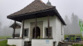
This stage will take you from Einsideln to Unterägeri. You will enjoy a superb view at the Chatzenstrick pass. You will descend to Unterägeri on the shores of Lake Ägeri via a ridge path.
Einsiedeln – Pfäffikon
 7.48 mi
+577 ft
-2,264 ft
3h 55
7.48 mi
+577 ft
-2,264 ft
3h 55
 Moderate
Departure from Einsiedeln (Canton of Schwyz)
Moderate
Departure from Einsiedeln (Canton of Schwyz)
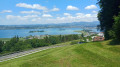
This hike follows the Via Jacobi (signposted with a No. 4 symbol). Einsiedeln, home to a vast monastery, is a major pilgrimage centre. The route offers views of Lake Sihl. After crossing the Etzel Pass, you’ll catch sight of Lake Zurich as you descend towards Pfäffikon.
Unterägeri - Cham via the Alpenpanorama Weg
 10.96 mi
+748 ft
-1,745 ft
5h 40
Difficult
Departure from Unterägeri (Canton of Zug)
10.96 mi
+748 ft
-1,745 ft
5h 40
Difficult
Departure from Unterägeri (Canton of Zug)
This stage will take you from Unterägeri to Cham. You will gradually arrive at Lake Zug after a short climb to the Brunegg mountain pasture. On the way down, you will pass the pretty chapel of St. Verena. You can enjoy a lovely walk along the lake in Zug.
For more walks, use our search engine .
The GPS track and description are the property of this route's author. Please do not copy them without permission.

