Country:

 City:
City:


Park near the small Kervoyal Beach or in the narrow streets and avenues leading to it.
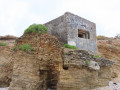
(S/E) From the main access to the beach (Rue de Pénestin), take the narrow Rue du Pont Saint-Sauveur, which heads south towards the Grande Plage de Kervoyal on the ocean side. This leads to a cul-de-sac that heads towards the headland. Then turn right towards the first access to the beach, just past a large blockhouse.
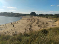
(1) Depending on the tide, either head down onto the beach or take the sandy path along the dune that follows the coastline. Walk westwards along the coast towards the village of Damgan. You’ll walk along the Grande Plage de Kervoyal, then on to Landrézac beach (which is actually part of the same stretch), before reaching the road embankment that protects the village of Damgan.
(2) Leave the beach to climb up onto the embankment and follow it to get past the rocky section of the beach; if the water level allows, head back down onto Damgan’s Grande Plage after passing another large bunker.
(3) Unless you are unable to get back down onto the beach, you will not leave it again until you reach the St-Guérin isthmus. As you pass, you’ll see the sailing school on your right.
(4) When you reach the concrete embankment protecting the isthmus, climb one of the staircases built there to come out onto Boulevard de l’Océan, which leads to Pénerf.
(5) Cross the main road and head straight north towards Larmor. The road runs alongside a marsh that the sea floods at spring tides. Walk through the village, making sure to take a look at the rows of old houses it is home to. After the fountain, continue along the Route du Guénéguélo. At the Luhé crossroads, continue slightly to the left, still on the Route du Guénéguélo.
(6) At the crossroads after the last houses, turn right onto the path leading towards the marshes. You’ll come to an area of former salt marshes, where you can still make out the embankments separating the various basins that once made up the marshes.
Turn right at the first junction to return to a straight road serving this residential area and a few campsites. Turn left onto this road and follow it almost all the way to Boulevard de l’Océan, which you crossed earlier.
(7) Fifty metres before reaching it, turn left into the narrow passage between two properties. This leads to the streets of a housing estate, which you cross straight through before exiting via another small passage at the corner of Rue des Bernacles.
You’ll find yourself back in the marshes; simply follow the path that runs alongside them to reach the market square (note that, outside market hours, this is just a large, ordinary car park, a stone’s throw from the village centre but on the other side of the boulevard).
(8) Cross the boulevard, keeping slightly to the right, to take Rue Gohec, which leads to the town centre. At the first junction, turn right towards the church.
(9) When you reach the foot of the church, turn left to walk alongside the building and carry on straight ahead until you reach Rue Fidèle Habert, the town’s main shopping street. Turn left towards the post office and turn right just before it. Follow Rue de Kervoyal to the second roundabout.
(10) At the second roundabout, turn left to head up Rue du Toul Rann. At the first junction, turn right onto Chemin du Pouldouar. Continue along this path until you reach the small road leading from Kervoyal to the mill of the same name.
(11) Turn right when you reach this road, then left about 200 metres further on to take the path leading to Tréhervé Beach. This marks the end of the least interesting part of the route – and we certainly won’t complain!
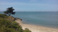
(12) When you reach the beach, take the coastal path which heads off to the right beneath two dense hedges. Here you’ll find a succession of tiny coves, reached via equally inconspicuous paths. But the sea only reaches them at high tide. Continue along this coastal path to Kervoyal harbour.
(13) If the tide is out, carry on along the path that runs past the villas. It leads to a flight of steps that takes you down to the beach to get past a rocky outcrop topped by a low wall belonging to a property. Behind it lies the Petite Plage de Kervoyal.
If the tide is high, head back up the street leading to the slipway, then turn left onto Avenue des Sinagots and follow it until you reach the street leading to Kervoyal’s Petite Plage. Walk along the beach from north to south to return to the starting point (S/E).

 Visorando Member
 Easy
Easy