


Refine your search for walks in Source du Pain Bouillis (Larche)
Source du Pain Bouillis (Larche) walks


 Visorando Member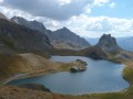
Walks near Source du Pain Bouillis (Larche)
 Trek around Chambeyron Mountain Range (5) Refuge Campo Base - Larche
 9.01 mi
 +3,560 ft
 -3,451 ft
 7h 15
7h 15
 Very difficult
 Departure from Acceglio (Cuneo)
Last stage of this trek around Chambeyron mountain range, taking you back to France through Col de Sautron. You'll find yourself in superb wildlife setting when arriving at the pass.
Chiappera - Chambeyron Refuge
 Association / Club / Walk leader
 7.10 mi
+4,344 ft
-1,145 ft
6 hrs
Very difficult
Departure from Acceglio (Cuneo)
7.10 mi
+4,344 ft
-1,145 ft
6 hrs
Very difficult
Departure from Acceglio (Cuneo)
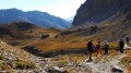
A lovely stage featuring a beautiful climb to the Stroppia Waterfall and the Lac des Neuf Couleurs.
Bacchi Rossi Refuge - Vens Lakes Refuge
 4.60 mi
+2,359 ft
-807 ft
4h 10
4.60 mi
+2,359 ft
-807 ft
4h 10
 Moderate
Departure from Argentera (Cuneo)
Moderate
Departure from Argentera (Cuneo)
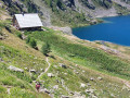
On thissecond day of the Tour of Mount Aiga from the Ferrere Refuge, you will pass through Plan de Belvédère, where there is a tin shelter overlooking the Rio Forneris valley and a fountain. You will also pass below Lake Emma, Monte Peiron at 2,796 m and Pointe Testa di Garbe at 2,749 m, to arrive, after a few hairpin bends, at Col de Fer at 2,584 m. You will then head towards Small Pass of Tortisse and the Vens Refuge, the end of this stage.
From the Barenghi Bivouac to Larche via the Col du Vallonnet
13.36 mi
+3,953 ft
-7,723 ft
8 hrs
Very difficult
Departure from Saint-Paul-sur-Ubaye (Alpes-de-Haute-Provence)
This route largely followsGRP®® markings (Tour du Chambeyron). A safe option, yet still spectacular.Spectacular, because the route constantly alternates between stark, steep and rocky terrain and lush, rolling and reassuring landscapes.Safe, because it is fully signposted and even offers alternative routes to avoid the most difficult sections in the event of bad weather.
Camp des Fourches - Ferrere Refuge
 6.25 mi
+1,381 ft
-2,615 ft
4h 05
Moderate
Departure from Saint-Dalmas-le-Selvage (Alpes-Maritimes)
6.25 mi
+1,381 ft
-2,615 ft
4h 05
Moderate
Departure from Saint-Dalmas-le-Selvage (Alpes-Maritimes)
This first stage of the Tour du Mont Aiga starts from Camp des Fourches on the Bonette road and, via the Col des Fourches, descends into the large Salso Moreno valley, which you climb back up to the Col de Pouriac. From the Col de Pouriac, you quickly reach Bassa di Colombart and then, after a long descent through the mountain pastures, the charming village of Ferrere. You may encounter flocks of sheep in Salso Moreno and, at night, the wolves that prey on them.
Trek around Chambeyron Mountain Range (3) Refuge du Chambeyron - Maljasset
 10.64 mi
+2,454 ft
-4,764 ft
8 hrs
Very difficult
Departure from Saint-Paul-sur-Ubaye (Alpes-de-Haute-Provence)
10.64 mi
+2,454 ft
-4,764 ft
8 hrs
Very difficult
Departure from Saint-Paul-sur-Ubaye (Alpes-de-Haute-Provence)
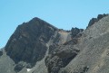
The most demanding stage of the hike during which you'll go through at least 4 passes at over 2700 metres in altitude. Beautiful scenery all along the way! The "Lacs Marinet" offer the opportunity for refreshments before the final descent.
Le Pra – Vens Mountain Hut
4.69 mi
+2,792 ft
-417 ft
4h 35
Moderate
Departure from Saint-Dalmas-le-Selvage (Alpes-Maritimes)
A first day to stretch your legs and discover the magnificent natural setting of the Vens lakes.
Note: as this route ends in Saint-Étienne-de-Tinée, it is advisable, if possible, to park a second car in Saint-Étienne-de-Tinée to shuttle back to the starting point. Otherwise, allow around €25 for the taxi journey from Saint-Étienne-de-Tinée to Le Pra, but please note that booking is required a few hours in advance.
Ussolo - Chialvetta
 8.68 mi
+3,747 ft
-3,199 ft
7h 15
8.68 mi
+3,747 ft
-3,199 ft
7h 15
 Difficult
Departure from Prazzo (Cuneo)
Difficult
Departure from Prazzo (Cuneo)
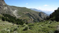
On this fourth day, you will continue along the left bank of the Maira. At Punta Culour, the highest point on this bank, a magnificent view to the west over the peaks on the border with France awaits you. You will then descend back down to the Maira river at Acceglio to cross over to the other bank. You will climb up the Unerzio valley to reach Chialvetta.
Small pass of Tortisse – Cime du Fer – Saint-Étienne-de-Tinée
 9.23 mi
+1,955 ft
-6,621 ft
5h 55
Difficult
Departure from Saint-Étienne-de-Tinée (Alpes-Maritimes)
9.23 mi
+1,955 ft
-6,621 ft
5h 55
Difficult
Departure from Saint-Étienne-de-Tinée (Alpes-Maritimes)
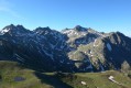
Before descending back to Saint-Etienne-de-Tinée, you climb to the Cime du Fer (2,700 m), which offers a superb 360° view, notably of the Tête de Moïse (3,104 m) and the magnificent Mont Viso (3,841 m).
Then we descend alongside the Tortisse torrent before heading back towards the Lacs de Vens and climbing up to the Lac des Babarottes.
We continue along a section of the Chemin de l’Énergie until we catch sight of Mont Ténibre.
We then finish with a long descent (-1,200 m) down to the village.
Trek around Chambeyron Mountain Range (1) Fouillouse - Refuge du Chambeyron
 3.88 mi
+2,470 ft
-36 ft
3h 55
Moderate
Departure from Saint-Paul-sur-Ubaye (Alpes-de-Haute-Provence)
3.88 mi
+2,470 ft
-36 ft
3h 55
Moderate
Departure from Saint-Paul-sur-Ubaye (Alpes-de-Haute-Provence)
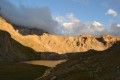
First stage around the Chambeyron Mountain Range which, after a steady climb, takes you to the shelter with the same name. You'll end up in a breath-taking setting, at the foot of Brec de Chambeyron.