Pindreau and the Chapel of the Precious Blood at Notre-Dame du Laus

Starting from Notre-Dame du Laus, this short walk takes you along a route dotted with stone benches to a monument dedicated to one of the apparitions witnessed by Benoite Rencurel. The return route follows a balcony path high above the Plaine de l’Avance. This walk can be extended by adding one or two routes (see § Practical Information).

Details

2944771
Creation:
Last update:
Last review:
  • Walking
    Activity: Walking
  • ↔
    Distance: 2.28 mi
  • ◔
    Average duration: 1h 15 
  • ▲
    Difficulty: Easy

  • ⚐
    Back to start: Yes
  • ↗
    Ascent: + 246 ft
  • ↘
    Descent: - 249 ft

  • ▲
    Highest point: 2,986 ft
  • ▼
    Lowest point: 2,726 ft

Photos

Description of the walk

Head to Notre-Dame-du-Laus and park in the tarmac car park on the right at the village entrance: there are several unpaved car parks nearby if there are no spaces left.

Yellow markings

(S/E) From the car park, walk past the toilets on the left and head towards the village. Soon, ignore a road on the left, then the next one leading towards the Col du Tourrond. Continue until you reach Benoite Rencurel’s house (on the right-hand side).

In front of this house, leave the main road which branches off to the right and carry on straight ahead towards the sanctuary. Climb the two flights of steps leading to the Basilica of Notre-Dame du Laus. Go round it on the right and head for a junction.

(1) Turn left and follow the road towards Pindreau (sign a few metres further on to the right). Ignore the turnings to the right and left leading to buildings or houses and carry on. Further on, the road winds down between the houses and reaches a crossroads. Carry on straight ahead towards Pindreau. Before the ‘Village Exit’ sign, leave the road to your left and continue straight ahead for 50 metres to the next crossroads.

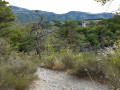
Carry on straight ahead again (ignore the Col du Tourrond road on the right), passing a wayside shrine. Walk through the woods, ignoring a path leading uphill to the left. The path then takes a wide bend to the left, offering views of the Avance Valley and then the Aiguilles de Chabrières. Head downhill to reach a crossroads.

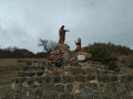
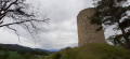
(2) Turn right and head for the Pindreau monument.

(3) Turn round and return to the previous junction.

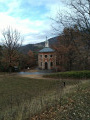
(2) Head up to the right towards the Chapelle du Précieux Sang. Once you reach the road, cross at the pedestrian crossing and head down to the right towards the Chapelle du Précieux Sang.

(4) Turn round, head back up to the road and follow it to the right as far as the car park (S/E).

Waypoints

  1. S/E : mi 0 - alt. 2,890 ft - Car park available - Notre-Dame du Laus
  2. 1 : mi 0.25 - alt. 2,986 ft - Basilique Notre-Dame du Laus
  3. 2 : mi 1.1 - alt. 2,776 ft - Crossroads
  4. 3 : mi 1.27 - alt. 2,736 ft - Statue de pindreau
  5. 4 : mi 2.13 - alt. 2,841 ft - Chapelle du Précieux Sang
  6. S/E : mi 2.28 - alt. 2,890 ft - Car park available - Notre-Dame du Laus

Notes

Variation 1: 12 km and 520 m elevation gain.

Around Notre-Dame du Laus via Pas du Lièvre

Alternative route 2: 16 km and 600 m elevation gain.

At the junction (4), leave the route described and turn left onto the path leading to the Col du Tourrond. Then follow the ‘Tour de Puy Cervier’ route as described; on returning to the Col du Tourrond, take the path opposite to reach the junction (4). Then resume the original route.

Worth a visit

Reviews and comments

5 / 5
Based on 2 reviews

Reliability of the description
5 / 5
Ease of following the route
5 / 5
Route interest
5 / 5
BAMX
BAMX

Overall rating : 5 / 5

Date of your route : Aug 15, 2025
Reliability of the description : ★★★★★ Very good
Ease of following the route : ★★★★★ Very good
Route interest : ★★★★★ Very good
Very busy route : Yes

A lovely walk when spending the day in Laus

Machine-translated

Claude6432
Claude6432

Overall rating : 5 / 5

Date of your route : Jun 16, 2020
Reliability of the description : ★★★★★ Very good
Ease of following the route : ★★★★★ Very good
Route interest : ★★★★★ Very good
Very busy route : No

A short, very easy and very pleasant walk. The route is clearly signposted. The route shown on the Visorando map is very accurate and easy to follow.

Machine-translated

Other walks in the area

For more walks, use our search engine .

The GPS track and description are the property of this route's author. Please do not copy them without permission.