Pic de l'Aigle and Belvédère des Quatre Lacs

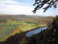
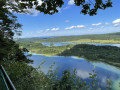
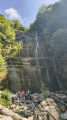
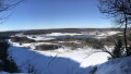
From the rocky ridge that marks the transition from the lake region to the Grandvaux plateau, the Pic de l'Aigle and the Belvédère des Quatre Lacs emerge during a wooded and lakeside walk.

Details

71687075
Creation:
Last update:
Last review:
  • Walking
    Activity: Walking
  • ↔
    Distance: 6.08 mi
  • ◔
    Average duration: 3h 35 
  • ▲
    Difficulty: Difficult

  • ⚐
    Back to start: Yes
  • ↗
    Ascent: + 889 ft
  • ↘
    Descent: - 866 ft

  • ▲
    Highest point: 3,261 ft
  • ▼
    Lowest point: 2,533 ft

Photos

Description of the walk

(S/E) From the Pic P1 car park, walk past the eyewear factory to take a small path leading to the Pic P2 and P3 car parks (“Parking du Haut du Pic”). At the road, turn right to go round P3 and reach P2.

(1) Start on the rocky path that climbs (yellow markings) northwards to the foot of the peak through beautiful dry grasslands. At the Fork in the road, go straight on. A steep climb (white and red markings) leads to the Pic de l’Aigle.

(2) The path continues to the right, heading north-east as it winds along the wooded ridge. It comes close to a forest track twice and leads to the Belvédère des Trois Lacs viewpoint (Ilay, Grand Maclu and Petit Maclu).

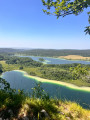
(3) Follow a stony path, still hugging the ridge, which leads out into the fir trees at the Belvédère des Quatre Lacs viewpoint.

(4) The path climbs to the right to the Belvédère car park, below the Route Forestière du Bois de Ban. Follow the track to the left, which continues as a path, running alongside the ridge marked by clusters of cliffs without ever getting too close to it. Via a steep, winding descent – which can be slippery in wet weather – the path joins the D 75 at the Côte de Maclu.

(5) Take the cycle lane on the left at the side of the road (yellow markings) to reach Lac du Petit Maclu. Reach the lake by following the path to the left at the bend.

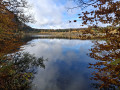
(6) Follow the path which then runs to the left of Lac du Petit Maclu and Lac du Grand Maclu towards Ilay. At the end of the Chemin des Lacs, the road on the left leads to Les Rousselets and its chapel, which seems to be nestled between two trees.

(7) Walk along the road to the left (marked with red and white signs) and take a path on the left which crosses the D39 twice – do so with care.

(8) After the second crossing, take the path furthest to the right opposite, then keep straight ahead and to the left. The well-marked path (an old tram line) climbs gradually up to the Chemin du Château. Then, at the junction between the forest road and the path you started on (yellow markings) towards P3, continue straight ahead to reach the car park from the outward journey (S/E).

Waypoints

  1. S/E : mi 0 - alt. 2,913 ft - Pic P1 car park
  2. 1 : mi 0.27 - alt. 2,953 ft - P2 peak car park
  3. 2 : mi 0.63 - alt. 3,205 ft - Pic de l'aigle 994m
  4. 3 : mi 1.59 - alt. 3,048 ft - Belvédère des Trois Lacs
  5. 4 : mi 1.83 - alt. 2,972 ft - Bélvédère des Quatre Lacs
  6. 5 : mi 2.77 - alt. 2,549 ft - Côte du Maclu - Lac du Petit Maclu
  7. 6 : mi 3.06 - alt. 2,543 ft - Lac du Petit Maclu
  8. 7 : mi 5.01 - alt. 2,549 ft - Les Rousselets
  9. 8 : mi 5.33 - alt. 2,664 ft - D39. Near the - Hérisson (rivière) - Affluent de l'Ain
  10. S/E : mi 6.08 - alt. 2,913 ft - P1 peak car park

Notes

This route can be very busy at weekends in May, as well as in the height of summer.

This route passes through a protected area, which may be subject to special regulations:

Worth a visit

There are two inns in the village of La Chaux-du-Dombief.

Reviews and comments

4.8 / 5
Based on 13 reviews

Reliability of the description
4.8 / 5
Ease of following the route
4.8 / 5
Route interest
4.9 / 5
Pou95
Pou95

Overall rating : 5 / 5

Date of your route : Aug 02, 2026
Reliability of the description : ★★★★★ Very good
Ease of following the route : ★★★★★ Very good
Route interest : ★★★★★ Very good
Very busy route : Yes

A superb hike; the views of the lakes from the viewing points are magnificent, with lagoon-like colours, and the section running alongside the lakes is perfect for a picnic with your feet in the water.
Hiking poles are a great help, particularly on the descent towards the lakes, as the paths are rutted with exposed roots.

Machine-translated

jpjournee
jpjournee

Overall rating : 4.7 / 5

Date of your route : Jul 02, 2026
Reliability of the description : ★★★★☆ Good
Ease of following the route : ★★★★★ Very good
Route interest : ★★★★★ Very good
Very busy route : No

A lovely walk with some beautiful views. Thank you.

I did this walk on my own in the morning in 3 hours in dry weather. It’s of moderate difficulty when done in the direction indicated.

2: Don’t miss the chance to climb up to the orientation table for a view of Mont Blanc (in dry weather and clear skies)

5: There’s no need to walk along the cycle path. There’s a footpath leading to Le Petit Maclu, and it’s very well signposted. It starts on your left once you reach the bottom of the descent.

8: Do not walk on the road. The footpath runs alongside it just above.

Machine-translated

matyeux
matyeux

Overall rating : 4.7 / 5

Date of your route : Jun 07, 2026
Reliability of the description : ★★★★☆ Good
Ease of following the route : ★★★★★ Very good
Route interest : ★★★★★ Very good
Very busy route : Yes

We went for a lovely walk today in glorious sunshine. We did the route with a 7-year-old and a 3-year-old (the 3-year-old spent half the time in a baby carrier).

Machine-translated

domkratt
domkratt

Overall rating : 4.7 / 5

Date of your route : Jun 01, 2026
Reliability of the description : ★★★★★ Very good
Ease of following the route : ★★★★☆ Good
Route interest : ★★★★★ Very good
Very busy route : Yes

A spectacular but challenging route, particularly the descent towards the lake.

Machine-translated

User 3229753

Hike completed on 8 May 2026

Please note,
There has been a change to the route. From Chemin du Château, you must go via the Pic car park. The direct route is closed.
Otherwise, a lovely hike.
Quite busy today.

Machine-translated

User 2152145

Overall rating : 5 / 5

Date of your route : Jan 06, 2026
Reliability of the description : ★★★★★ Very good
Ease of following the route : ★★★★★ Very good
Route interest : ★★★★★ Very good
Very busy route : No

It is advisable to allow a little more time than indicated.

Machine-translated

User 6922124

Overall rating : 5 / 5

Date of your route : Oct 10, 2025
Reliability of the description : ★★★★★ Very good
Ease of following the route : ★★★★★ Very good
Route interest : ★★★★★ Very good
Very busy route : No

A very beautiful hike to do in this direction in order to gain altitude. The views from above are magnificent.
You can also walk along the cliff while staying close to the trail.
I recommend this hike, it's a must!
There weren't too many people when I went on 10/10/25. It's the beginning of autumn, and the colours are beautiful too.
The trail has some muddy sections, but it is possible to get around them.

Machine-translated

Foto.phil67
Foto.phil67

Overall rating : 5 / 5

Date of your route : Aug 15, 2025
Reliability of the description : ★★★★★ Very good
Ease of following the route : ★★★★★ Very good
Route interest : ★★★★★ Very good
Very busy route : Yes

Please note: the route is very slippery in places and difficult for elderly people or young children

Machine-translated

Blondin01
Blondin01

Overall rating : 4.7 / 5

Date of your route : Aug 11, 2025
Reliability of the description : ★★★★☆ Good
Ease of following the route : ★★★★★ Very good
Route interest : ★★★★★ Very good
Very busy route : No

A lovely hike with some fairly steep climbs and/or descents and rocky, root-covered ground, so not necessarily suitable for beginners.

We set off at 8.30 a.m., so there weren't too many people on the trail and we were able to enjoy the cool morning air, even though most of the trail is in the shade.

Taking in the views and different locations, the walk took us 3 hours and 40 minutes.

Machine-translated

User 21602062

Overall rating : 5 / 5

Date of your route : Jul 27, 2025
Reliability of the description : ★★★★★ Very good
Ease of following the route : ★★★★★ Very good
Route interest : ★★★★★ Very good
Very busy route : Yes

Very beautiful route, shaded, well described, magnificent views. No difficulty for a hiker.

Machine-translated

User 18433251

Overall rating : 5 / 5

Date of your route : Jul 14, 2025
Reliability of the description : ★★★★★ Very good
Ease of following the route : ★★★★★ Very good
Route interest : ★★★★★ Very good
Very busy route : Yes

A beautiful shaded route along the heights of the lakes, with a peaceful return to their shores.
After the descent, choose the path rather than the lake road, if it is dry.
There are quite a few rocks and roots.

Machine-translated

Camille MZO
Camille MZO

Overall rating : 5 / 5

Date of your route : Jun 06, 2025
Reliability of the description : ★★★★★ Very good
Ease of following the route : ★★★★★ Very good
Route interest : ★★★★★ Very good
Very busy route : Yes

Hike done in June
The route is very varied, with forest at the top of the cliffs and a magnificent view of the lakes on the way back.
We were lucky enough to encounter some chamois.
And for botany enthusiasts, there are some very unusual box trees along the route.
The route is relatively slippery when it rains and there are some fairly steep descents, but it's easy if you're comfortable hiking.
I highly recommend it.

Machine-translated

User 9673297

Overall rating : 4.7 / 5

Date of your route : Jun 03, 2025
Reliability of the description : ★★★★★ Very good
Ease of following the route : ★★★★★ Very good
Route interest : ★★★★☆ Good
Very busy route : Yes

Nice route with no real difficulty

Machine-translated

ogalo
ogalo

Overall rating : 4 / 5

Date of your route : May 15, 2025
Reliability of the description : ★★★★★ Very good
Ease of following the route : ★★★☆☆ Average
Route interest : ★★★★☆ Good
Very busy route : Yes

Very enjoyable hike. Beautiful scenery. Completed in 3 hours, without breaks. Very easy to follow. Be careful, it is very muddy (May) with lots of roots in the undergrowth. Take walking sticks to avoid accidents.
However, the route is imported by the Tourist Office, which wanted to favour the start that suited them best, but if you start from P1, as they recommend, you begin by seeing the view of the Eagle Peak, then the viewpoints in the first 2 km, then you descend to the lakes so that the last 2 km are all uphill with no view at the end. My advice: follow the route in the same direction but starting from Ilay. This way, the last section of your hike will be the lakes, where you can picnic/swim.
At point 5, it is not clear from the map, but continue along the path rather than the road.

Machine-translated

Other walks in the area

For more walks, use our search engine .

The GPS track and description are the property of this route's author. Please do not copy them without permission.