Menditxorrotx from Etxalar

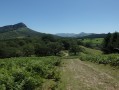
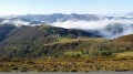
A lovely circular route around the village of Etxalar, passing by several peaks including Kokori and Menditxorrotx along beautiful forest paths, offering stunning views of the village and the various surrounding peaks.

Details

36782865
Creation:
Last update:
Last review:
  • Walking
    Activity: Walking
  • ↔
    Distance: 9.47 mi
  • ◔
    Average duration: 6h 25 
  • ▲
    Difficulty: Moderate

  • ⚐
    Back to start: Yes
  • ↗
    Ascent: + 2,398 ft
  • ↘
    Descent: - 2,379 ft

  • ▲
    Highest point: 2,362 ft
  • ▼
    Lowest point: 289 ft

Photos

Description of the walk

The starting point for the walk is the car park at the entrance to the village of Etxalar on Calle Bekolanda. To get there, see the ‘Practical Information’ section below.

(S/E) From the car park, take the road (Calle Bekolanda) heading to the left. The tarmac road gives way to a dirt track. This leads to the Ermita de Santa Cruz (Santa Krute Ermita). It is situated near the River Tximista and was built in the 16th century. Admire the various crosses arranged around it (some of which also date from the 16th century) and, a little further on, a pretty bridge. Legend has it that witches used to gather in the meadow next to it to celebrate the Akelarre (i.e. the Sabbath).

(1) Walk round the Ermita and take the path leading off to the left. Join a tarmac road and follow it to the right until you reach a fork in the road.

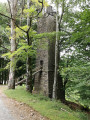
(2) Follow the directions shown on the sign for “Gaingo Borda” and on the other sign for “Azkua”. At the house you come to a little further on, follow the sign for “Azkua”. A short while later, you’ll notice the beautiful lime kiln, which was used to turn limestone into lime. This lime was then used to improve the quality of farmland or to whitewash the façades of houses. Continue to the junction.

(3) Do not follow the signs for “Azkua” any further, but take the path on the right. At an altitude of around 290 m, you’ll come to a junction where three paths meet.

(4) Leave the path you have been following and take the one on the left, which will lead you further on to another junction where three paths meet.

(5) Turn right, heading north-west, and continue to the next Y-junction.

(6) Turn left to reach a four-way junction.

(7) Turn left again. Then follow the track to reach the summit of Kokori at 723 m.

(8) Then take the descent, following the clearly visible ridge due north, until you reach the junction with the return path on the right.

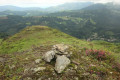
(9) Ignore this and continue straight on to the summit of Menditxorrotx or Mendizorrotz at 596 m, marked only by a small cairn.

(10) Retrace your steps for a few metres.

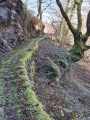
(9) Use the tree with white and yellow markings as a landmark. Do not take this path, but instead head straight down the slope for a few metres to reach the very narrow path visible a few metres below. Follow this path, which fades a little amongst the ferns, until you reach a wide track; follow this to the right until you come to a fork at an altitude of 490 m.

(11) Turn off to the left. A little further on, continue to the right along this wide track and do not follow theGR® signpost. Join a cross-track.

(12) Suggested round trip to visit the reservoir by following the “Odia-ubidea” path to the right.

(13) Pass the small dam of the very pretty reservoir and carry on to the end of the covered canal that feeds it, which is also our turning point to return to the path we left.

(12) Continue the walk straight ahead until you reach a junction of several paths and tracks.

(15) Follow the sign for “Etxalar” and return to the village of Etxalar.

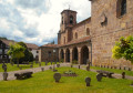
(16) In the centre of the village, take in the Church of Santa Maria or Andra Mari * and continue to the left to return to the car park (S/E).

Waypoints

  1. S/E : mi 0 - alt. 315 ft - Car park at Etxalar
  2. 1 : mi 0.57 - alt. 302 ft - Ermita
  3. 2 : mi 1.24 - alt. 699 ft - Signs
  4. 3 : mi 1.55 - alt. 722 ft - Junction
  5. 4 : mi 2.98 - alt. 968 ft - Junction
  6. 5 : mi 3.35 - alt. 1,257 ft - Change of direction
  7. 6 : mi 3.56 - alt. 1,339 ft - Change of direction
  8. 7 : mi 3.9 - alt. 1,575 ft - Junction
  9. 8 : mi 5.26 - alt. 2,352 ft - Kokori
  10. 9 : mi 5.67 - alt. 1,919 ft - Junction. Return route to the summit
  11. 10 : mi 5.69 - alt. 1,906 ft - Menditxorrotx summit
  12. 11 : mi 6.75 - alt. 1,683 ft - Junction
  13. 12 : mi 7.58 - alt. 1,020 ft - Junction. Return via the reservoir and canal
  14. 13 : mi 7.88 - alt. 994 ft - Water retention
  15. 14 : mi 7.97 - alt. 997 ft - Canal
  16. 15 : mi 8.7 - alt. 784 ft - Sign
  17. 16 : mi 9.34 - alt. 335 ft - Andra Mari Church
  18. S/E : mi 9.47 - alt. 318 ft - Car park

Notes

To get to Etxalar by car.
Cross the border at Behobie. At the roundabout, take the left-hand lane to join the N121-A towards Pamplona. Take the exit for NA4400/Etxalar/NA1210/Lesaka (you’ll see the Hotel Etxalar clearly signposted on the hill).
At the roundabout, turn left (second exit) to go under the bridge and continue straight on. You are now on the NA4400. After the sign marking the entrance to Etxalar, you will find the car park on your right.

Warning: you will be passing through an area with hunting posts. You should therefore not undertake this walk during the hunting season.

Worth a visit

  • ‘Andra Mari’ is a traditional Basque expression referring to the Virgin Mary. In France, this would correspond to the Church of Notre-Dame de l’Assomption. This church was built in three phases: the first in 1200, then as the population grew in the early 17th century, and finally the front section, the sacristy and the tower in the mid-17th century.

But do take particular note of the memorial stones. Most are circular in shape and bear dates ranging from the 17th to the 19th century. There are also some in the shape of a cross. On some of them, you can also read the names of the village households that own the stone.

Always be cautious and plan ahead when you're outdoors. Visorando and the author of this route cannot be held responsible for any accidents occurring on this route.

The GR® and PR® markings are the intellectual property of the Fédération Française de Randonnée Pédestre.

Reviews and comments

5 / 5
Based on 2 reviews

Reliability of the description
5 / 5
Ease of following the route
5 / 5
Route interest
5 / 5
User 4558449

Overall rating : 5 / 5

Date of your route : Jan 26, 2026
Reliability of the description : ★★★★★ Very good
Ease of following the route : ★★★★★ Very good
Route interest : ★★★★★ Very good
Very busy route : No

A very pleasant hike with no major difficulties.
We were also tempted to climb to the summit of Azcua and we did not regret it.
Take the time when you arrive to explore the beautiful village of Etxalar.

Machine-translated

Lannemi
Lannemi

Overall rating : 5 / 5

Date of your route : Aug 07, 2023
Reliability of the description : ★★★★★ Very good
Ease of following the route : ★★★★★ Very good
Route interest : ★★★★★ Very good
Very busy route : No

A new walk that we tried out straight away. The start point in the village, with its car park, and the finish, with its taverns, are particularly welcome. The walk is very pleasant, with sections through woodland and others along the ridges, and presents no difficulty whatsoever.
At point 8, we decided to head south towards the summit of Askua, which was beckoning us. From there, we then took the GR11/12 eastwards, which brought us back onto the main route at point 11. It took us 6½ hours, including a lunch break, to complete the circular route.

Machine-translated

Other walks in the area

For more walks, use our search engine .

The GPS track and description are the property of this route's author. Please do not copy them without permission.