Lakes Laramon and Serpent via the Chemin de Ronde, starting from Névache

The two lakes, Laramon and Serpent, are a classic hiking destination in the Clarée Valley. For us, the journey is often more important than the destination, which is why we made our way there via the Chemin de Ronde, a route that’s well worth the walk in its own right.

Details

10015042
Creation:
Last update:
Last review:
  • Walking
    Activity: Walking
  • ↔
    Distance: 12.11 mi
  • ◔
    Average duration: 8h 05 
  • ▲
    Difficulty: Difficult

  • ⚐
    Back to start: Yes
  • ↗
    Ascent: + 2,897 ft
  • ↘
    Descent: - 2,877 ft

  • ▲
    Highest point: 8,100 ft
  • ▼
    Lowest point: 5,223 ft

Photos

Description of the walk

Head to the village of Névache.
Park in the large car park at the entrance to the village, near the Tourist Office.

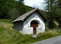
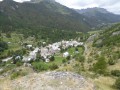
(S/E) Enter the village via the street between the war memorial and the Tourist Office, go round the church and its cemetery on the right, and join the road at the village exit. Cross the Torrent du Vallon, passing the Saint-Benoît Chapel and the entrance to the path leading to the Col du Vallon. You’ll reach a crossroads on the path just before thefirst hairpin bend.

(1) Turn right onto this path to cut across the bends. You will then rejoin the road, passing the Notre-Dame de Bon Secours Chapel – near which stands a large wooden cross – and then the Sainte-Barbe Chapel. Continue on until you reach another path junction.

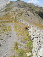
(2) Take this path on the right; it is theGRP® Tour du Mont Thabor, marked in red and yellow. Here, tackle a steady climb to reach the Chalets de Biaune. Then turn left, still following the GRP®. Enjoy this balcony path, which is sometimes level and sometimes slightly uphill: this is the Chemin de Ronde.
Follow it – you can’t go wrong – until you pass two small lakes in quick succession on your right.

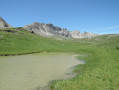
(3) Turn right onto a path that leads directly to Lac Laramon.

(4) After crossing the lake’s outlet, join the path that climbs along its right bank.
Then continue along the path uphill to reach Lac Serpent. As you pass a group of ruins of small dry-stone buildings – no doubt former sheepfolds – it is best to take the left-hand branch of the path, which offers a more distant view of Lac Serpent.

(5) Head back down the same route to return to the Lac Laramon junction.

(4) Turn right onto the wide, well-restored track to reach the junction of the Chemin de Ronde and the GRP®.

(6) Cut across this path to continue the descent along the winding track and reach the hamlet of Ricou.

(7) Continue along the track suitable for vehicles, passing through a few small clusters of chalets – Pied de Ricou and La Chalanchette – before reaching the hamlet of Fontcouverte.

(8) Here, take the track, known as the Route de la Haute Vallée de la Clarée. Stay on this track until you reach the GRP® junction.

(2) Follow the same route as on the way out to return to the tourist office car park (S/E).

Waypoints

  1. S/E : mi 0 - alt. 5,223 ft - Car park - Office de tourisme de Névache
  2. 1 : mi 0.8 - alt. 5,518 ft - Path cutting across the hairpin bends
  3. 2 : mi 1.31 - alt. 5,817 ft - GRP junction
  4. 3 : mi 4.73 - alt. 7,559 ft - The small lakes
  5. 4 : mi 5.07 - alt. 7,746 ft - Lac Laramon
  6. 5 : mi 5.67 - alt. 8,100 ft - Lac du Serpent
  7. 6 : mi 6.54 - alt. 7,516 ft - Chemin de Ronde junction
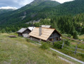
  8. 7 : mi 7.32 - alt. 6,946 ft - Refuge de Ricou
  9. 8 : mi 8.36 - alt. 6,106 ft - Fontcouverte - Clarée (rivière)
  10. S/E : mi 12.11 - alt. 5,223 ft - Car park - Office de tourisme de Névache

Notes

Although there are no major difficulties, this walk does not require any special skills, but you mustn’t be put off by the occasional climb. Good mid-mountain walking boots and a pair of walking poles are therefore recommended.
There are no shelters or water sources along this route, apart from the lakes where you can cool off.

Worth a visit

By personal choice, we made our return journey from Fontcouverte to Névache by road, in order to see the chapels dotted here and there along the route, and to get a closer look at the glacially eroded rocks at Basse Sausse and Notre-Dame de Bon Secours.

A more straightforward option would have been to follow, from Fontcouverte (and all the way to Névache without interruption), the excellent and very scenic path along the right bank of the Clarée which, as well as offering lovely views of the river, takes you past some beautiful waterfalls – including those at Fontcouverte and Débaret – and a large number of picturesque bridges: the Jadis, the Souchère, the Rately, etc.
To get an idea of the route for this option, see the walk: ‘The Clarée, right bank: from Névache to the Laval car park’, which describes this route in the uphill direction. I therefore recommend this option to those who, above all, dislike walking on tarmac.

Reviews and comments

5 / 5
Based on 2 reviews

Reliability of the description
5 / 5
Ease of following the route
5 / 5
Route interest
5 / 5
stjo
stjo

@Gomez Carlos, for the return journey, you should have followed my suggestion to take the path along the right bank of the Clarée. (Described in the opposite direction by another contributor.) Bear this in mind if you ever do this route again.

Machine-translated

Gomez Carlos
Gomez Carlos

Overall rating : 5 / 5

Date of your route : Nov 21, 2023
Reliability of the description : ★★★★★ Very good
Ease of following the route : ★★★★★ Very good
Route interest : ★★★★★ Very good
Very busy route : No

There weren’t many people around at the end of November, and there was snow from Lac Laramon onwards.
Lovely view from the balcony path. The return journey by road is a bit long all the way to Nevache.

Machine-translated

gerhub
gerhub

Overall rating : 5 / 5

Date of your route : Sep 08, 2020
Reliability of the description : ★★★★★ Very good
Ease of following the route : ★★★★★ Very good
Route interest : ★★★★★ Very good
Very busy route : No

A really lovely route, beautiful mountains, stunning high-altitude lakes, well-groomed trails – definitely best done in bad weather

Machine-translated

Other walks in the area

For more walks, use our search engine .

The GPS track and description are the property of this route's author. Please do not copy them without permission.