Les Bécasses

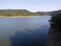
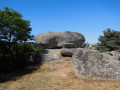
This hike will allow you to discover the surroundings of Chaudes-Aigues and the local agriculture based on livestock farming (beautiful Aubrac cows). Throughout the route, the flora is rich and varied.

Details

756644
Creation:
Last update:
Last review:
  • Walking
    Activity: Walking
  • ↔
    Distance: 6.86 mi
  • ◔
    Average duration: 4h 05 
  • ▲
    Difficulty: Moderate

  • ⚐
    Back to start: Yes
  • ↗
    Ascent: + 1,079 ft
  • ↘
    Descent: - 1,079 ft

  • ▲
    Highest point: 3,369 ft
  • ▼
    Lowest point: 2,490 ft

Description of the walk

Starting point: Enclos car park, next to the Chaudes-Aigues gymnasium.

(S/E) Walk up towards the church, take the small street that descends to the left and, at the crossroads, take the street that ascends to the right (Rue Saint-Blaise). Continue straight on towards the Cité Saint-Michel.

(1) Turn right onto the small path that goes uphill and follow it towards the north-west. At the road, continue right for 200 metres, then, at the bend, follow the path on the left that goes back up towards the D11. Continue a few dozen metres to the left.

(2) At the Hert crossroads, take the path on the left to Fridière.

(3) When you reach the farm, follow the road to the left to the Croix du Morentès.

(4) At the cross, leave the road and continue along the path opposite, which crosses the meadows and then part of the woods before arriving at Croix de Védrines.

(5) At the road, turn left. At the entrance to the woods, leave the road and take the path opposite to the D921.

(6) Cross the crossroads and turn left onto the path along the road until you reach the crossroads with the Route des Deux-Verges. Turn right onto the D513 road at a place called "Les Bécasses".

(7) Leave the road and turn left onto the path. Pass under a power line and take the second path on the left, which leads to the hamlet of Lescure.

(8) At the hamlet, turn left onto the local road until you reach the D921.

(9) Follow this road to the left and, at the next hairpin bend, turn right onto a path and head up towards Château du Couffour.

(10) When you arrive below the château, turn left under the farmhouse, then right past the campsite reception building and down into the forest (viewpoint over Chaudes-Aigues) to the rest area.

(11) Take the small road opposite that passes behind the police station, continue to the Cité Saint-Michel and follow the street to the end.

(12) Turn right and go down the road you took on the way there to the Enclos car park (S/E).

Waypoints

  1. S/E : mi 0 - alt. 2,510 ft - Enclos car park.
  2. 1 : mi 0.28 - alt. 2,615 ft - Path ascending to the right.
  3. 2 : mi 0.92 - alt. 3,038 ft - Carrefour de l'Hert
  4. 3 : mi 1.89 - alt. 3,248 ft - Fridière
  5. 4 : mi 2.28 - alt. 3,215 ft - Croix du Morentès
  6. 5 : mi 3.22 - alt. 3,320 ft - Croix de Védrines
  7. 6 : mi 3.72 - alt. 3,337 ft - Junction with the D921
  8. 7 : mi 4.27 - alt. 3,268 ft - Path on the left
  9. 8 : mi 5.28 - alt. 3,104 ft - Lescure, turn left onto the local road
  10. 9 : mi 5.62 - alt. 2,930 ft - Junction with the D921
  11. 10 : mi 5.87 - alt. 3,018 ft - Le Couffour
  12. 11 : mi 6.27 - alt. 2,667 ft - Small road behind the police station
  13. 12 : mi 6.57 - alt. 2,618 ft - Rue Saint-Blaise
  14. S/E : mi 6.86 - alt. 2,510 ft - Enclos car park.

Notes

Crossing private property, dogs prohibited even on a leash.
Yellow markings.

Worth a visit

Croix de Morentès.
Croix de Védrines.
Saint-Martin - Saint-Blaise Church in Chaudes-Aigues.
Source du Par (water at 82°C).
Thermal establishments.

Reviews and comments

4.5 / 5
Based on 16 reviews

Reliability of the description
4.8 / 5
Ease of following the route
4.8 / 5
Route interest
4.1 / 5
Gargani
Gargani

An interesting walk with quite varied sections and a few scenic spots; be careful on the short stretch of road as there are a lot of cars.

Machine-translated

Boge
Boge

Overall rating : 4.7 / 5

Date of your route : Jul 27, 2026
Reliability of the description : ★★★★★ Very good
Ease of following the route : ★★★★★ Very good
Route interest : ★★★★☆ Good
Very busy route : No

Perhaps it would have been a good idea to mention that this lovely walk is very well signposted in yellow...!

Machine-translated

Gargani
Gargani

Overall rating : 4.3 / 5

Date of your route : Jun 15, 2026
Reliability of the description : ★★★★☆ Good
Ease of following the route : ★★★★★ Very good
Route interest : ★★★★☆ Good
Very busy route : No

A leisurely walk through lush, varied countryside; not difficult overall
A bit long towards the end, passing near a housing estate
Note: there is a tricky section on a fairly busy road, but fortunately this section is short

Machine-translated

tpenot
tpenot

Overall rating : 5 / 5

Date of your route : Nov 18, 2024
Reliability of the description : ★★★★★ Very good
Ease of following the route : ★★★★★ Very good
Route interest : ★★★★★ Very good
Very busy route : No

Beautiful scenery, moderate difficulty but a significant elevation gain at the start of Chaudes Aigues.

Machine-translated

Nanou31
Nanou31

Overall rating : 4.7 / 5

Date of your route : Aug 26, 2024
Reliability of the description : ★★★★★ Very good
Ease of following the route : ★★★★★ Very good
Route interest : ★★★★☆ Good
Very busy route : No

Great walk and beautiful scenery.
Very little shelter from the sun.

Machine-translated

lyllatsrando
lyllatsrando

Overall rating : 4.7 / 5

Date of your route : Jul 16, 2024
Reliability of the description : ★★★★★ Very good
Ease of following the route : ★★★★★ Very good
Route interest : ★★★★☆ Good
Very busy route : No

A very beautiful hike done under bright sunshine, easy to follow, with some nice climbs in the first part and a gentle finish. Don't miss a stroll through Chaudes Aigues when you arrive, a very pretty village full of character

Machine-translated

Nathjp63
Nathjp63

Overall rating : 4.7 / 5

Date of your route : Nov 11, 2022
Reliability of the description : ★★★★★ Very good
Ease of following the route : ★★★★★ Very good
Route interest : ★★★★☆ Good
Very busy route : No

A very pleasant and well-marked hike. Marked as 11 km, it is actually only 9 km. Long climb at the start, then flat. Unobstructed view 😉

Machine-translated

MARIEHE
MARIEHE

Overall rating : 5 / 5

Date of your route : Nov 03, 2022
Reliability of the description : ★★★★★ Very good
Ease of following the route : ★★★★★ Very good
Route interest : ★★★★★ Very good
Very busy route : No

a slightly dangerous section, albeit very short, on the D921 road (between 9 and 10 on the map) with a safety barrier and no possibility of passing behind it. We did not encounter any other hikers.

Machine-translated

Nicolas03800
Nicolas03800

Overall rating : 5 / 5

Date of your route : Sep 04, 2022
Reliability of the description : ★★★★★ Very good
Ease of following the route : ★★★★★ Very good
Route interest : ★★★★★ Very good
Very busy route : No

It's not easy to describe how busy it is in September. Very nice route. BE CAREFUL at stage 9, as the road is relatively dangerous for 100 metres before climbing up to the castle. Challenging hike.

Machine-translated

randoloire42
randoloire42

Overall rating : 4.7 / 5

Date of your route : Jun 17, 2022
Reliability of the description : ★★★★★ Very good
Ease of following the route : ★★★★★ Very good
Route interest : ★★★★☆ Good
Very busy route : No

Lovely walk

Machine-translated

REDONDIE ARLETTE
REDONDIE ARLETTE

Overall rating : 5 / 5

Date of your route : Jun 13, 2021
Reliability of the description : ★★★★★ Very good
Ease of following the route : ★★★★★ Very good
Route interest : ★★★★★ Very good
Very busy route : No

magnificent hike with glorious sunshine and stunning scenery,

Machine-translated

coco93
coco93

Overall rating : 4 / 5

Date of your route : Sep 11, 2020
Reliability of the description : ★★★★☆ Good
Ease of following the route : ★★★★☆ Good
Route interest : ★★★★☆ Good
Very busy route : No

beautiful hike

Machine-translated

Yann63
Yann63

Overall rating : 4.3 / 5

Date of your route : Aug 22, 2020
Reliability of the description : ★★★★★ Very good
Ease of following the route : ★★★★☆ Good
Route interest : ★★★★☆ Good
Very busy route : Yes

The hike is very pleasant, the only downside is that you have to walk along the main road for 10 minutes, which is a shame.

Machine-translated

Denis L3.
Denis L3.

Overall rating : 4 / 5

Date of your route : Aug 09, 2020
Reliability of the description : ★★★★☆ Good
Ease of following the route : ★★★★☆ Good
Route interest : ★★★★☆ Good
Very busy route : No

A lovely walk to explore the area around Chaudes-Aigues, but it's not easy to find the trail in Chaudes-Aigues.

Machine-translated

Marsilly17
Marsilly17

Overall rating : 4.7 / 5

Date of your route : Oct 06, 2019
Reliability of the description : ★★★★★ Very good
Ease of following the route : ★★★★★ Very good
Route interest : ★★★★☆ Good

The highly detailed itinerary allowed us to discover this environment and enjoy the region's attractions. Magnificent flora and dense fauna (birds, all kinds of game, etc.) enhance this hike.

Machine-translated

Other walks in the area

For more walks, use our search engine .

The GPS track and description are the property of this route's author. Please do not copy them without permission.