The Malbonnet circuit

A walk through the hills above Malbo, amongst woods and pastures.

Details

32870702
Creation:
Last update:
Last review:
  • Walking
    Activity: Walking
  • ↔
    Distance: 6.97 mi
  • ◔
    Average duration: 4h 05 
  • ▲
    Difficulty: Moderate

  • ⚐
    Back to start: Yes
  • ↗
    Ascent: + 1,010 ft
  • ↘
    Descent: - 1,007 ft

  • ▲
    Highest point: 4,557 ft
  • ▼
    Lowest point: 3,622 ft

Photos

Description of the walk

Park in the small car park at the entrance to the village.

(S/E) Turn right onto the D54 towards Roupon, following the red signposts. Pass the cemetery and follow the road to the path leading to the Rocaillade site.

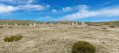
(1) Turn right to reach the site.

(2) Once you’ve enjoyed the site, return to the road.

(1) Continue to the right until you reach the next path on the left, which has a car park.

(3) Follow this track to a junction at the top of the hill.

(4) Keep left and carry on straight ahead until you reach the next junction.

(5) Turn right at the sign and head uphill to the gate. Climb over the ladder and turn left towards the woodland, which you should cross by continuing straight on to its northern edge to reach a field. Cross the pasture and rejoin the path.

(6) Turn left and head uphill, following the edge of the Bois de las Fros, until you reach a three-way junction with a signpost.

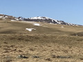
(7) Take the dirt track on the left and enjoy the view of the Plomb du Cantal. Make a 90° right-hand turn, then arrive at a junction with a path on the left.

(8) Follow this path towards Malbo. Note the Blats alpine huts on your right and head down the path to Polverelles.

(9) Walk through the hamlet and continue along the road, going straight on at every junction.

(10) Pass the Church of Saint-Jean-Baptiste on your left, negotiate the bend and reach the car park (S/E).

Waypoints

  1. S/E : mi 0 - alt. 3,635 ft - Car park
  2. 1 : mi 0.59 - alt. 3,740 ft - Path on the right
  3. 2 : mi 0.73 - alt. 3,711 ft - La Rocaillade site
  4. 3 : mi 0.99 - alt. 3,770 ft - Path on the left
  5. 4 : mi 1.49 - alt. 3,904 ft - Y-junction
  6. 5 : mi 1.66 - alt. 3,917 ft - Turn right
  7. 6 : mi 3.2 - alt. 4,455 ft - Crossroads
  8. 7 : mi 3.82 - alt. 4,357 ft - Signpost, path on the left
  9. 8 : mi 4.45 - alt. 4,557 ft - Crossroads
  10. 9 : mi 6.32 - alt. 3,934 ft - Polverelles
  11. 10 : mi 6.74 - alt. 3,727 ft - Saint-Jean-Baptiste Church
  12. S/E : mi 6.97 - alt. 3,635 ft - Car park

Worth a visit

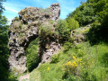
(2) La Rocaillade site.
(7) View of the Plomb du Cantal.
(8) The Blats burons.

Reviews and comments

4.7 / 5
Based on 3 reviews

Reliability of the description
4.7 / 5
Ease of following the route
5 / 5
Route interest
4.3 / 5
User 11252665

Overall rating : 4.3 / 5

Date of your route : Aug 03, 2026
Reliability of the description : ★★★★☆ Good
Ease of following the route : ★★★★★ Very good
Route interest : ★★★★☆ Good
Very busy route : No

A lovely walk with some shaded sections.
However, we took it at a leisurely pace and it only took us 2½ hours instead of the 4 hours stated in the description.

Machine-translated

Planeu
Planeu

Overall rating : 4.7 / 5

Date of your route : Jun 22, 2026
Reliability of the description : ★★★★★ Very good
Ease of following the route : ★★★★★ Very good
Route interest : ★★★★☆ Good
Very busy route : No

All in all, a lovely walk

Machine-translated

User 28146486

Overall rating : 5 / 5

Date of your route : Nov 27, 2025
Reliability of the description : ★★★★★ Very good
Ease of following the route : ★★★★★ Very good
Route interest : ★★★★★ Very good
Very busy route : No

A magnificent hike that allows you to discover these superb landscapes between forests, pastures and trails where it is pleasant to hike.

Machine-translated

Other walks in the area

For more walks, use our search engine .

The GPS track and description are the property of this route's author. Please do not copy them without permission.