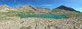
A circular route via the Roc d’Alibrandes and the Pointe de Méollion from Orcières

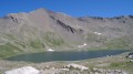
Discover the vast network of trails around Orcières by climbing up to the Roc d’Alibrandes, then on to the Pointe de Méollion, which offers a view over the other side of the mountain and a magnificent vista of the Champsaur. A pleasant route despite its proximity to the resort.

Details

49252765
Creation:
Last update:
Last review:
  • Walking
    Activity: Walking
  • ↔
    Distance: 6.68 mi
  • ◔
    Average duration: 4h 55 
  • ▲
    Difficulty: Moderate

  • ⚐
    Back to start: Yes
  • ↗
    Ascent: + 2,113 ft
  • ↘
    Descent: - 2,113 ft

  • ▲
    Highest point: 8,123 ft
  • ▼
    Lowest point: 6,086 ft

Description of the walk

Travel to Orcières via the D944, then head up to the Orcières Merlette resort via the D76. At the entrance to the resort, take Rue des Soleils, which climbs to the left (Les Hauts de Merlette). Park at the very end of the street, just below the Cro Magnon restaurant, in the car park.
Note: a free bus service runs in July and August between the leisure centre, the village and the resort. The regular coach service between Gap and Orcières Merlette 1850 operates all year round.

(S/E) Walk up to the top of the resort via the Impasse du Serre des Boucs (numerous wooden steps), keeping the Le Cro Magnon restaurant on your right. At the end of the cul-de-sac, take the footpath, walk past a house and head north (wooden sign) into the forest. Ignore the small paths to the right and left. Leave the forest and join the track.

(1) Turn left onto it and follow the winding track uphill until you reach a hairpin bend.

(2) Continue along the track to the left until you reach the Clot du Serre junction. Near the ‘La Chaup’ sign (2,040 m) is the launch site for many paragliders.

(3) Turn onto the path on the left; you’ll soon come to another crossroads.

(4) Take the path on the right. Pass the Marches ski lift. Continue on to reach the Lauzières chairlift.

(5) Continue along a path running along the hillside until you reach a Y-junction.

(6) Take the path on the right. Pass beneath the Cross of Saint-Jean and carry on to the Col d’Alibrandes, skirting the summit.

(7) Turn right to reach the Roc d’Alibrandes and the cross at the summit.

(8) Turn back to return to the junction.

(7) Turn right onto the path and follow the ridge. You’ll reach another Y-shaped junction.

(9) Turn right and continue the climb, via a series of gentle hairpin bends, until you reach the Pointe de Méollion, near the top station of the ski lifts.

(10) Head down the slope to the right to reach the top station of the Lauzières chairlift. Note: the path branching off to the right is an alternative route that also leads to the slope.

(11) Continue along the track, veering slightly to the right, passing under the chairlift three times before reaching the top station of the Montagnou chairlift.

(12) Walk past the Marches ski lift station, then take the piste that descends to the right and continue down the ridge until you reach the Clot de Serre junction, which you passed earlier on the way up.

(3) Turn left and retrace your steps along the route you took on the way there to return to the car park on Rue des Soleils (S/E).


Waypoints

  1. S/E : mi 0 - alt. 6,086 ft - Rue des Soleils car park
  2. 1 : mi 0.38 - alt. 6,470 ft - Former top station of the Soleil chairlift (altitude 1,971)
  3. 2 : mi 0.61 - alt. 6,617 ft - Former Montagnou chairlift
  4. 3 : mi 0.99 - alt. 6,680 ft - Clot du Serre (2,037 m)
  5. 4 : mi 1.12 - alt. 6,690 ft - Start from the Cairn
  6. 5 : mi 1.71 - alt. 7,057 ft - Lauzières chairlift
  7. 6 : mi 2.06 - alt. 7,352 ft - Y-junction
  8. 7 : mi 2.77 - alt. 7,838 ft - Roc d’Alibrandes ridge. Fork in the path. Return
  9. 8 : mi 2.88 - alt. 7,874 ft - Roc d’Alibrandes
  10. 9 : mi 3.43 - alt. 7,808 ft - Ubac de Méollion junction
  11. 10 : mi 3.81 - alt. 8,123 ft - Pointe de Méollion
  12. 11 : mi 4.05 - alt. 8,022 ft - Upper station of the Lauzières chairlift
  13. 12 : mi 5.21 - alt. 7,123 ft - Upper station of the Montagnou chairlift
  14. S/E : mi 6.68 - alt. 6,086 ft - Rue des Soleils car park

Notes

There are no water sources along the route, but all facilities are available at the Orcières resort.

Worth a visit

The route starts and finishes amongst the resort’s slopes (skiing in winter, mountain biking in summer). However, the ascent to the Roc and the Pointe de Méollion alternates between woodland and flower-filled meadows. Paragliders take off from the ridges.
Lovely views over the Champsaur (the Autanes, the Aiguille d’Orcières) and the Écrins range, with the Aiguille de Cédéra in the foreground.
(7) Alternative route to the Roc d’Alibrandes: follow the ridge to climb to La Muande (elevation 2,464). This adds approximately 50 metres of elevation gain and 10 minutes to the walk.

Reviews and comments

4 / 5
Based on 4 reviews

Reliability of the description
4 / 5
Ease of following the route
3.8 / 5
Route interest
4.3 / 5
User 5714902

Overall rating : 3.3 / 5

Date of your route : Aug 03, 2026
Reliability of the description : ★★★☆☆ Average
Ease of following the route : ★★★☆☆ Average
Route interest : ★★★★☆ Good
Very busy route : No

Two years ago, I did this lovely walk along the upper section (between the Roc d’Alibrandes and the Meolion), but since then, the path has been ruined by the construction of new ski runs along a large part of the suggested route. If I were to do it again, I’d go via the Forest des Marches and then take a path heading due north to rejoin the original trail at point 4. And the same on the way back.

Machine-translated

marceldetouillon@gmail.com

Overall rating : 4.3 / 5

Date of your route : Aug 11, 2025
Reliability of the description : ★★★★★ Very good
Ease of following the route : ★★★★☆ Good
Route interest : ★★★★☆ Good
Very busy route : No

This season, due to major work on the ski slopes at Orcières Merlette, part of the route is unpleasant,
dusty construction site, risk of falling rocks, etc.

Machine-translated

DE CARO
DE CARO

Overall rating : 3.3 / 5

Date of your route : Jul 15, 2025
Reliability of the description : ★★★☆☆ Average
Ease of following the route : ★★★☆☆ Average
Route interest : ★★★★☆ Good
Very busy route : No

We were unable to follow the route properly as work was blocking the way and should be cleared.

Machine-translated

rpastant
rpastant

Overall rating : 5 / 5

Date of your route : Sep 06, 2024
Reliability of the description : ★★★★★ Very good
Ease of following the route : ★★★★★ Very good
Route interest : ★★★★★ Very good
Very busy route : No

On Friday 6 September 2024, taking advantage of some milder weather, I decided to go on this round-trip hike from the top of the resort to the Col d’Alibrandes.
At the end of the season, you can park in the car park at Impasse du Serre des Boucs (1,860 m), just below the Cro-Magnon restaurant, near Impasse des Vieux Chalets. After climbing the numerous wooden steps, head north through the larch forest. The track leads to the Clot du Serre (sign for La Chaup at an altitude of 2,040m), a popular launch site for paragliders in this area. A little further on, an old wooden sign points to the Roc d’Alibrandes, which is reached via an overhanging path that passes above the Croix Saint-Jean
(signpost 2,240 m). This route, from the La Chaup signpost, is marked in yellow. Before the pass, there’s a slightly tricky section of path (micashist?). There’s a lovely view of the Grande Autane, the Palastre, the Tourrond…
As soon as possible, I’ll continue this hike by completing the circular route via the Pointe de Méollion at an altitude of 2,477 metres. Thanks to our guide for all the information provided – it was very useful.
On the route, I saw just two hikers and, near the take-off area, about ten paragliders. A very pleasant route, where you can take time for yourself and admire the magnificent natural surroundings, with the added bonus of eagles and marmots. Thank you, and as always in the mountains, be careful!
This is a hike that can also be done via the Forest de Marches trail...

Machine-translated

Other walks in the area

For more walks, use our search engine .

The GPS track and description are the property of this route's author. Please do not copy them without permission.