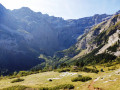
The Pimené, an exceptional viewpoint over the Cirque de Gavarnie

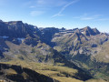
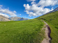
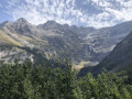
This beautiful day’s hike in the high mountains offers breathtaking views of the Cirque de Gavarnie, with its peaks over 3,000 metres towering above it, the Mont-Perdu massif, the Cirque d’Estaubé, as well as a 360° panorama of the entire Pyrenees mountain range, the border, the Spanish peaks and the whole of the French Piedmont region of the Hautes-Pyrénées.
On the return leg, this circular walk follows the ridge leading up to the Hourquette d’Alans, offering a fun and airy, yet un exposed, section.
Please read the recommendations regarding the (5) on both the outward and return journeys.

Details

2555043
Creation:
Last update:
Last review:
  • Walking
    Activity: Walking
  • ↔
    Distance: 10.48 mi
  • ◔
    Duration according to the author: 7 hrs 
  • ▲
    Difficulty: Very difficult

  • ⚐
    Back to start: Yes
  • ↗
    Ascent: + 5,174 ft
  • ↘
    Descent: - 5,148 ft

  • ▲
    Highest point: 9,098 ft
  • ▼
    Lowest point: 4,498 ft

Photos

Description of the walk

Park in the local authority car park on the right on the outskirts of the village, or – before 9.30 am in high season – in the village itself, in one of the private car parks. Both charge €5 per day (as of 2019).

(S/E) Finish walking through the village, heading towards the unmissable Cirque, which lies due south. Cross the Pont Brioule bridge near the gendarmerie and continue along the right bank for about 500 metres.

Reach the junction for the Refuge des Espuguettes, the Hourquette d’Alans and the Gloriettes dam. Yellow directional signs indicate all the destinations.

(1) Start the ascent on the left, first alongside the Ruisseau d’Alans, which flows down from the Petit Piméné and the Espuguettes, then into the Bois de Pailla. Although the path is not signposted, it is very clearly marked. On leaving the Bois de Pailla, just over an hour after setting off from Gavarnie, you can just make out the tip of the refuge’s roof.

(2) At the 1782-metre mark, on the vast Pailla Plateau, near a National Park sign, ignore the fork to the right towards the Cabane de Pailla (the ascent towards the Swan couloir between the two Astazou peaks), and head north-east up the final 250 metres, finding the best route to the refuge via the main path – which is clearly marked and visible – or the countless secondary paths and cattle tracks.

(3) From the refuge, on the grassy summer pasture plateau, take care to stay on the main path. Head north-east towards the Col du Pimené, below the Petit Pimené. Pass the watering hole and the Espuguettes marsh on your right and continue up the slope, which becomes steeper once again.

Circumvent the Plateau des Cardous to the north, adjusting your course towards the east-south-east and then towards the south-east via several hairpin bends; pass the 2,232-metre hillock, keeping it on your right, then take one final hairpin bend. At 2,260 metres, you’ll reach a fork in the path with a signpost.

(4) Turn left here, heading north-north-west along the south-western flank of the Pimené. After several hairpin bends, reach the Col du Pimené (2,482m). From here, you cannot see the Pimené itself, only its ‘little brother’ to the left, almost due north.

(5) At the pass, head left to stay on the ridge and climb to the summit of the Petit Pimené (splendid view).

(6) Descend due north to the small pass (2,647 m).

(7) Resume the ascent of the ridge heading north. The slope becomes really steep.
Follow the Pyrenees National Park markings (the letters ‘PN’ and chamois in red on a white square background).
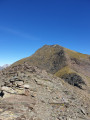
Caution: after a very gruelling 150m climb where you’ll need to use your hands and navigate a few exposed sections, you’ll reach the Pimené. On the final metres of the ascent, make sure you stay right on the ridge line – that’s where it’s safest!

(8) The descent follows the same route back to the small pass.

(7) Then take a path skirting the Petit Pimené to the east (marked in purple on the IGN map).

(5) This will take you back to the Col du Pimené. Continue south-east along the ridge leading to the Hourquette d’Alans. This path is fairly well marked, but these ridges remain challenging nonetheless. Pass the unnamed peaks at 2,487m, 2,465m and 2,521m. There is no longer any marked path for the final 300 metres. On the 2,521m peak, a cairn is visible from a distance.

(9) The final rocky spur or outcrop is very difficult to access (erroneously marked as 2,505 m, but is in fact higher than the one crossed at 2,521 m). You must bypass it on the left (east) as soon as the rock face rises steeply opposite the ridge line. Then descend towards the Cirque d’Estaubé and rejoin the path coming from the Barrage des Gloriettes, which can be seen from the ridge.

(10) Turn right and climb up to the Hourquette d’Alans. This pass alone is well worth the trip!

(11) Turn right and descend directly below the rocky outcrop you bypassed earlier and the ridge.

(4) At the junction you passed on the way up, turn left and descend to the Refuge des Espuguettes.

(3) Continue down the same route as on the way there until you reach Gavarnie (S/E).

Waypoints

  1. S/E : mi 0 - alt. 4,498 ft - Village de Gavarnie
  2. 1 : mi 0.61 - alt. 4,557 ft - Common junction (out and back) - Gave de Pau
  3. 2 : mi 1.53 - alt. 5,837 ft - Junction at Cabane de Pailha
  4. 3 : mi 2.18 - alt. 6,640 ft - Refuge des Espuguettes
  5. 4 : mi 3.22 - alt. 7,425 ft - Junction of the circular loop
  6. 5 : mi 4.07 - alt. 8,291 ft - Col de Pimené (2530m)
  7. 6 : mi 4.38 - alt. 8,720 ft - Petit Pimené
  8. 7 : mi 4.49 - alt. 8,720 ft - False pass
  9. 8 : mi 4.76 - alt. 9,065 ft - Piméné
  10. 9 : mi 6.02 - alt. 8,182 ft - Summit in front of the rocky outcrop
  11. 10 : mi 6.3 - alt. 7,441 ft - Gloriettes trail junction – Turn right
  12. 11 : mi 6.7 - alt. 7,933 ft - Hourquette d'Alans (2430m)
  13. S/E : mi 10.48 - alt. 4,498 ft - Village de Gavarnie

Notes

This description is based on a hike undertaken in summer.

In both summer and winter, check the weather forecast and, in winter in particular, the snow and avalanche bulletin from Météo-France for the Haute-Bigorre massif in the Hautes-Pyrénées. A call to the Haute-Montagne Gendarmerie unit may also put your mind at rest.
However, a ‘Visorando’ hike to La Hourquette d’Alans covers a large part of the route on snowshoes through snow.

Estimated time
I completed this route in 7 hours 15 minutes, including breaks and a picnic. This is a fairly tight estimate. Allowing 8 hours seems reasonable.

Difficulty
The hike is classified as “Very Difficult” (summer) due to the combination of an already long distance and a very substantial elevation gain, the lack of trail markings on the ground, several exposed sections, and off-trail sections between the Col de Piméné (5) and the Hourquette d’Alans (11). It is a challenging route where you need to keep your cool.
The IBP Index (an automated system for assessing the difficulty of a route), a partner of the FFRandonnée, is 174 HKG, which corresponds to a ‘Difficult’ route for a hiker with a high level of physical fitness.

Water sources
In summer, there is an outdoor tap at the Refuge des Espuguettes (3) and the named springs, though there is no guarantee that the water is safe to drink due to grazing livestock.
Don’t forget to allow for around 2 litres per person in summer, from the refuge to the return point.

Shelters
The Refuge des Espuguettes (3) is open all year round. In winter, it is unstaffed and has 8 beds available.
See the refuge’s website.
The staff are really friendly and the coffee (€1) is the cheapest in the whole of the Pyrenees!
In the event of bad weather between the Hourquette d’Alans (11) and the junction (4), there is a lovely rock shelter that can serve as a refuge for several people.

Equipment
In summer, bring the usual equipment for mountain hiking (hiking boots, suitable clothing, rainwear, water, food, survival blanket, knife, compass, map, whistle, etc.).

Traffic
In summer, the route is relatively busy, except on the ridge between the Col de Piméné (5) and the Sentier des Gloriettes (10).

Worth a visit

(8) Some useful information about the Pimené:
Less busy than the Brèche route, the Pimené trail is a Pyrenean classic that many hikers, skiers and tourists tackle all year round. You’ll come across children delighted to discover the high mountains in groups or with their families. For some, it’s a revelation. Source: korpa.fr/pyreneesecretes

Long known to shepherds, hunters and border guards, the Pimené is the ultimate vantage point for the Gavarnie region and the neighbouring valleys; lookouts could easily spot a stray animal, prey, troop movements or contraband. The first recorded ascent was made by the geographer and mineralogist Henri Reboul and the astronomer and chemist Jacques Vidal in 1787, who had been commissioned to carry out topographical surveys there.
Find out more...

(11) Some useful information about Hourquette d’Alans:
The Hourquette is overlooked by the Pic Rouge de Pailla (2,780 m), which obscures the two Astazous – the Grand (3,071 m) and the Petit (3,012 m) – flanking the Swan Couloir and the Col Swan (2,967 m), as well as most of the Cirque de Gavarnie, except for the Brèche de Roland (2,800 m) in the distance, the ‘false breach’ (Pointe Bazillac, 2,975 m) and the Doigt (2,944 m).
From the Hourquette, there is a magnificent view to the east over the Cirque d’Estaubé and, lower down, the Pla d’Ailhet (with its waterfall tucked away at the far end – a must-visit in summer; see the Visorando entry ‘Le Cirque d’Estaubé’), and the prominent peaks overlooking it: the Pic d’Estaubé (2,807 m), Port Bieil (2,599 m), Pic Blanc (2,828 m), Col Port Neuf de Pinède (2,466 m), the start of the Brèche de Tuquerouye, but also, looking back westwards, numerous peaks of the main range, in particular: the Taillon (3,144 m), the peaks of the Vignemale Massif, including the Pique Longue (3,298 m). At the foot of the Pique Longue, you can clearly see the largest glacier in the Pyrenees on the French side, the Ossouë Glacier. At its source, in the distance, near the Col de Cerbillonas, on a very clear day you can see the three small white dots against the black rock face of the famous Russell Caves.
Very close by on the right are the Piméné peaks, the Grand (2,801 m) and the Petit (2,667 m), perfectly aligned behind the ridge connecting us to them.
In the background, on the plateau to the west, the Espuguettes mountain hut looks very small!

All along the route
There are plenty of vantage points for taking photos of the surrounding wonders.

Nearby
- The village of Gavarnie and its church,
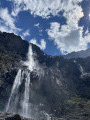
- The Cirque de Gavarnie, at least as far as the Grande Waterfall, even in winter.
See theGavarnie Tourist Office website.

Alternative descent route
Circular route via the Alans hut, at the end of the Plateau d’Alans (which extends from the Plateau des Cardous). See the Visorando page for the Refuge des Espuguettes and the Plateau d’Alans

Reviews and comments

5 / 5
Based on 2 reviews

Reliability of the description
5 / 5
Ease of following the route
5 / 5
Route interest
5 / 5
Puech Jacques
Puech Jacques

Overall rating : 5 / 5

Date of your route : Oct 27, 2025
Reliability of the description : ★★★★★ Very good
Ease of following the route : ★★★★★ Very good
Route interest : ★★★★★ Very good
Very busy route : Yes

Steep climb to the Espuguettes refuge, then on the plateau, follow the route details carefully as the trail is not very visible

Machine-translated

PaulaGauthier
PaulaGauthier

Overall rating : 5 / 5

Date of your route : Oct 06, 2025
Reliability of the description : ★★★★★ Very good
Ease of following the route : ★★★★★ Very good
Route interest : ★★★★★ Very good
Very busy route : No

A very beautiful hike done in early October

Machine-translated

Charles de Montalier

As the Expuguettes mountain hut is fully booked on 9 September 23, the trip will be postponed until next spring.

Machine-translated

Other walks in the area

For more walks, use our search engine .

The GPS track and description are the property of this route's author. Please do not copy them without permission.