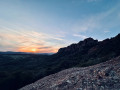
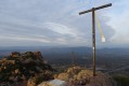
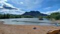
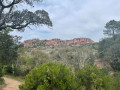
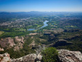
Sunset over the rocky cliffs of the Rocher de Roquebrune

We experienced the sunset over the rocky cliffs of the Rocher de Roquebrune, followed by a night-time descent, and therefore carried the appropriate kit for this type of hike. 

Details

70397288
Creation:
Last update:
Last review:
  • Walking
    Activity: Walking
  • ↔
    Distance: 3.49 mi
  • ◔
    Average duration: 2h 20 
  • ▲
    Difficulty: Easy

  • ⚐
    Back to start: Yes
  • ↗
    Ascent: + 814 ft
  • ↘
    Descent: - 810 ft

  • ▲
    Highest point: 860 ft
  • ▼
    Lowest point: 30 ft

Photos

Description of the walk

Park near the barrier on the Chemin des Hauts Pétignons: there are two or three spaces on the hard shoulder. 

(S/E) Take the path on the right, which forms part of the GR® route. After a fairly easy climb, you’ll reach a section near private property with ‘no trespassing’ signs on either side.

(1) Walk for about 100 m, then carry on straight ahead when the path forks to your left: GR® right of way. 

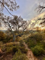
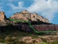
(2) When you reach some boulders, turn right onto a path leading towards the Rocher de Roquebrune, which allows you to rejoin the GR® further up and thus save time on the climb. The climb is fairly easy, through the vegetation and past a few ruins well hidden in the undergrowth. Once at the top of the climb, rejoin the main path leading to the Rocher de Roquebrune.

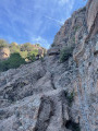
(3) Turn right. From here, there are a few rocky sections where you’ll need to use your hands to get through, but they’re not particularly difficult: dogs should not be brought along, however. Make your way to the foot of the rock face, where a magnificent panorama with a sunset awaits you.

(4) Head back to the previous junction. 

(3) Carry on to the right and rejoin the GR®. 

(5) Follow it to the left to head downhill and rejoin the start of the path that served as a shortcut on the way up. 

(2) Go straight on and retrace your steps in the opposite direction to return to the start (S/E). 

Waypoints

  1. S/E : mi 0 - alt. 46 ft - Barrier on the Chemin des Hauts Pétignons
  2. 1 : mi 0.64 - alt. 305 ft - GR right of way
  3. 2 : mi 1.05 - alt. 374 ft - Lower circular junction
  4. 3 : mi 1.38 - alt. 636 ft - Junction. Return trip to the rock
  5. 4 : mi 1.6 - alt. 860 ft - Rock face – Panoramic views - Rocher de Roquebrune (373m)
  6. 5 : mi 1.97 - alt. 568 ft - Rocher de Roquebrune (373m)
  7. S/E : mi 3.49 - alt. 49 ft - Barrier on the Chemin des Hauts Pétignons

Notes

Climb at the end of the day to watch the sunset, followed by a night-time descent with suitable equipment: thermal clothing, head torches, spare batteries, water and gloves. 

Worth a visit

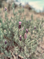
Panoramic views and the biodiversity of the flora and fauna. 

Always be cautious and plan ahead when you're outdoors. Visorando and the author of this route cannot be held responsible for any accidents occurring on this route.

The GR® and PR® markings are the intellectual property of the Fédération Française de Randonnée Pédestre.

Reviews and comments

5 / 5
Based on 2 reviews

Reliability of the description
5 / 5
Ease of following the route
5 / 5
Route interest
5 / 5
User 15742089

Overall rating : 5 / 5

Date of your route : Oct 13, 2025
Reliability of the description : ★★★★★ Very good
Ease of following the route : ★★★★★ Very good
Route interest : ★★★★★ Very good
Very busy route : Yes

Very good hike, but the starting point marked for parking is incorrect
There is no car park or parking space
The nearest car park is a 15-minute walk from the start of the hike

Machine-translated

User 27378413

Overall rating : 5 / 5

Date of your route : Aug 22, 2025
Reliability of the description : ★★★★★ Very good
Ease of following the route : ★★★★★ Very good
Route interest : ★★★★★ Very good
Very busy route : No

Very beautiful route, accessible for children (our daughter is 6 years old).
However, make sure you wear good shoes.
We did the trail during the day and the views were magnificent.
The description of the hike was perfect, as was the estimated time.

Machine-translated

Other walks in the area

For more walks, use our search engine .

The GPS track and description are the property of this route's author. Please do not copy them without permission.