Circular Sentier des Roches, Hohneck and Kastelberg circuit

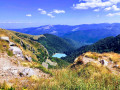
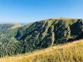
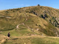
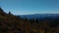
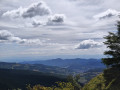
A magnificent hike with breathtaking scenery. The first section is very technical along the rocky path, followed by the ascent to the Hohneck.
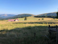
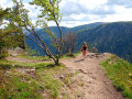
Very varied scenery and sublime views throughout the route. There are opportunities to stop for a break at the inns along the way.

Warning! This route includes several sections that are off-limits or should be avoided in winter conditions
The hike should be undertaken from May to October, depending on snow conditions (see practical information below).

Details

24257013
Creation:
Last update:
Last review:
  • Walking
    Activity: Walking
  • ↔
    Distance: 10.61 mi
  • ◔
    Duration according to the author: 7 hrs 
  • ▲
    Difficulty: Very difficult

  • ⚐
    Back to start: Yes
  • ↗
    Ascent: + 2,198 ft
  • ↘
    Descent: - 2,169 ft

  • ▲
    Highest point: 4,462 ft
  • ▼
    Lowest point: 3,153 ft

Photos

Description of the walk

Park at the Col de la Schlucht.

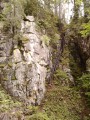
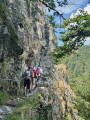
(S/E) Start on the Sentier des Roches below the Chalet hotel and restaurant. Follow the Blue Rectangle route – this is the GR®531. The path is very technical, but handrails provide support in the trickiest sections. Please note that the route is closed in winter.
Then head to the Marcairie, situated at the bottom of the Frankenthal cirque.

(1) Continue along theGR® route, then turn right onto the Red Triangle trail. Carry on climbing to reach the Col du Schaeferthal.

(2) Turn sharply right and follow the ascent along the Red Rectangle path – this is the GR®5 – to reach the Hohneck.

(3) Pass the hotel and restaurant at the summit of the Hohneck on your right and descend along the ridge via the Red Rectangle trail marked with white. Reach the Col de Wormspel.

(4) Continue along the ridge, now following the Yellow Cross trail on the ‘Sentier des Névés’. Take a moment here to enjoy the view of the magnificent Lake Schiessrothried. You’ll reach a Y-junction after crossing a road at a place called Tagweidle.

(5) Turn right onto the Blue Rectangle trail; this is the GR®531 again. Continue to the junction at the Auberge de la Chaume du Firstmiss.

(6) Turn sharply right just before reaching the inn to join the Red Rectangle with White Rectangle trail. Continue to the Col de Wormspel.

(4) Keep left following these markings to reach the Col du Falimont.

(7) Turn off onto the Red Rectangle path – this is theGR®5again – and continue to the Rochers de la Martinwand.

(8) Continue along the ridge until you reach the junction with the road to the Refuge des Trois Fours.

(9) Cross the road and continue straight ahead on theGR® to easily reach the Col de la Schlucht car park (S/E).


Waypoints

  1. S/E : mi 0 - alt. 3,737 ft - Start of the Sentier des Roches
  2. 1 : mi 2.4 - alt. 3,379 ft - Marcairie du Frankenthal
  3. 2 : mi 3.28 - alt. 4,022 ft - Col du Schaeferthal (1224m)
  4. 3 : mi 3.85 - alt. 4,462 ft - Le Hohneck
  5. 4 : mi 4.16 - alt. 4,193 ft - Col du Wormspel (1275m)
  6. 5 : mi 6.03 - alt. 4,029 ft - Turn right at the Blue Rectangle
  7. 6 : mi 6.65 - alt. 4,072 ft - Turn right onto the red and white marked path. Passage nearby - Moselotte (rivière)
  8. 7 : mi 8.69 - alt. 4,242 ft - Col de Falimont (1295m)
  9. 8 : mi 9.3 - alt. 4,098 ft - Rocher d'escalade de la Martinswand
  10. 9 : mi 9.55 - alt. 4,026 ft - Route from - refuge des Trois Fours
  11. S/E : mi 10.61 - alt. 3,737 ft - Col de la Schlucht

Notes

(S/E) Col de la Schlucht: car park with public toilets; hotel and restaurants available

Warning! The rocky path (the route taken from the starting point to point 1 via theGR®531) is closed from 1 November to 30 April each year (prefectural decree of 18 May 2022).
In spring, on the snowfield trail (points 4 to 5), the cornices may still be substantial. Do not get too close to them, as the risk of falling remains high.

This route passes through a protected area, which may be subject to special regulations:

Worth a visit

Near (S/E) on the return journey: visit the Notre-Dame-des-Chaumes Chapel.

Warning! This route

Always be cautious and plan ahead when you're outdoors. Visorando and the author of this route cannot be held responsible for any accidents occurring on this route.

The GR® and PR® markings are the intellectual property of the Fédération Française de Randonnée Pédestre.

Reviews and comments

5 / 5
Based on 2 reviews

Reliability of the description
5 / 5
Ease of following the route
5 / 5
Route interest
5 / 5
User 29718713

Overall rating : 5 / 5

Date of your route : Jun 29, 2026
Reliability of the description : ★★★★★ Very good
Ease of following the route : ★★★★★ Very good
Route interest : ★★★★★ Very good
Very busy route : No

A lovely walk!
The rocky section of the trail is indeed a bit more challenging, but absolutely stunning!

Machine-translated

virgule
virgule
augustinstella
augustinstella
• Edited:

Overall rating : 5 / 5

Date of your route : Apr 13, 2024
Reliability of the description : ★★★★★ Very good
Ease of following the route : ★★★★★ Very good
Route interest : ★★★★★ Very good
Very busy route : Yes

A very beautiful route, closer to 20 km than the advertised 17 km. However, I highly recommend this magnificent hike.

Machine-translated

Other walks in the area

For more walks, use our search engine .

The GPS track and description are the property of this route's author. Please do not copy them without permission.