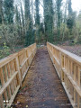
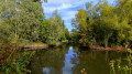
Ligny-le-Grand circular route via the golf course and through the fields

A short walk through the Illies countryside, passing the golf course, fields and a few old World WarI bunkers.

Details

10628812
Creation:
Last update:
Last review:
  • Walking
    Activity: Walking
  • ↔
    Distance: 2.98 mi
  • ◔
    Average duration: 1h 25 
  • ▲
    Difficulty: Easy

  • ⚐
    Back to start: Yes
  • ↗
    Ascent: + 39 ft
  • ↘
    Descent: - 39 ft

  • ▲
    Highest point: 135 ft
  • ▼
    Lowest point: 75 ft
  • ⚐ Country: France
  • ⚐ City: Illies (59480)
  • ⚑
    Start/End: N 50.561738° / E 2.831247°
  • ❏
    IGN map(s): Ref. 2405E
  • Hour-by-hour weather

Description of the walk

Start from the car park at the Grande Place, opposite Illies church.

(S/E) With your back to the church, follow Rue Jean Mermoz to the right, then at the end of this street, turn left onto Rue du Chamoine Rigaut. Leave the village and, at the fourth junction, turn right.

(1) You’ll come to a T-junction.

(2) First turn right then left, and follow the golf course on your right-hand side.

(3) At the end of the road, turn 90° to the left and follow the main track to the end. Pass through a residential area until you reach a crossroad. Turn left and head towards the start of a lane on the left, which is closed to all vehicles except residents.

(4) Take this lane, Chemin Delannoy, and continue to the junction in front of the church.

(5) Do not join the road, but take the small path on the left which runs past the last house on the right and then a garage. When you reach the tarmac, turn right and join the D141. Continue to the left along the road; watch out for traffic, but there is space on the pavement. You will come to a brick farmhouse (No. 3).

(6) Take the path at the corner of the farm, which heads off to the right, and continue across the fields. At the T-junction, turn left, then right when you reach the tarmac. Join the D141 and continue towards the centre of Illies until you reach the Grande Place (S/E).

Waypoints

  1. S/E : mi 0 - alt. 95 ft - Start in front of Illies Church
  2. 1 : mi 0.32 - alt. 79 ft - Junction
  3. 2 : mi 0.45 - alt. 89 ft - T-junction
  4. 3 : mi 0.77 - alt. 85 ft - End of the route
  5. 4 : mi 1.48 - alt. 125 ft - Path on the left.
  6. 5 : mi 1.64 - alt. 112 ft - A hidden little path
  7. 6 : mi 1.94 - alt. 89 ft - Path across the fields
  8. S/E : mi 2.98 - alt. 95 ft - Finish

Notes

Please note: the section of path through the fields is not maintained, and the grass is often tall. You can take a shortcut along the D141, as there is a pavement running the whole way.

Reviews and comments

3.6 / 5
Based on 6 reviews

Reliability of the description
3.5 / 5
Ease of following the route
3.7 / 5
Route interest
3.5 / 5
ACQUAERT Marc
ACQUAERT Marc

Overall rating : 4.3 / 5

Date of your route : Apr 16, 2025
Reliability of the description : ★★★★★ Very good
Ease of following the route : ★★★★★ Very good
Route interest : ★★★☆☆ Average
Very busy route : No

We had previously visited the Fromelles Museum.
We would have preferred a tour starting from the museum; what’s more, there were some historical points of interest along that route.

Machine-translated

Pierrelerandonneur
Pierrelerandonneur

Overall rating : 2.7 / 5

Date of your route : Feb 04, 2024
Reliability of the description : ★★☆☆☆ Disappointing
Ease of following the route : ★★☆☆☆ Disappointing
Route interest : ★★★★☆ Good
Very busy route : No

At the start of the route, we find ourselves on private property and are forced to turn back.
It is possible to cross the farm, but it seemed to us that we were on private land.
The route through the fields is a bit of a let-down, as there’s a ‘private property – no trespassing’ sign at the start of the path.
This route definitely needs reviewing.

Machine-translated

RANDONNEESFRANCE
RANDONNEESFRANCE

Overall rating : 3.7 / 5

Date of your route : Jun 19, 2023
Reliability of the description : ★★★☆☆ Average
Ease of following the route : ★★★★☆ Good
Route interest : ★★★★☆ Good
Very busy route : No

The path running alongside the golf course is impassable, with logs strewn across it and a ‘private property’ sign.
You’ll need to head back to the road and rejoin the route further up in a village.
Otherwise, the rest of the walk is pleasant, taking you through fields and past a farm.

Machine-translated

Salamand59115
Salamand59115

Overall rating : 4.7 / 5

Date of your route : Jun 06, 2022
Reliability of the description : ★★★★★ Very good
Ease of following the route : ★★★★★ Very good
Route interest : ★★★★☆ Good
Very busy route : No

I really enjoyed this mix of countryside and small-town charm. I discovered golf and the village of Ligny. Thanks to Visiorando, I had no trouble following the route, even though it isn’t signposted. The details are also very clear, allowing you to make the most of this walk.
I’d love more walks like this, which only take an hour and a half.
We’ll be doing it again.

Machine-translated

pascal62138
pascal62138

Overall rating : 1 / 5

Date of your route : Feb 08, 2022
Reliability of the description : ★☆☆☆☆ Very disappointing
Ease of following the route : ★☆☆☆☆ Very disappointing
Route interest : ★☆☆☆☆ Very disappointing
Very busy route : No

There were no landmarks on the ground; I couldn’t find the route; I’m very disappointed

Machine-translated

David Rando
David Rando

Overall rating : 5 / 5

Date of your route : Sep 13, 2021
Reliability of the description : ★★★★★ Very good
Ease of following the route : ★★★★★ Very good
Route interest : ★★★★★ Very good
Very busy route : No

A lovely little 5-kilometre walk.
It’s a bit noisy at the start as you go through the town centre and there’s a lot of traffic, but then you’re out in the open countryside and it’s much more pleasant.
The route follows the actual terrain closely; it avoids busy roads, which is great for safety.
The little hidden path is lovely!

Machine-translated

Other walks in the area

For more walks, use our search engine .

The GPS track and description are the property of this route's author. Please do not copy them without permission.