Around the Lanches de Lormay

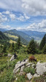
A relatively challenging but always rewarding hike, with the added bonus of a beautiful balcony trail between the Aravis range and the upper Bouchet valley, upstream from Le Grand-Bornand.

Details

9543459
Creation:
Last update:
Last review:
  • Walking
    Activity: Walking
  • ↔
    Distance: 6.63 mi
  • ◔
    Average duration: 5h 15 
  • ▲
    Difficulty: Moderate

  • ⚐
    Back to start: Yes
  • ↗
    Ascent: + 2,507 ft
  • ↘
    Descent: - 2,493 ft

  • ▲
    Highest point: 5,430 ft
  • ▼
    Lowest point: 3,530 ft

Photos

Description of the walk

In Le Grand Bornand, head towards Vallée du Bouchet – Col des Annes. At La Chapelle des Plans, leave the Col des Annes road on your left and turn right onto the Lormay road.
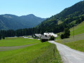
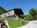
After crossing a stream and a wooded area, the road opens out into a beautiful part of the valley, with the tennis courts and other sports facilities on the right and, on the left, a row of large chalets including the Auberge Nordique: this is Lormay.
Park in the large herringbone car park to the left of the road before the inn.

(S/E) Walk back along the road in the opposite direction, cross the wooded area and the stream again, pass the La Bombardelle mountain lodge, and look out for a wooden hut on the left-hand side of the road, which is probably used as a bin shelter. Then, to the right of this hut, look for the sign indicating: Les Confins – La Bombardellaz.

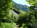
(1) Follow this sign to the left, crossing the Le Borde stream via a pretty bridge. After the bridge, take the path opposite, where there is another sign indicating the same directions. Begin the climb through the forest here. After a long, fairly straight climb, continue via switchbacks up much steeper slopes. You’ll reach a fork where a sign points to: Les Confins on the right and La Bombardellaz on the left. Turn left towards La Bombardellaz.
You’ll then reach another junction with signposts indicating several directions.

(2) Head straight on towards La Bombardelle. Continue uphill to reach a crossroads of paths.

(3) Leave the path that continues straight ahead and turn right uphill to reach the Pierre Marquée junction. Here, you’ll rejoin the Chemin de la Bombardellaz, which forms part of the GRP® Massif de Tournette-Aravis.

(4) Turn left towards the Refuge de la Bombardellaz – 10 mins. Reach the refuge via a series of hairpin bends and walk past it.

(5) Continue along the GRP® via a balcony-like section until you reach a wayside shrine.

(6) Carry on straight ahead along the GRP® following the red and yellow markings and pass through the small hamlet of the Bombardellaz chalets. Ignore the signpost for Combe du Charvet straight ahead and turn left towards Le Planet. From here, a series of ascents and descents leads to Le Planet.

(7) Leave the GRP® here and turn left towards Les Troncs. Shortly afterwards, cross the stream, leave the path running alongside it on your left, and continue straight ahead on the balcony path which soon enters the forest. You’ll reach afirst junction.

(8) Take the track leading down to the left. At the sharp bend to the right, leave the path on your left that leads to the hamlet of Plattuy and stay on the track, which now descends gently. You’ll reach another junction at the next hairpin bend.

(9) Take the path on the left. Stay on this path and descend via a series of hairpin bends, keeping the stream bed in sight – this is likely to be the Borne.
You’ll come out at the car park at the end of the Route de la Vallée du Bouchet.

(10) Turn right onto this road, pass through the hamlet of Les Troncs before reaching the Lormay car park (S/E).

Waypoints

  1. S/E : mi 0 - alt. 3,606 ft - Lormay’s herringbone-style car park
  2. 1 : mi 0.42 - alt. 3,530 ft - Chalet poubelle
  3. 2 : mi 0.98 - alt. 4,354 ft - La Bombardellaz crossroads
  4. 3 : mi 1.35 - alt. 4,800 ft - Crossroads towards the Pierre Marquée
  5. 4 : mi 1.57 - alt. 5,020 ft - La Pierre Marquée
  6. 5 : mi 1.81 - alt. 5,299 ft - Refuge de la Bombardellaz
  7. 6 : mi 2.16 - alt. 5,226 ft - Chalets de la Bombardellaz
  8. 7 : mi 3.88 - alt. 5,430 ft - Le Planet
  9. 8 : mi 4.44 - alt. 5,240 ft - 1st junction
  10. 9 : mi 4.81 - alt. 5,020 ft - Crossroads with a sharp bend
  11. 10 : mi 5.58 - alt. 4,144 ft - Car park at the end of the Route de Lormay
  12. S/E : mi 6.63 - alt. 3,606 ft - Lormay’s herringbone-style car park

Notes

As for facilities, there are public toilets near the car park in Lormay, and a water tap – the water is likely to be safe to drink – at the Bombardellaz chalets.
Those who haven’t brought their own food can eat at the Refuge de la Bombardelaz or the Auberge Nordique in Lormay.
As for equipment, please note that the climb to the Pierre Marquée is often steep and the descent between the Planet and the road is often steep and abrupt. You should therefore bring good hiking boots and a pair of walking poles. However, the trails and paths are still in good condition.

Worth a visit

(4) La Pierre Marquée: at the crossroads stands a monolith measuring approximately one cubic metre, bearing engraved inscriptions, which once marked the boundary between the municipalities of La Clusaz and Le Grand-Bornand.
(5) The Bombardellaz refuge is a large chalet on the edge of the piste, overlooking the Bouchet valley and offering superb panoramic views. It features a terrace with parasols and provides accommodation and catering facilities.
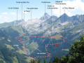
Between (5) and (6) on this balcony trail, take in the view:
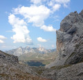
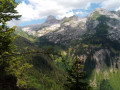
- to the left, the Bouchet Valley and the eastern slope of Mont Lachat de Châtillon, along which the road winds its way up to the Col des Annes,
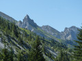
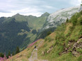
- to the right, the succession of peaks, separated by valleys, of the Aravis range.
Shortly afterwards (6), in the north-eastern pass, you can make out the valley where Le Planet is situated, at the end of which the Col de l’Oulettaz is clearly visible

In mountaineering terminology, a ‘lanche’ is a grassy, sloping strip of land bounded by two ravines. It is likely that those at Lormay historically existed as such before the slopes became almost entirely overgrown with woodland.

Those interested in the vocabulary of the land and the mountains, and who wish to understand the names of the places they pass through, will often find the answers to their questions in this book: Vocabulary and Toponymy of Mountain Regions.

Reviews and comments

4.9 / 5
Based on 3 reviews

Reliability of the description
5 / 5
Ease of following the route
4.7 / 5
Route interest
5 / 5
User 3486955

Overall rating : 5 / 5

Date of your route : Jul 29, 2026
Reliability of the description : ★★★★★ Very good
Ease of following the route : ★★★★★ Very good
Route interest : ★★★★★ Very good
Very busy route : No

lovely panoramic view of the Aravis range; a pleasant route – a shaded climb

Machine-translated

ririV
ririV

Overall rating : 4.7 / 5

Date of your route : Aug 10, 2022
Reliability of the description : ★★★★★ Very good
Ease of following the route : ★★★★☆ Good
Route interest : ★★★★★ Very good
Very busy route : No

A lovely walk – a steep climb but entirely in the shade. Stunning scenery. Despite it being August, there weren’t many people about, so it was very pleasant. I’d definitely recommend it!

Machine-translated

raymondehautesavoie
raymondehautesavoie

Overall rating : 5 / 5

Date of your route : Jul 05, 2021
Reliability of the description : ★★★★★ Very good
Ease of following the route : ★★★★★ Very good
Route interest : ★★★★★ Very good
Very busy route : Yes

a superb hike along the opposite side of the Aravis valleys

Machine-translated

Other walks in the area

For more walks, use our search engine .

The GPS track and description are the property of this route's author. Please do not copy them without permission.