Country:

 City:
City:


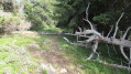
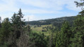
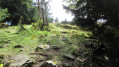
Start of the walk: by the cinema at the Roche Béranger shopping centre, Chamrousse 1750.
(S/E) Head up the green ‘La Lauze’ ski run, which runs alongside the long covered magic carpet lift. At the top, veer slightly to the left towards sign no. 5 on the green ‘Bachat Bouloud’ ski run. You’ll reach a junction with a wide run at elevation 1756.
(1) Turn left onto this straight, ascending track. At the top, on the flat section, pass the gantries and continue straight ahead across the meadow. You’ll reach a T-junction.
(2) Turn right onto the stony path, then, about 180 metres further on, turn left onto a long descent which joins the Astragale trail. Turn left onto this trail. You’ll immediately spot the start of the snowshoe route on your left: the Clairières de l’Arselle.
(3) Turn left onto this route, which passes through the forest and crosses several clearings. You’ll come to a Y-junction.
(4) Turn left and you’ll come to a climbing wall (no. 8). At the foot of the rock, head right towards the east along a rugged, overgrown path. Use of a GPS is recommended from this point onwards. Cross a dry stream, then the path climbs steeply in switchbacks. After passing through a hollow, turn left and continue climbing to the foot of a rounded boulder.
(5) Climb this rock without difficulty, heading to the right to reach, halfway up, a clearly visible track leading into the woodland. Cross the Salinière stream and arrive at a junction with the Achard Lake path.
(6) Turn right onto this uneven path which descends (pebbles and exposed roots) and joins the Astragale track at elevation 1717.
(7) Turn left, then immediately left again onto the path that heads deep into the forest, heading south-south-east. You’ll reach the edge of a cliff and a fault line. Take in the view. Continue to the right, skirting the cliff. The route then becomes much more difficult, with a very steep and slippery path. You’ll reach the Rocher de l’Homme. The view is spectacular. Set off again, following the ridge westwards.
(8) Begin a steep and slippery descent through the forest to go round a large boulder and a fault. Your GPS will once again be very useful to avoid going too far down into the forest (there are numerous tracks). As soon as possible, head back up towards the ridge.
(9) Asecond boulder must be bypassed in the same way (a shorter detour). At the bottom, pass alongside a large fault. The path levels out on the ridge. You’ll reach a wider area and a Y-junction.
(10) Keep to the left and join the snowshoe route: the Crètes de l’Arselle. Follow the route’s markings, then continue towards a rocky summit at an elevation of 1,712 metres. Take in the view.
(11) Turn left and descend due south for about twenty metres, then look out for a path heading south-west.
(12) Follow this path, which can be difficult to spot at times and winds its way through the fir trees. Stay close to the ridge line. Your GPS will come in handy again; you can also use the black dotted line on the IGN map (marking the boundaries between municipalities) as a guide. Keep heading south-west. Turn north onto a steeper slope which leads to a T-junction near the Plateau de l’Arselle.
(13) Turn left and follow the path which leads to the edge of the cliffs, near the safety barriers (danger signs) and the Arselle bog. Continue along the path which descends towards the Salinière stream.
(14) Cross the stream (ford) and head towards the Astragale track, which lies opposite and higher up. Turn left onto this track. Keep to the right at thefirst Y-junction, then, about 120 metres further on, you’ll reach an X-junction.
(15) Turn left onto the wide track which descends gently through the forest. After a right-hand bend, join the Fondroide forest road and follow it to the right.
(16) After a wide S-bend, leave the track to the left and follow the path which leads to the Arselle plateau at the Badet spring. You’ll come to a Y-junction.
(17) Turn right onto the path that runs past the foot of La Salinière restaurant. Pass the 1636-metre mark, go past the riding centre and continue eastwards.
(18) Turn left onto the path which climbs and then runs past the small blocks of flats in the Le Domaine de l’Arselle housing estate. You’ll reach the tarmac road to Bachat Bouloud at an altitude of 1,700 metres.
Follow the road uphill towards Roche Béranger, either all the way to the shopping centre, or by turning right at the Bachat Bouloud chairlift to take the track that leads back up to the magic carpet and the starting point (S/E).


 Visorando Member

 Easy
Easy 
 Difficult
 Very difficult