


 Country:

 City:
City:


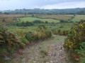
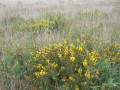
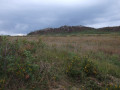
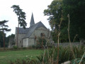
Park in the car park between the town hall and the church.
GR® de Pays Tour du Pays de Morlaix, marked in yellow and red
(S/E) With your back to the church, walk up the street past the town hall and, at Rue de la Libération, turn left. Follow this street until you reach the Stop sign on the D785. Cross with care and take the Route du Relecq (D 111) opposite for about a hundred metres.
(1) Turn right onto a small road and follow it to the hamlet of Guirhoël.
PR® marked in yellow + mountain bike
(2) On leaving the hamlet, leave theGRP®® on your right and head straight up the path which joins the D111 near a headless cross (Croaz ar Person). Turn right and you’ll come to a memorial stone commemorating the liberation of Plounéour-Ménez on 6 August 1944.
(3) Leave the D111 and take the stony track leading up towards the water tower. Go round it on the right and continue until you rejoin the D111, which you follow as far as the access road to the hamlet of Le Guillec.
(4) Turn left and follow the small road leading to this hamlet (with its beautiful stone houses). Walk through the hamlet to the last house.
(5) On leaving the hamlet, veer left to follow the path through the meadows. Ignore a path on your right and you’ll come to a fork.
(6) Turn right into a wooded area, then through a marshy area, to reach the large hamlet of Mengleuz, which you cross by turning right. The hamlet’s name comes from the Breton ‘mein gleus’ (‘stone in the embankment’). Numerous rocks are visible in this hamlet.
(7) At the southern end, continue along a series of steep, narrow paths that descend to join the GR®380.
GRP® marked in yellow and red + mountain biking
(8) Turn left onto theGRP® and follow the path towards the former abbey of Le Relecq. At the road, turn left.
(9) Walk round a lake along a beautiful beech-lined avenue and reach the former Cistercian abbey church (open to visitors, as is its garden). Inside the abbey church, note the excellent acoustics.
(10) Head towards the Stop sign on the D111, cross it carefully and take the path opposite which turns left. Cross a stream and reach a road at a place called Pen ar Quinquis. Follow this road to the right to reach the large hamlet of Quillioguè, which you go round on the right.
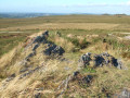
(11) On leaving the hamlet, turn right onto a farm track which climbs steadily, first through meadows and fields and then across areas of moorland where it narrows. You’ll reach a path coming from the left just before a power line.
(12) Turn right and continue climbing along the ridge line until you reach a small road that slopes gently downwards. Note an area on your left that was burnt in the summer of 2022, and reach aGR®® junction (cross base).
PR® marked in yellow (in the opposite direction)
(13) Leave theGRP®® and turn right to begin a new climb to the highest point of this walk (340 m). Continue downhill through open heathland. On a well-maintained boardwalk, cross a peat bog that feeds a stream which becomes the Queffleuth, a river that joins the River Morlaix, and arrive at another junction where you leave thePR®® trail.
GRP® marked in yellow and red + mountain biking
(14) Take a sharp left-hand bend onto theGRP®® and begin a new climb due south, still through the same open heathland. Reach another high point.
(15) Take a sharp right-hand bend onto an ancient Roman road that descends steadily. At a right-angled bend, leave this ancient Roman road and turn left onto a path flanked by embankments. You’ll reach a water catchment area.
(16) Turn right and continue with the water catchment area on your left. Carry on until you reach the junction with the outbound route.
(2) Turn left and, following the route in the opposite direction to the outward leg, return to the village of Plounéour-Ménez, where you can visit the church and its churchyard near the starting car park (S/E).

 Visorando Member
 Very difficult
 Difficult

 Local authority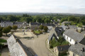
 Easy
Easy 
