Aiguille de l’Épaisseur

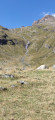
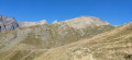
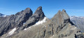
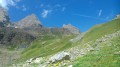
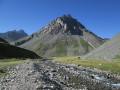
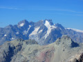
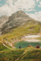
Although it looks like a large hill from its south-eastern slope, the ascent of the Aiguille de l’Épaisseur is very physically demanding in its final section, from the refuge, with 970 m of elevation gain over 3 km, representing an average gradient of over 35 per cent. However, it probably offers the finest view of the Aiguilles d’Arves you can get, not to mention a magnificent 360° panorama.
This hike is not very popular, which is hardly surprising given the final ascent. It is reserved for seasoned hikers who are not too prone to vertigo.

Details

39784146
Creation:
Last update:
Last review:
  • Walking
    Activity: Walking
  • ↔
    Distance: 8.62 mi
  • ◔
    Duration according to the author: 8 hrs 
  • ▲
    Difficulty: Very difficult

  • ⚐
    Back to start: Yes
  • ↗
    Ascent: + 5,062 ft
  • ↘
    Descent: - 5,062 ft

  • ▲
    Highest point: 10,587 ft
  • ▼
    Lowest point: 5,522 ft

Photos

Description of the walk

From Valloire, take the road to the Col du Galibier and head towards the hamlet of Bonnenuit. The car park runs alongside the road.
Yellow markings and signposts.

(S/E) From the car park, continue straight on to the Valloirette stream and cross the first stream. If the current is too strong, head back up the Route du Galibier, cross the bridge and turn right to reach the first footbridge.

(1) Cross the footbridge and turn right until you reach a second footbridge over the Torrent des Aiguilles.

(2) Turn left towards the hamlet of Les Aiguilles.

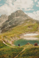
(3) At the hamlet, carry on straight ahead through the mountain pastures and past herds of cows until you reach the refuge. Continue on to the ruins of the Commandraut.

(4) Leave the path on your right and carry on straight ahead to the refuge.

(5) Turn right to begin the long ascent (960 m elevation gain over 3 km) to the Aiguille de l’Épaisseur. Continue to a junction.

(6) Ignore the small path on the right leading to the Col de l’Épaisseur and turn left towards the summit. A signpost indicates the way. From here on, it’s just a long climb that seems never-ending, and the summit seems to never get any closer. As you go, the vegetation disappears.

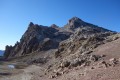
(7) It gives way to scree and boulders. The path becomes a bit overgrown at times. Keep a close eye out for the yellow markings, often visible from a distance, which give you an idea of the route to follow. Small cairns also help you find your way. If in doubt, just keep climbing. Reach the secondary summit.

(8) The actual summit is about ten minutes further on. Make your way through the boulders on the eastern side of the ridge path, as the western side is very vertiginous and steep! The yellow markings are very useful here. Use your hands for support if necessary. Reach the summit.

(9) Enjoy the view of the Aiguilles d’Arves. Return to the car park (S/E) via the same route.

Waypoints

  1. S/E : mi 0 - alt. 5,525 ft - Bonnenuit car park
  2. 1 : mi 0.1 - alt. 5,538 ft - Valloirette (rivière)
  3. 2 : mi 0.25 - alt. 5,564 ft - Torrent des Aiguilles
  4. 3 : mi 0.55 - alt. 6,066 ft - The Aiguilles
  5. 4 : mi 1.6 - alt. 6,926 ft - Le Commandraut
  6. 5 : mi 2.58 - alt. 7,356 ft - Refuge des Aiguilles d’Arves
  7. 6 : mi 3.15 - alt. 8,264 ft - Crossing beneath the peak
  8. 7 : mi 3.48 - alt. 8,894 ft - Stony path
  9. 8 : mi 4.15 - alt. 10,315 ft - Secondary summit
  10. 9 : mi 4.29 - alt. 10,587 ft - Aiguille de l'Épaisseur (3230 m)
  11. S/E : mi 8.62 - alt. 5,525 ft - Bonnenuit car park

Notes

Warning! If there is snow at the summit, an ice axe and crampons are strongly recommended! Snow may still be present in July.
You can fill your water bottle at the Refuge des Aiguilles d’Arves and stop there on the way back for a well-deserved tasty snack.
It is possible to complete the ascent over two days, staying overnight at the refuge.

Reviews and comments

4.7 / 5
Based on 4 reviews

Reliability of the description
4.8 / 5
Ease of following the route
4.8 / 5
Route interest
4.5 / 5
User 14034108

Overall rating : 4.3 / 5

Date of your route : Aug 04, 2026
Reliability of the description : ★★★★★ Very good
Ease of following the route : ★★★★★ Very good
Route interest : ★★★☆☆ Average
Very busy route : Yes

A tedious climb to the summit,

Machine-translated

Lioneldu69
Lioneldu69

Overall rating : 5 / 5

Date of your route : Jul 24, 2026
Reliability of the description : ★★★★★ Very good
Ease of following the route : ★★★★★ Very good
Route interest : ★★★★★ Very good
Very busy route : No

We set off the day before from the Verneys car park to spend the night at the mountain hut, leaving at 7 am and reaching the summit at around 10.15 am; the climb was very steep, even rugged, for the final 100 metres.

A stunning view of the Aiguilles d’Arves.

Machine-translated

User 3061294

Overall rating : 5 / 5

Date of your route : Aug 07, 2025
Reliability of the description : ★★★★★ Very good
Ease of following the route : ★★★★★ Very good
Route interest : ★★★★★ Very good
Very busy route : No

Superb hike with magnificent views at the summit, but you have to work for it because the climb from the refuge to the summit is tough on the thighs and calves

Machine-translated

Jean Pierre Gaschin
Jean Pierre Gaschin

Overall rating : 4.3 / 5

Date of your route : Aug 20, 2024
Reliability of the description : ★★★★☆ Good
Ease of following the route : ★★★★☆ Good
Route interest : ★★★★★ Very good
Very busy route : Yes

This hike, with its significant elevation gain, is aimed at those who are sufficiently fit – but what a view from the summit! We were treated to one of the clearest days of August, with, amongst other things, Mont Blanc in the distance and the majestic Aiguilles d’Arves almost within reach.
The finish can be a bit daunting with the sheer drop all around you, but it’s no problem for those who stay cautious 😉.
We were lucky enough to spot a griffon vulture in flight.
A word of advice: set off early enough, as we saw a few hikers (on the way up) struggling during our descent around 11.30 am 🤷‍♂️.

Machine-translated

Other walks in the area

For more walks, use our search engine .

The GPS track and description are the property of this route's author. Please do not copy them without permission.