


Refine your search for walks in Zone de quiétude de la faune sauvage Varambon
Zone de quiétude de la faune sauvage Varambon walks


 Crêt de la Goutte via Le Sac and Varambon
 Visorando Member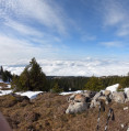
 7.07 mi
 +2,346 ft
 -2,326 ft
 5h 20
5h 20
 Moderate
 Departure from Chézery-Forens (Ain)
Tour of the chalets of the Col du Sac and Varambon via the Crêtes du Sorgia - 360° view at the Crêt de la Goutte with orientation table to discover the Monts d'Ain, Lake Geneva and its water jet, the start of the Jura mountain range, the Swiss and French Alps including the Matterhorn in good weather and the majestic Mont Blanc.
The water ridges
 8.42 mi
+3,196 ft
-3,163 ft
6h 40
8.42 mi
+3,196 ft
-3,163 ft
6h 40
 Difficult
Departure from Bellegarde-sur-Valserine (Ain)
Difficult
Departure from Bellegarde-sur-Valserine (Ain)
Plateau of the Jura mountain range, overlooking the valleys of Bellegarde sur Valserine and Fort l'écluse. The highest point of the Crêt de la Goutte offers a 360° panorama of the Jura Natural Park and Lake Geneva on the Geneva side, with a horizon dominated by the Alps, including Mont Blanc.
Circular at Grand Crêt d'Eau
 4.62 mi
+1,345 ft
-1,375 ft
3h 20
Moderate
Departure from Lancrans (Ain)
4.62 mi
+1,345 ft
-1,375 ft
3h 20
Moderate
Departure from Lancrans (Ain)
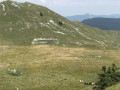
A circular with limited elevation gain, winding through mountain pastures, allowing you to visit three of the ridges that form the Grand Crêt d'Eau (including the highest point) and enjoy breathtaking views of the Genevois and the Alps.
 Le Grand Crêt d'Eau
 6.67 mi
+1,522 ft
-1,542 ft
6 hrs
Difficult
Departure from Chézery-Forens (Ain)
6.67 mi
+1,522 ft
-1,542 ft
6 hrs
Difficult
Departure from Chézery-Forens (Ain)
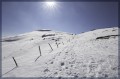
A circular route on the Grand Crêt d'Eau massif at an altitude of 1,600 metres, passing through pine forests and crossing a large hilly plateau with views of the Mont Blanc massif, among other things.
Moderator's warning: route presents a risk of avalanches.
Grand Crêt d'Eau circular path starting from Farges
9.53 mi
+2,510 ft
-2,497 ft
6h 35
Difficult
Departure from Farges (Ain)
Walk on the Grand Crêt d'Eau at the far end of the Jura. The route starts at the top of Farges, passes via the Crêts du Miroir, du Milieu and de la Goutte, then descends to Menthières where you can stop for a bite to eat or a drink at the Bistrot de La Gentiane. We then head back up via Le Vélu and Le Pelaz. Beautiful alpine landscapes and views over the Pays de Gex, the Genevois, the Valserine Valley and Menthières
Pierre à Fromage via the Crêt de la Goutte
 5.39 mi
+1,591 ft
-1,585 ft
3h 50
Moderate
Departure from Confort (Ain)
5.39 mi
+1,591 ft
-1,585 ft
3h 50
Moderate
Departure from Confort (Ain)
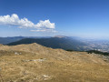
A family hike offering views of the Mont Blanc massif and the Pays de Gex
La Poutouille Refuge - Lancrans
 Tourist office10.44 mi
+1,893 ft
-5,092 ft
6h 25
Difficult
Departure from Péron (Ain)
Tourist office10.44 mi
+1,893 ft
-5,092 ft
6h 25
Difficult
Departure from Péron (Ain)
Open from 1 April to 30 November ( subject to there being no snow)
Third stage of the Grande Traversée du Jura walking route: from La Borne au Lion to Culoz, in 6 days.
The GTJ links Mandeure (Doubs) to Culoz (Ain) in 15 to 20 days, crossing the Jura Mountains and the Haut-Jura Regional Nature Park. The route proposed here corresponds to the second half of the itinerary.
The route winds through the heart of the Haut-Jura Regional Nature Park and the Haute Chaîne du Jura National Nature Reserve: a protected area to be explored with respect.
Part of the route crosses the Haute Chaîne du Jura National Nature Reserve.
Dogs arenot permitted, even on a lead, and camping in tents is prohibited
Please respect these rules to preserve this exceptional environment.
Grande Traversée du Jura: from La Borne au Lion to Culoz
62.98 mi
+11,985 ft
-15,436 ft
6 days
 Very difficult
Departure from La Pesse (Jura)
Very difficult
Departure from La Pesse (Jura)
The GTJ runs through the Jura Mountains from Mandeure (Doubs) to Culoz (Ain), crossing the Haut-Jura Regional Nature Park and offering a detour into Switzerland. The route suggested here covers the second half of the itinerary.
Opened in 2004, the GTJ follows the GR®5, GR®9 and GR® de Pays trails for 400 km. Winding along ridges, skirting lakes and emerging from forests, this is a route accessible to most people, with no particular difficulty. It can be tackled as a 2–3-day trip for families, or as the full 15–20-day route.
The route winds through the heart of the Haut-Jura Regional Nature Park and the Haute Chaîne du Jura National Nature Reserve: a protected area to be explored with respect.
La Poutouille - Lancrans
 10.55 mi
+1,900 ft
-5,092 ft
6h 30
Very difficult
Departure from Péron (Ain)
10.55 mi
+1,900 ft
-5,092 ft
6h 30
Very difficult
Departure from Péron (Ain)
Open from1 April to 30 November – subject to there being no snow.
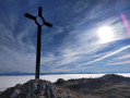
The section between La Poutouille and Lancrans is the third stage of the six-day walking tour, “The GTJ from Mijoux”.
The GR®9 enters the Ain department via Mijoux, before following the spectacular ridges of the Monts-Jura, passing through the Crêt de la Neige, the highest point of the massif. It then descends towards Bellegarde-sur-Valserine, crosses the Retord plateau, and then crosses the Grand Colombier. The trail continues its route to Culoz and the Rhône Valley, before leaving the Ain to reach Savoie and continuing southwards.
Part of the route passes through the Haute Chaîne du Jura National Nature Reserve, which is subject to specific regulations:Dogs are not permitted, even on a lead, and camping in tents is also prohibited.
Please respect these rules to preserve the richness of this exceptional environment.
The GTJ from Mijoux
 65.00 mi
+13,048 ft
-15,538 ft
6 days
Very difficult
Departure from Lajoux (Jura)
65.00 mi
+13,048 ft
-15,538 ft
6 days
Very difficult
Departure from Lajoux (Jura)
Open from 1 April to 30 November – subject to there being no snow.
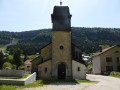
The GR® 9 enters the Ain department via Mijoux, before following the spectacular ridges of the Monts-Jura, passing through the Crêt de la Neige, the highest point of the massif. It then descends towards Bellegarde-sur-Valserine, crosses the Plateau de Retord, and then crosses the Grand Colombier. The trail continues its route to Culoz and the Rhône Valley, before leaving the Ain to reach Savoie and continuing southwards.
Part of the route passes through the Haute Chaîne du Jura National Nature Reserve, which is subject to specific regulations.
Dogs are prohibited, even on a lead, as is camping in tents. Please respect these rules to preserve the richness of this exceptional environment.
Menthières - Valserhône
10.99 mi
+2,152 ft
-4,459 ft
6h 55
Very difficult
Departure from Chézery-Forens (Ain)
Open from 1 April to 30 November – subject to there being no snow.
The fifth and final stage of the GRP® de la Valserine. The stage begins in the forest before reaching the mountain pastures and the Pierre à Fromage. The Crêt de la Goutte (1,621 m) offers a breathtaking panorama of the Alps, Mont Blanc and the three great lakes — Lake Geneva, Lake Annecy and Lake Bourget. The descent crosses the nature reserve between the Crêt du Miroir and Crêt du Milieu to Sorgia-d’en-Haut, then the path heads into the forest before following the banks of the Valserine to Bellegarde-sur-Valserine.
Protected area: dogs and tent camping are prohibited in the Haute Chaîne du Jura National Nature Reserve.
If the Valserine riverside path is closed, follow the diversion via the Voie du Tram to reach the centre of Bellegarde.
GR® de Pays - Grand Tour de la Valserine
 60.94 mi
+13,058 ft
-13,081 ft
5 days
Very difficult
Departure from Bellegarde-sur-Valserine (Ain)
60.94 mi
+13,058 ft
-13,081 ft
5 days
Very difficult
Departure from Bellegarde-sur-Valserine (Ain)
Open from 1 April to 30 November – subject to there being no snow.
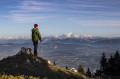
The GR® de Pays Grand Tour de la Valserine covers a vast area in the Ain department. This circular route winds through the Haut-Jura Regional Nature Park, passing through the contrasting landscapes of the Retord plateau, the Valserine valley, the Pays de Gex and the Haute Chaîne du Jura.
Part of the route passes through the Haute Chaîne du Jura National Nature Reserve, which is subject to specific regulations:Dogs are prohibited, even when kept on a lead, as is camping in tents.Please respect these rules to preserve the richness of this exceptional environment.