


 Country:

 City:
City:


(S) Wochenbrunner Alm
The route starts from the car park at the Wochenbrunner Alm. Follow the well-marked path which climbs northwards towards the Gruttenhütte. You’ll initially walk through the forest and across the first Tyrolean alpine pastures.
(1) View of Ellmau
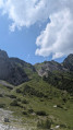
As the path quickly gains altitude, the view opens up to reveal a magnificent vantage point overlooking the village of Ellmau and the valley. This is the perfect spot for your first photo break before the path becomes rockier and steeper. Continue the ascent.
(2) Gruttenhütte
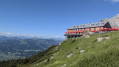
You reach the Gruttenhütte (1,620 m), a spectacular mountain hut nestled at the foot of the Ellmauer Halt cliffs. Leave the hut by following the path that winds its way up the slope into an imposing rocky cirque. The route then climbs steeply east/north-east, towards the great gap in the Ellmauer Tor.
(3) Ellmauer Tor (2,000 m)
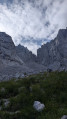
Once you reach this vast pass, at an altitude of over 2,000 metres, you’ll find yourself surrounded by vertiginous limestone spires. The landscape literally changes dramatically. Begin the descent down the opposite (northern) slope, over a steep scree slope (Steinerne Rinne) which demands your full attention, then head northwards before climbing slightly again to reach the next mountain hut.
(4) Stripsenjoch Hut
You have now reached the Stripsenjoch Hut (Stripsenjochhaus – 1,577 m), a mecca for local mountaineering. After taking in the view of the massif’s northern slope, continue southwards towards the challenging Kopftörl pass. The landscape once again becomes very rocky and alpine.
(5) Kopftörl (2,058 m)
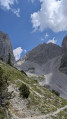
Crossing the Kopftörl is one of the key sections of this circular route. This narrow pass is technical and often secured by cables. It takes you back over to the southern slope of the massif. Begin the long descent: you’ll first traverse imposing scree slopes in tight switchbacks, before gradually reaching softer terrain and vegetation.
(E) Wochenbrunner Alm
The path eventually levels out through the forest, taking you back to the Wochenbrunner Alm mountain pasture, marking the end of this superb yet challenging Tyrolean circular route.
 Visorando Member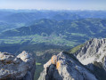

 Easy
Easy 
