


 Country:

 City:


Park in the small car park at the entrance to Rue de la Baume in Frambouhans.
(S/E) Cross the road and turn right onto Rue du Capitaine Treilhes. Walk through the whole village. Go past the last house and look out for a small path on the left.
(1) Take this path and head up into the woods. When you reach the pasture, cross it, then head into the woods opposite and walk down to a small road.
(2) Take this road, turning left then right, and continue along this track, winding your way uphill past the Adroit de Courtain farm. Carry on until you reach a car park and a house.
(3) Head into the woods, taking the path on the right, heading north-east. Further on, look out for the faintly marked path that branches off to the left in a hairpin bend. Continue along this descending path, ignoring the side paths. Pass the Pré la Ruse farm, reach the D231 and follow it to the left for 50 metres.
(4) Turn right into the village of Lizerne via Rue du Pressoir. After a few metres, you’ll soon come to a Y-junction.
(5) Turn right to reach the D464. Cross it with great care and walk alongside it on the left. Turn right shortly afterwards to head down towards the Fontaine de Godard. Take a moment to enjoy the renovated site, then continue downhill until you reach another road.
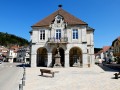
(6) Turn right onto this road and continue until you reach the junction by the town hall in Mancenans. As you pass, take a look at the structures for the tapped springs. Walk through the village and past the town hall.
(7) Turn left onto Rue de l’Hermitage and head downhill until you reach a junction. Turn left onto the D347, where you’ll immediately find a car park.
(8) Enter the car park on the left, then follow the sign on the right for the Waroly Caves. Take in the site, which stretches for a few hundred metres, and enter the underground passageways. Make your way to the final chamber.
(9) Turn back at the last chamber and head back to the car park.
(8) Head down the path on the right through the woods, then cross the pasture and the stream. You’ll come to a ford and a crossroads.
(10) Cross the ford to enter the Waroly Waterfalls site. Then continue along this track, which crosses a large pasture and then some woodland. At a hairpin bend, you’ll reach a new road.
(11) Ignore this road; take the path on the left and begin a new climb to reach the D464. Walk very carefully for about 200 metres along the edge of this road, as this section is completely unsecured.
(12) Then take the fairly steep little path that branches off to the right. Continue climbing, enjoying the view of the Château de l’Ermitage. You will then come across a dirt track.
(13) Turn right and head towards the entrance to the village of Lizerne.
(5) Walk through the village in the opposite direction to your outward journey to return to the D231 junction.
(4) Turn right onto it until you reach the road leading to the farms at Pré Cernay
(14) Turn left onto the small path. Before you reach the houses, look out for the small path in the pasture and follow it into the woodland. Continue uphill, staying on the ridge, and, between the hedges, look out for the path that branches off sharply to the right. Climb quite steeply through the woodland and, on the flat stretch, carry on straight ahead across the meadow, staying on the track.
(15) In the woods, turn left onto the forest track. Here, you can walk a further hundred metres or so to see a memorial stone honouring members of the Resistance during theSecond World War.
Head quite steeply uphill through the woods along a path badly damaged by forestry machinery.
Once you reach level ground, and after a wide bend to the left, look out for a fairly wide path that branches off to your left in a hairpin bend.
(16) Take this lovely path to the left and reach the Faux Verger site at an altitude of 980 metres.
After the viewpoint, follow the path back into the woods and head down to the car park towards the house you passed on the way there.
(3) Then follow the path you took on the way there, but in the opposite direction. Enjoy the view of the Alps once more as you arrive above the Adroit de Courtain farm. Cross through woodland and pasture to reach the car park on Rue de la Baume (S/E).


 Visorando Member



 Easy
 Difficult

