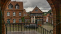
From Mölln around Lake Schmalsee and Lake Lütauer

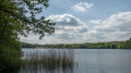
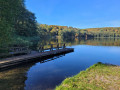
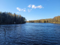
Schmalsee and Lütauer See are part of a string of lakes in the Duchy of Lauenburg that stretches from Gudow to Mölln like a string of pearls. The lakes are linked by the Hellbach stream, which also feeds the Hellbachtal floodplain a little further south.

The walk takes you round both lakes along paths that are mostly well-maintained.

Details

62589435
Creation:
Last update:
Last review:
  • Walking
    Activity: Walking
  • ↔
    Distance: 4.39 mi
  • ◔
    Average duration: 2h 05 
  • ▲
    Difficulty: Easy

  • ⚐
    Back to start: Yes
  • ↗
    Ascent: + 102 ft
  • ↘
    Descent: - 105 ft

  • ▲
    Highest point: 148 ft
  • ▼
    Lowest point: 69 ft

Photos

Description of the walk

Start: The best way to reach the starting point of the walk is by car. There is ample parking available in the car park at
Uhlenkolk Wildlife Park.

(S/E) From the car park at Uhlenkolk Wildlife Park, we head south – away from the wildlife park – onto the footpath into the woodland.

(1) After just under 200 metres, we reach a car park in the woods. Here, we turn left and, after about 50 metres, take a narrow path to the right down the hill.

(2) We reach Schmalsee and continue to the right here. We follow this path for a while, keeping Schmalsee on our left at all times.

(3) We reach the point where the path crosses from Lütauer See to Schmalsee and continue straight ahead along the path. From here on, Lütauer See is on our left until we reach the country road from Mölln to Lehmrade.

(4) At the country road, we continue to the left along the footpath and cycle path until we reach the Lütauer See campsite.

(5) At the Lütauer See campsite, we turn left. Directly behind the reception, on the right-hand side, is the ‘Zur Hütte’ restaurant. We walk across the campsite for about 300 metres until we reach the edge of the wood.

(6) Once at the edge of the forest, we turn left onto the footpath leading down to Lütauer See. When we reach the lake, the path curves to the right. From now on, Lütauer See remains on our left-hand side again.

(7) We reach the opposite side of the passage between Lütauer See and Schmalsee. The path along the lake curves slightly to the right. We follow this path to the end of Schmalsee.

(8) At the end of Schmalsee, we turn left over the bridge and then immediately left again, walking along the lake for a few metres.

(9) After about 150 metres, we turn right up the path and leave Schmalsee behind.

(10) We have reached the road leading to the car park where the walk began. Here, we turn left and follow the road to the car park.

(S/E) We turn left once more and have now reached our starting point, the car park at Uhlenkolk Wildlife Park.

Waypoints

  1. S/E : mi 0 - alt. 141 ft - Uhlenkolk Wildlife Park car park
  2. 1 : mi 0.2 - alt. 125 ft - Car park in the woods
  3. 2 : mi 0.29 - alt. 92 ft - At Schmalsee
  4. 3 : mi 0.91 - alt. 92 ft - Path between Schmalsee and Lütauer See
  5. 4 : mi 2.01 - alt. 95 ft - Country road from Mölln to Lehmrade
  6. 5 : mi 2.46 - alt. 105 ft - Lütauer See Campsite
  7. 6 : mi 2.59 - alt. 138 ft - Edge of the forest at the Lütauer See campsite
  8. 7 : mi 3.35 - alt. 82 ft - Path between Schmalsee and Lütauer See
  9. 8 : mi 4.03 - alt. 79 ft - Bridge over the Pinnau
  10. 9 : mi 4.12 - alt. 85 ft - Path to the road
  11. 10 : mi 4.14 - alt. 92 ft - Road to the wildlife park
  12. S/E : mi 4.39 - alt. 141 ft - Car park at the wildlife park

Notes

No special equipment is required for the walk.

Worth a visit

At the starting point of the walk, the Uhlenkolk Wildlife Park is well worth a visit.

From fallow deer to eagle owls and wild boar, 30 native animal species can be spotted in the 22-hectare wildlife park. The park is open all year round and admission is free. Donations towards its upkeep are welcome. Dogs are not permitted in the wildlife park.

Further information on the region:

Mölln Tourist Information
Am Markt 12
23879 Mölln
Germany
Tel.: +49 4542 976510
Email: info@moelln-tourismus.de

For more walks, use our search engine .

The GPS track and description are the property of this route's author. Please do not copy them without permission.