Country:
 City:
City:


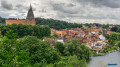
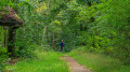
Start: The walk begins at Ratzeburg railway station and ends at Mölln railway station. Both stations are connected via the Lüneburg–Lübeck railway line. Trains run hourly on this route.
For motorists, there are also car parks at both stations. In Mölln, however, there are very few parking spaces. If you want to be sure of a parking space, it is therefore better to leave your car in Ratzeburg.
(S) From the station, we follow Bahnhofsallee towards the town centre until we reach the area around Lake Ratzeburg. As the route for pedestrians on the right-hand side of the road becomes rather unattractive further on, it is advisable to switch to the left-hand side early on. Upon reaching Lake Ratzeburg, we also come across the first saltires marking the E-hiking trails.
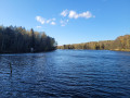
(1) At the ‘Der Seehof’ hotel, we cross the road to the right again. To our right is now the Küchensee. Shortly after crossing the road, we leave Bahnhofsallee to continue walking to the right along the shore of the Küchensee. At the end of the park, the path continues over an old railway embankment between the ‘Kleiner Küchensee’ on the left and the ‘Küchensee’ on the right.
(2) At the end of the old railway embankment between the lakes, we turn right onto Waldesruher Weg and stay on the footpath alongside the Küchensee.
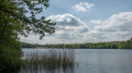
(3) We have briefly left the lake and turn off to the right again to continue walking along the Küchensee. We return to the Küchensee and cross the Schaalsee Canal. If you’d like to stop for a bite to eat, take the turn-off to the left after about 200 metres towards the Farchauer Mühle. Otherwise, carry on a little further along the lake until the path finally leaves the shore.
(4) We follow the E1 to the right towards the old Farchau paper mill. The buildings of the former paper mill have been extensively renovated and the mill wheel is turning once more.
(5) At the next crossroads, we turn left. We now enter the woods via the track.
(6) Shortly afterwards, a narrow path branches off to the left. We follow this until we reach a gravel road. Opposite is a car park.
(7) We then continue to the left of the car park, along the forestry track. After a short while, we cross a disused railway line and shortly afterwards reach a crossroads.
(8) We turn left and, after a few metres, reach the edge of the woodland. Here, we stay on the path on the right. Before we head back into the woodland, we pass a row of large greenhouses.
(9) At the junction of ‘Alter Frachtweg’ and ‘Wasserkrüger Weg’, we turn left onto ‘Alter Frachtweg’. This leads briefly but steeply uphill. Once at the top, there is a car park and a bench on the right. We cross the road and continue along ‘Alter Frachtweg’. We go straight on at the next junction and ignore the next two turnings to the right and left.
(10) Then we turn right onto the grassy path leading downhill. After just a few minutes, we need to be particularly careful, as the footpath changes direction very frequently from this point onwards. The white saltires marking the E1 and E6 routes help with navigation.
(11) At the next junction, we turn left and, just a few metres later, straight back to the right.
(12) At the next crossroads, we turn right and, just a few metres later, left again.
(13) We reach another crossroads, turn left and, just a few metres later, turn right again.
(14) We have reached the edge of the forest. Ahead of us lies the ‘Don Bosco-Haus für das behinderte Kind e.V.’ complex. There, we continue to the right along the access road. Just past the complex, we turn left onto the narrow path running alongside the grounds. After a short, slightly steeper section of the path, we turn immediately left.
(15) We now turn right and follow the forest track for a few hundred metres. Then we follow the narrow path that branches off to the right.
(16) A small flight of steps now leads to the right, up to the road. Once at the top, we cross the road and walk across the car park into the woods.
(17) On the left, on the hill, we can see the First World War memorial. We briefly leave the E1 and E6 and head straight up the hill to the memorial tower. Behind the tower, we continue straight ahead onto the narrow path.
(18) We stay on the __path_ above and walk past the housing estate to our left.
(19) We now turn left onto Brombeerweg and walk to the next junction, Ohle Drift. There, we turn right and walk along the outside edge of the housing estate (the estate is to our left).
(20) A flight of steps now leads us down to Mölln. Once at the bottom, we cross the road and walk straight ahead into the old town.
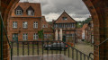
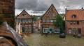
(21) On the street‘Am Markt’, we turn right and walk up the cobbled street towards the church. At the top of the market square is a cluster of historic half-timbered houses and the Till Eulenspiegel monument.
(22) After leaving the market square, we keep to the right and walk through the town centre to Mölln railway station, our destination (E).
 Visorando Member
 Easy
Easy