Marly–Pournoy-la-Chétive Greenway

An easy walk along the start of the old railway line, now the Marly to Coin-sur-Seille greenway.

Details

n°31018808
Creation:
Last update:
Last review:
  • Walking
    Activity: Walking
  • ↔
    Distance: 7.69 mi
  • ◔
    Average duration: 3h 35 
  • ▲
    Difficulty: Moderate

  • ⚐
    Back to start: Yes
  • ↗
    Ascent: + 43 ft
  • ↘
    Descent: - 43 ft

  • ▲
    Highest point: 604 ft
  • ▼
    Lowest point: 561 ft
  • ⚐ Country: France
  • ⚐ City: Marly (57157|57155)
  • ⚑
    Start/End: N 49.057645° / E 6.147074°
  • Hour-by-hour weather

Description of the walk

The route starts at the southern end of Marly. To reach the starting point from the D5, take the D113A and follow it to the triangular Cour de la Gare roundabout. Parking is available on Rue du Chemin de Fer.

(S/E) Take the greenway at the roundabout, pass quickly under the D113A bridge, then over the motorway footbridge, and arrive at a junction with a small road.

(1) Continue straight ahead on the cycle path for about 3 km, pass the yellow gas pipeline marker No. 169 and reach the corner of the Bois de Saulx Solange.

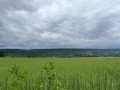
(2) Turn left onto a dirt track that runs alongside the path, then turns left to continue across the fields alongside the Fossé Saint-Laurent. Join a cross-road (D66), turn right, then take a path on the left at the edge of the woods.

(3) Turn left onto this track which runs alongside the Seille.

(4) Turn left, leaving the river behind.

(5) At the T-junction, turn left and head towards the village of Cuvry. Pass the church on your left and reach a side street.

(6) Turn right onto it, leave the village and follow the road until you rejoin the greenway you took earlier.

(1) Follow it to the right and retrace your steps to the Cour de la Gare roundabout (S/E).

Waypoints

  1. S/E : mi 0 - alt. 604 ft - Cour de la Gare roundabout
  2. 1 : mi 0.58 - alt. 587 ft - A/R junction
  3. 2 : mi 3.1 - alt. 581 ft - Angle du Bois de Saulx Solange
  4. 3 : mi 4.58 - alt. 571 ft - Path on the left at the edge of the woods - Seille (Affluent de la Moselle)
  5. 4 : mi 5.33 - alt. 564 ft - Junction
  6. 5 : mi 5.81 - alt. 564 ft - Junction, on the left
  7. 6 : mi 6.39 - alt. 577 ft - Crossing street
  8. S/E : mi 7.69 - alt. 604 ft - Cour de la Gare roundabout

Notes

Paths may be muddy after rain, for about 3 km, whilst crossing the fields.

Worth a visit

Take the time to explore the open-air photo exhibition near Pournoy.

Reviews and comments

3.2 / 5
Based on 3 reviews

Reliability of the description
4 / 5
Ease of following the route
2.7 / 5
Route interest
3 / 5
User 24445601

Overall rating : 2.3 / 5

Date of your route : Dec 15, 2025
Reliability of the description : ★★★☆☆ Average
Ease of following the route : ★★☆☆☆ Disappointing
Route interest : ★★☆☆☆ Disappointing
Very busy route : No

Start of the hike is straight as it follows an old railway line for 1 hour.
Do not attempt to cross the Saulx Solange woods, as it is impossible to do so due to fallen trees. Turn left after the stable in the meadow and cross the fields. The path is marked on the map. The return journey is very muddy.
Patrick

Machine-translated

Maryse Schaefer
Maryse Schaefer

Overall rating : 3.3 / 5

Date of your route : Sep 23, 2024
Reliability of the description : ★★★★★ Very good
Ease of following the route : ★★☆☆☆ Disappointing
Route interest : ★★★☆☆ Average
Very busy route : No

At point 2 on the Visorando map, there is no longer a path at the entrance to the forest
I had to turn back to find the path further on after walking alongside the road

Machine-translated

Tilorice
Tilorice
• Edited:

Overall rating : 4 / 5

Date of your route : Sep 16, 2023
Reliability of the description : Not used / Not applicable
Ease of following the route : ★★★★☆ Good
Route interest : ★★★★☆ Good
Very busy route : No

The section running alongside the stream in the St Laurent meadow ditch (a short stretch through the woods to the left just after the bridge over this stream) no longer exists at all; the trees have been knocked down, have fallen into the woods and the path has become completely impassable.
We crossed over the stream and walked along the other side (through a field with horses), but the grass was tall and damp (which we hadn’t anticipated); then, when we rejoined the route through the Chassis pasture, the grass was tall and damp despite the tractors having driven along these towpaths.

Machine-translated

Other walks in the area

For more walks, use our search engine .

The GPS track and description are the property of this route's author. Please do not copy them without permission.