


Refine your search for walks in Versoud (cours d'eau) - Affluent de l'Isère
Versoud (cours d'eau) - Affluent de l'Isère walks


 The hamlet of Les Monts and the Gorges du Gorgonnet
 Visorando Member

 8.39 mi
 +1,329 ft
 -1,345 ft
 5h 00
 Moderate
 Departure from L'Albenc (Isère)
Please note: due to a major landslide, this hike is currently not possible.
You start by walking along the Isère river through walnut trees. You then climb up the foothills of the Vercors, before returning via the Gaffe footbridge and the wild, steep-sided Gorgonnet gorges.
The Rivet viewpoint
 5.25 mi
+965 ft
-965 ft
3h 15
 Easy
Departure from Saint-Gervais (Isère) (Isère)
A remarkable walk in the Écouges forest, classified as a protected sensitive area.
This walk is very family-friendly and suitable for children in pushchairs.
However,be careful at the viewpoint as the walk is high up.
Discovery trails in Les Écouges
 5.75 mi
+1,007 ft
-1,007 ft
3h 30
Moderate
Departure from Saint-Gervais (Isère) (Isère)
This hike is not too difficult and takes you through a variety of landscapes. Discover a very old Carthusian church, sharp limestone pavement, magnificent ferns, vertiginous cliffs and unlikely mill ruins.
From Pont Chabert to Pas de la Pierre Taillée
 11.18 mi
+2,575 ft
-2,556 ft
7h 25
Moderate
Departure from Saint-Gervais (Isère) (Isère)
A slightly long walk, but it starts with a "flat hill"...
Alternating shaded forests and meadows.
Beautiful views of the northern Vercors: the Isère valley, Chambarans and more... weather permitting.
Les Deux Pas in Les Écouges
 11.12 mi
+2,697 ft
-2,697 ft
7h 30
 Difficult
Departure from Saint-Gervais (Isère) (Isère)
This walk, in the Écouges, passes through two ‘pas’: the Montbrand and the Pierre Taillée. It is very well signposted. Pleasant during heatwaves as it is mostly in the woods. At the ‘pas’, magnificent views over the Isère plain.
Crossing the Vercors from Engins to Saint-Gervais
21.71 mi
+5,394 ft
-7,323 ft
14h 40
 Extremely difficult
Departure from Engins (Isère)
This traverse of the northern Vercors links Engins to Saint-Gervais from east to west, passing over three peaks and through particularly wild sections. The route offers a wonderful variety of landscapes, ranging from forests to mountain pastures and the ridges typical of the Vercors. The higher ground offers stunning views over the Isère valley, the Chartreuse and the surrounding Alpine massifs. The route alternates between open stretches and more wooded sections, some of which are very remote.
⚠️ This route is intended solely for experienced and well-trained walkers. A GPX track is essential. See practical information.
 Saint-Gervais to Pont-d'Oxford Greenway
 39.81 mi
+95 ft
-98 ft
4 hrs
Difficult
Departure from L'Albenc (Isère)
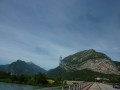
A long and beautiful cycle ride along the banks of the Isère on the Belle Via, on avery flat, well-shaded and car-free route. The route starts from the towpath, near the Saint-Gervais bridge, with the Vercors cliffs accompanying you all the way. The route follows the River Isère upstream to its confluence with the Drac, then crosses both rivers, with the Casque de Néron directly opposite and the snow-capped Pic de Belledonne to the right. The return journey follows the right bank of the Isère.