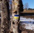
Very nice hike without any difficulty, with stunning views of the Pas des Voutes, Pas de la Charmate and Pas de l'Allier.
Technical sheet No. 4098630


Description
From the Col de Méselier car park, take the road for 250 m towards Saffrières, then take the first path to the left (1), which rises gradually in the forest of Serves Foulette. At the fork (2), take the left path around an almost 180° turn and climb the steep route to the Pas des Voutes (3).
Arrive at the ridge, head in the direction of St-Julien-en-Vercors, via the Pas de la Charmate (4) then by the Cabin in Lily (5).
Having arrived at the Cabin in Lily, turn right. We arrive at an intersection (6) Turn right and reach the view point of Pas de l’Allier (7).
Then head down the hillside to point (2) through which we passed on the outbound leg. There remains only to head straight to the car park at the starting point.
Waypoints :
D/A : km 0 - alt. 539 m - Col de Méselier (534m)
1 : km 0.36 - alt. 562 m - Start at Chemin de la Forêt du Sert de la Foulette
2 : km 2.17 - alt. 818 m - Intersection with Chemin du Pas de la Voute.
3 : km 3.11 - alt. 1,113 m - Pas de la Voute.
4 : km 3.3 - alt. 1,160 m - Pas de la Charmate. - Bourne (rivière)
5 : km 5.14 - alt. 1,143 m - Cabin in Lily.
6 : km 6.21 - alt. 1,151 m - Fork. Turn right.
7 : km 7.05 - alt. 1,152 m - Pas de l'Allier.
D/A : km 11.14 - alt. 540 m
Useful Information
No special equipment is required.
Visorando and this author cannot be held responsible in the case of accidents or problems occuring on this walk.
During the walk or to do/see around
Many variants for this hike near the Gorges de la Bourne, Choranches Caves and the beautiful village of Pont en Royans, with its hanging balconies.
Opinions and comments
Average
Global average : 5/5
Number of opinions : 1
Clarity of route description : 5/5
Clarity of route map : 5/5
Walk interest : 5/5
Admin walker
Thanks for your feedback!
Walker
Global average : 5 / 5
Date of walk
: 12/10/19
Clarity of route description
: ★★★★★ Very good
Clarity of route map
: ★★★★★ Very good
Walk interest
: ★★★★★ Very good
This is the 1st walk that I have used Visorando for and I was very impressed with the quality of the desctiption, the route map, directions and the starting point (lat & lon) which was absolutely 100% accurate.
The only thing that I would say is that this is marked as average although the walk has a very steep vertical climb which I think should be mentioned. I, on hindsight should have realised myself as the description does include the total height gained and also when I used Mapsource to get the route to my GPS, I also saw the altitude graph.
It is not a difficult walk and not easy so average is probably the best description but..
Overall - a very good walk and well done to the person who published it. 100% accurate and stunning views.
Other walks in the area
For more walks, use our search engine.
The GPS track and description are the property of the author.