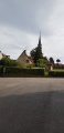
The valley of the church at Les Autels-Saint-Bazile

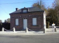
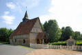
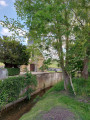
Starting from the town hall in Les Autels-Saint-Bazile, you’ll walk on level ground through a forest along a dirt track, then down a small sunken path leading to the little church at Les Autels-Saint-Bazile (listed as a historic monument). You’ll cross the River Monne, passing pastures dotted with apple trees and half-timbered houses, before heading back up a picturesque sunken path

Details

n°3392161
Creation:
Last update:
Last review:
  • Walking
    Activity: Walking
  • ↔
    Distance: 5.81 mi
  • ◔
    Average duration: 3h 00 
  • ▲
    Difficulty: Easy

  • ⚐
    Back to start: Yes
  • ↗
    Ascent: + 417 ft
  • ↘
    Descent: - 446 ft

  • ▲
    Highest point: 738 ft
  • ▼
    Lowest point: 325 ft

Photos

Description of the walk

Park after the town hall in Les Autels-Saint-Bazile.

(S/E) With your back to the town hall, follow the D38A / Route de la Monne to the first crossroads.

(1) Take the forest track on the left towards the forest until you reach the Route de la Varinière.

(2) Turn right, continue past the 90° bend, and carry on until you reach the first track on the right (just after the white fences on the right and an equestrian centre on the left).

(3) Turn right onto the sunken track, which is often damp on the descent, and at the very bottom you’ll reach the church at Les Autels-Saint Bazile.

(4) At the church, go straight on, cross the Monne bridge and turn right onto the Route de Saint-Bazile towards Le Renouard until you reach the Route de la Monne.

(5) Turn right, cross the Monne again and head for the hamlet of Les Autels.

(6) Turn left between pastures dotted with apple trees, continue along the right-hand side until you pass a meadow, follow the hedge on the right, and carry on along a dirt track which then becomes tarmac until you reach the hamlet known as Le Moulin à Tan (a beautiful Norman property on the left).

(7) Turn off onto the path on the right under the deciduous trees (opposite a path leading to the river), join the Route de la Lune and arrive at the junction from the outward journey, the Route de la Monne (D38a).

(1) Turn left to return to the town hall (S/E).

Waypoints

  1. S/E : mi 0 - alt. 738 ft - Les Autels-Saint-Bazile Town Hall
  2. 1 : mi 0.25 - alt. 712 ft - Crossroads at the end of the circular loop
  3. 2 : mi 1.4 - alt. 682 ft - Route de la Varinière
  4. 3 : mi 2 - alt. 581 ft - Fork in the path
  5. 4 : mi 2.51 - alt. 325 ft - Church of Les Autels-Saint-Bazile
  6. 5 : mi 3.27 - alt. 390 ft - Junction with the Route de la Monne
  7. 6 : mi 3.73 - alt. 397 ft - Turn left at the fork between the meadows and apple orchards
  8. 7 : mi 4.75 - alt. 397 ft - Junction after Moulin à Tan
  9. S/E : mi 5.81 - alt. 738 ft - Les Autels-Saint-Bazile Town Hall

Notes

Park in the car park on Route de la Monne, just past the town hall in Les Autels-Saint-Bazile.
Keep dogs on a lead; sturdy footwear is strongly recommended.
An ideal family walk… pushchairs not recommended.
No shelter, no water points – please bring your own drinks.
No rubbish bins – please collect and keep your rubbish with you.
Suitable for all seasons.

Worth a visit

Forest track.
Sunken paths.
Church of Les Autels-Saint-Bazile (listed as a historic monument).
Half-timbered houses, apple trees.
The Monne Valley.

Reviews and comments

3.6 / 5
Based on 3 reviews

Reliability of the description
3.3 / 5
Ease of following the route
3.3 / 5
Route interest
4 / 5
strideworld
strideworld

Overall rating : 3.7 / 5

Date of your route : Jul 01, 2024
Reliability of the description : ★★★★☆ Good
Ease of following the route : ★★★☆☆ Average
Route interest : ★★★★☆ Good
Very busy route : No

Like the hikers before us, we found it very difficult to make headway between points 6 and 7.
We carried on nonetheless, cutting across fields of tall grass, stinging nettles and brambles…
Watch out for ticks – there are plenty of them! (July 2024).
Overall, a very pleasant walk with very few (if any) other walkers.

Machine-translated

Danneville
Danneville

Hello everyone,
We have been raising this issue with local councillors since the spring… without success
We have just submitted a request directly to the Lisieux urban community, which is responsible for footpaths and hiking trails.
In the hope that things will move forward, we have also requested that the route be signposted.
We’ll be sure to keep you updated here.
Kind regards

Machine-translated

Randoserge
Randoserge

Overall rating : 3.7 / 5

Date of your route : Sep 24, 2023
Reliability of the description : ★★★☆☆ Average
Ease of following the route : ★★★★☆ Good
Route interest : ★★★★☆ Good
Very busy route : No

A lovely route in the heart of the Pays d’Auge, but we were unable to complete the route because, three-quarters of the way between checkpoints 6 and 7, the path was impassable, blocked by brambles, stinging nettles and a fallen tree lying across the path; we had to turn back and complete the rest of the walk along the road.

Machine-translated

Apetitspas
Apetitspas

Overall rating : 3.3 / 5

Date of your route : Aug 20, 2023
Reliability of the description : ★★★☆☆ Average
Ease of following the route : ★★★☆☆ Average
Route interest : ★★★★☆ Good
Very busy route : No

Peace and quiet guaranteed on this walk in the heart of the Pays d’Auge!
We were a bit unsure before point 2 about where the Route de la Varinière was, as it isn’t marked on the map. After re-reading the description, we found it!
Between point 6 and point 7, it’s best to follow the faint tracks, as the route alternates between paths and open grassland… and we couldn’t find the Moulin à Tan!
A lovely walk, best done in dry weather.

Machine-translated

Other walks in the area

For more walks, use our search engine .

The GPS track and description are the property of this route's author. Please do not copy them without permission.