Circular walk in the Monne Valley starting from Les Autels-Saint-Bazile

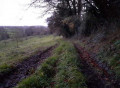
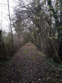
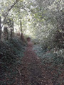
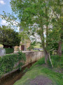
A circular loop along the sunken paths of the Pays d’Auge, a landscape typical of Normandy. Descend into the Monne valley, following the path of the old tannery mill and the leat (which no longer exist). Climb up another valley along another sunken path before crossing a forest… A few damp sections, a steep descent and a lovely climb.

Details

n°3391989
Creation:
Last update:
Last review:
  • Walking
    Activity: Walking
  • ↔
    Distance: 3.78 mi
  • ◔
    Average duration: 2h 05 
  • ▲
    Difficulty: Easy

  • ⚐
    Back to start: Yes
  • ↗
    Ascent: + 371 ft
  • ↘
    Descent: - 371 ft

  • ▲
    Highest point: 738 ft
  • ▼
    Lowest point: 367 ft

Photos

Description of the walk

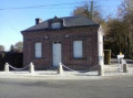
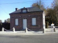
Start from the car park at the town hall in Les Autels-Saint-Bazile, along the D38.

(S/E) Head east and follow the D38A (Route de la Monne) to the junction.

(1) Turn right onto the Chemin de la Lune. At the end of the tarmac road, continue along a sunken track and descend to a junction at elevation 187.

(2) Ignore a turn-off to the left and carry on straight ahead along a downhill path (wetland, short steep section). Join a tarmac cross-road (Chemin du Moulin à Tan).

(3) Follow it to the left. Pass the hamlet of Le Moulin à Tan and reach the hamlet of La Cour l’Abbé.

(4) Continue along the grassy track. After a road sign, cross a wetland area and continue along a hedge through the pasture. Then continue through the woodland, still following the hedge, and carry on along the grassy path above the pasture with apple trees. You’ll come out onto the Route de la Monne; head down it slightly to the right for a few metres.

(5) Immediately turn left onto the Chemin des Hayettes, which is tarmac-surfaced at first, then becomes a stony track and finally a grassy path. The path narrows into a sunken track with a steep climb. You’ll reach the hamlet of Les Goubins.

(6) Continue uphill along a small road and, after about 250 m, reach the plateau and a junction with a path.

(7) Turn left onto a lane lined with fir trees. Continue along the edge of the forest. At a junction (elevation 218), go straight on and return to the junction you took at the start of the walk.

(1) Turn right and carry on straight ahead to the town hall car park (S/E).

Waypoints

  1. S/E : mi 0 - alt. 738 ft - Les Autels-Saint-Bazile – Town Hall car park
  2. 1 : mi 0.25 - alt. 712 ft - Junction of the circular loop
  3. 2 : mi 0.61 - alt. 617 ft - Junction
  4. 3 : mi 1.05 - alt. 397 ft - Chemin du Moulin à Tan. Follow the - la Monne
  5. 4 : mi 1.38 - alt. 397 ft - La Cour l’Abbé
  6. 5 : mi 2.1 - alt. 384 ft - Les Autels – Chemin des Hayettes
  7. 6 : mi 2.65 - alt. 630 ft - Les Goubins
  8. 7 : mi 2.8 - alt. 705 ft - Crossroads
  9. S/E : mi 3.78 - alt. 738 ft - Les Autels-Saint-Bazile – Town hall car park

Notes

Keep dogs on a lead; sturdy footwear is strongly recommended.
An ideal family walk; pushchairs are not recommended.
No shelter, no drinking water – please bring your own.
There are no bins; please pick up and keep your rubbish with you.
Suitable for all seasons.

Worth a visit

Le Monne Valley
Half-timbered houses
Sunken paths

There is another walk starting from the same point: the Valley of the Church of Les Autels.

Reviews and comments

3.8 / 5
Based on 2 reviews

Reliability of the description
4 / 5
Ease of following the route
4 / 5
Route interest
3.5 / 5
jourdanpatrick1951
jourdanpatrick1951

Overall rating : 4 / 5

Date of your route : Sep 15, 2025
Reliability of the description : ★★★★☆ Good
Ease of following the route : ★★★★★ Very good
Route interest : ★★★☆☆ Average
Very busy route : No

Walk along sunken paths offering few views. The route was taken in dry weather, but the first part is likely to be very muddy in wet weather.

Machine-translated

User 26277476
• Edited:

A pleasant walk for the views, but very poorly maintained. We were forced to retrace our steps at points 6–7 – IMPASSABLE – because of bushes blocking the path.

Machine-translated

domiclau14
domiclau14
• Edited:

Overall rating : 3.7 / 5

Date of your route : Oct 03, 2023
Reliability of the description : ★★★★☆ Good
Ease of following the route : ★★★☆☆ Average
Route interest : ★★★★☆ Good
Very busy route : No

Hello. First of all, to get to the town hall, stay on the Route de Trun (D38), as a car sat-nav set for the village of Autels Saint Bazile will take you to the church (point 4 of the walk). I had no trouble walking down to the church. Just before you get there, the path is very narrow and damp. There are no picnic tables near the church, which is a shame! Indeed, between points 6 and 7 (Les Authieux), a tree lying across the path makes it very difficult to get through. Furthermore, this section is neither signposted nor clearly marked. The GPS track helped us stay on course. The climb back up from point 7 is quite long and steep. In summary, this walk isn’t easy but is of moderate difficulty.

Machine-translated

DELCAMP André
DELCAMP André
• Edited:

In response to your enquiry of 21 August 2023, here is my feedback regarding route 829562, followed by route 3392161 (also applicable to route 3391989). For the first hike, ‘Between countryside and woodland around Boissey’, on 17 August 23, after passing point 1, the route is overgrown for more than 250 metres, making it impassable for a group. We were forced to take the path at the village exit to rejoin the route at altitude 59 after ‘Les Bertrand’. Regarding the second hike, ‘Vallée de l’église des Autels-St Bazile’, which we recce’d on Thursday 31 August 2023 for our club ‘Le Plateau de Meulles ’ 14140’ this Sunday 3 September 2023, we came across an impassable section after point 6, ‘Les Authieux’; point 7 was inaccessible. A very large tree trunk lay across the path; it was impossible to climb over it, unless crawling on one’s stomach through the mud below. The path was indistinct and overgrown behind it for an unmeasurable distance, as it could not be bypassed via the meadow on the left: we found no way through all the way to the river – barbed wire, shrubs, brambles, etc. The same was true to the right, through the undergrowth in the woods. We had to turn back and head up via the D 38a, which meant covering almost half the route by road! The same goes for route 3391989 – a shorter, reverse route… received this week by email! For the past three years, it’s the first few routes we’ve covered that have caused us problems. Thank you for all of this.

Machine-translated

Other walks in the area

For more walks, use our search engine .

The GPS track and description are the property of this route's author. Please do not copy them without permission.