Country:

 City:
City:


Starting point: Bois Rond car park.
(S/E) Take the TMF (Tour du Massif de Fontainebleau) southwards.
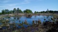
(1) Turn right onto a small path to reach the Mares des Couleuvreux.
(2) Walk alongside the wetland on your left, continuing southwards. You’ll reach the Route Forestière des Hautes Plaines, a tarmac road. To the south of this road lies a strictly protected nature reserve which is off-limits. Follow the forest road to the left.
(3) Leave this road and take the Route de la Hase to the north. Cross the Route de la Fontaine Sainte-Marguerite, continue straight ahead, then take a path sloping north-east to join the Route Descamps.
(4) Follow it to the right. Walk alongside an area burnt by fire.
(5) Pass the Route Circulaire on your right and carry on straight ahead. Do the same at the next junction and continue to the five-way junction.
(6) Head diagonally to the left (north-east) to follow Route du Sapin Blanc and reach the junction of the same name.
(7) Take the third road on the right, Route Alexandre, then turn slightly left before the Route de la Princesse to cross it further on, following the Route du Blaireau. You will reach the Carrefour du Blaireau.
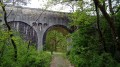
(8) Take Route de la Poche, turning west. Cross the underground Aqueduc de la Vannes. Continue north-east until you reach a five-way junction.
(9) Turn left to follow Route de la Louve westwards to the Carrefour de la Louve.
(10) Turn right, then left onto Route du Louvard. Turn left again to climb up to the Hurlevent viewpoint. Follow the circular path back to the Carrefour de la Louve.
(10) Continue to the right, heading south, along the Route du Louvard. Cross the Route de Milly, join the Chemin des Pieds and follow it to the left until you reach the junction with the Chemin des Platières de la Touche aux Mulets
(11) Turn right onto this path, heading due west. Caution! The route across the plateaus is not signposted and the rocks can be slippery in wet weather.
(12) Take care at this fork: do not head down to the right but carry on straight ahead towards the west. Join the Rochers de la Reine and follow them, still heading west, to the end.
(13) Head downwards due south for about 150 m, until you come out onto the Chemin du Bois Rond, then follow this path to the left, heading due east.
(14) Turn right, heading south-west, to follow the Chemin de l’Auberge to the Bois Rond car park (S/E).



 Visorando Member

 Difficult
 Easy
Easy