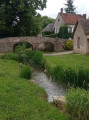
A circular walk in Puisaye

A route through the meadow leading to the Ferrier de la Garenne.

Details

n°906709
Creation:
Last update:
Last review:
  • Walking
    Activity: Walking
  • ↔
    Distance: 6.04 mi
  • ◔
    Average duration: 2h 55 
  • ▲
    Difficulty: Easy

  • ⚐
    Back to start: Yes
  • ↗
    Ascent: + 200 ft
  • ↘
    Descent: - 197 ft

  • ▲
    Highest point: 738 ft
  • ▼
    Lowest point: 607 ft

Description of the walk

Park near the church in Tannerre-en-Puisaye
(S/E) From the church, take the Grande Rue and continue for 200 metres until you reach a three-way junction.

(1) Turn right onto the path leading to La Sarauderie. Continue until you reach the hamlet known as Le Lieu Gros.

(2) Turn left onto the tarmac path. Cross the D160 and carry on to Les Ruineaux via Les Assises.

(3) At the crossroads, turn left heading north-east, where you’ll come to another three-way junction.

(4) Keep to the right on the small path between two hedges until you reach Béon.

(5) Turn left onto the D7 for 200 metres and then turn right straight away towards the Moulin de Béon. Cross the Branlin stream via the footbridge. Caution: it can be slippery. Continue until you reach the road linking Les François to Les Jaluzots.

(6) Turn left towards Les François, cross the road and take the path opposite. Stay on this path, ignoring the tracks on the right. You’ll reach another road at the 210-metre mark.

(7) Turn left onto it. You’ll arrive at the Ferrier de la Garenne crossroads.

(8) Turn left into the Ferrier and follow the green signposts, then return to the car park via Rue Carreau (S/E).

Waypoints

  1. S/E : mi 0 - alt. 617 ft - Car park at the church in Tannerre-en-Puisaye - Branlin (rivière)
  2. 1 : mi 0.27 - alt. 620 ft - On the right, a three-way junction
  3. 2 : mi 1.03 - alt. 709 ft - Le Lieu du Gros
  4. 3 : mi 2.13 - alt. 709 ft - Les Ruineaux
  5. 4 : mi 2.65 - alt. 663 ft - On the right, a three-way junction
  6. 5 : mi 2.97 - alt. 653 ft - Béon
  7. 6 : mi 3.95 - alt. 735 ft - Crossroads: road towards Les François
  8. 7 : mi 4.83 - alt. 696 ft - Crossroads at elevation 210
  9. 8 : mi 5.12 - alt. 712 ft - Ferrier de la Garenne crossroads - Le Ferrier de la Garenne
  10. S/E : mi 6.04 - alt. 617 ft - Car park at the church in Tannerre-en-Puisaye

Worth a visit

Reviews and comments

4.7 / 5
Based on 1 review

Reliability of the description
5 / 5
Ease of following the route
5 / 5
Route interest
4 / 5
Bois vert
Bois vert

Overall rating : 4.7 / 5

Date of your route : May 13, 2024
Reliability of the description : ★★★★★ Very good
Ease of following the route : ★★★★★ Very good
Route interest : ★★★★☆ Good
Very busy route : No

A pleasant walk. A map is essential, as the route is not signposted.
Thank you!

Machine-translated

Other walks in the area

For more walks, use our search engine .

The GPS track and description are the property of this route's author. Please do not copy them without permission.