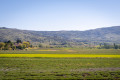
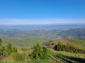
A circular walk starting from Saint-Montan

A lovely ride along the back roads of the Ardèche, a blissful experience of tranquillity. A short stretch of forest track, perfectly manageable on a hybrid bike, but there’s an alternative tarmac road if your bike isn’t suited to gravel.

Details

n°1870011
Creation:
Last update:
Last review:
  • Touring/Gravel
    Activity: Touring/Gravel
  • ↔
    Distance: 24.81 mi
  • ◔
    Duration according to the author: 4 hrs 
  • ▲
    Difficulty: Difficult

  • ⚐
    Back to start: Yes
  • ↗
    Ascent: + 2,034 ft
  • ↘
    Descent: - 2,011 ft

  • ▲
    Highest point: 1,322 ft
  • ▼
    Lowest point: 194 ft
  • ⚐ Country: France
  • ⚐
  • ⚐ City: Saint-Montan (07220)
  • ⚑
    Start/End: N 44.431086° / E 4.653224°
  • ❏
    IGN map(s): Ref. 2938SB, 2939OT, 3038SB

  • ◶
    Type of surface:
  •  
     
     
    ■ 33% Road ■ 34% Byway ■ 33% Path
  • Hour-by-hour weather

Photos

Description of the route

The starting point is at the ‘Chez Francine’ lodge at the Domaine de Montmale, near Saint-Montan

(S/E) Walk a few metres along the D86 and, at the roundabout, take the road branching off to your right. You’ll find yourself in peaceful surroundings straight away. Walk past the school and head towards Saint-Montan, following the GPS route to stay on quiet, little-used roads.

(1) Saint-André Church in Mitroys.

(2) In Saint-Montan, head towards Larnas. A very narrow road leads there; it’s winding and a bit steep, but this will be the only significant climb.

(3) You’ll pass Saint-Pierre Church.

(4) At the junction, take the small road signposted for Fontfreyde. A lovely, winding descent takes you to a four-way junction.

(5) Turn left onto the D362 towards Gras – a lovely, long and easy road. It follows the contour lines, then cross the departmental road to stay on a quiet little road. Then take the D262 and climb gently towards Mas de Gras.

(6) At Mas de Gras, take the D462 towards La Plaine. Pass through Rimouren and, after a hairpin bend, you’ll come to a junction with a forest track.

(7) Here you have two options:
- if you’re on a hybrid bike, take the forest track which will lead you to the D4,
- otherwise, you can continue by turning right and staying on the D462, which will take you further on to the D4 to rejoin the rest of the route.
Note: if you don’t like gravel, avoid the forest track used for maintenance work on the electricity pylons.

(8) Turn left towards Bourg-Saint-Andréol on the D4 ((9) passing close to the source of the Tourbe stream). The D4 is wide and descends steeply towards Bourg-Saint-Andréol.

(10) To avoid the village centre and traffic, take the road on the left which winds through the housing estate to join the D190.

(11) Turn left onto it. This is the least pleasant section, but it is short.
Note: Watch out for the Tramontane, which can blow very strongly against you.
After Courbier, you’ll come to a crossroads with four roads running at right angles to each other.

(12) Turn right; you’re back on a lovely, perfect and quiet road – it’s magnificent. Head towards the hamlet of Parot and cross La Conche.

(13) At the crossroads, turn left to rejoin the route you took on the way there in the Plaine du Cour neighbourhood, then head towards the Domaine de Montmale (S/E).

Waypoints

  1. S/E : mi 0 - alt. 197 ft - Car park at Lodge Chez Francine
  2. 1 : mi 1.11 - alt. 364 ft - Église Saint-André de Mitroys (Saint-Montan)
  3. 2 : mi 1.86 - alt. 381 ft - Head towards Larnas. Near the - Grotte de Lourdes (Saint-Montan)
  4. 3 : mi 4.33 - alt. 1,024 ft - Église Saint-Pierre (Larnas)
  5. 4 : mi 4.4 - alt. 1,007 ft - Onwards to Fontfreyde
  6. 5 : mi 7.01 - alt. 686 ft - Head towards Gras, along the - Nègue (rivière) - Affluent de l'Escoutay
  7. 6 : mi 10.54 - alt. 1,152 ft - Head towards La Plaine
  8. 7 : mi 13.2 - alt. 1,125 ft - Crossroads on the forest track
  9. 8 : mi 15.28 - alt. 1,263 ft - Towards Bourg Saint Andréol
  10. 9 : mi 16.03 - alt. 1,322 ft - Near the source of the - Tourne (ruisseau) - Affluent du Rhône
  11. 10 : mi 18.28 - alt. 666 ft - Entrance to Bourg-Saint-Andéol - Croix du Liby (Bourg-Saint-Andréol)
  12. 11 : mi 20.13 - alt. 246 ft - D190
  13. 12 : mi 22.7 - alt. 361 ft - Four-way junction
  14. 13 : mi 23.82 - alt. 213 ft - Conche (rivière)
  15. S/E : mi 24.81 - alt. 194 ft - Car park at Lodge Chez Francine

Worth a visit

Saint-Montan: a magnificent old village and castle. Small bistros and a bakery.
A very beautiful Romanesque chapel in Larnas
Excellent restaurant in Larnas:

Reviews and comments

5 / 5
Based on 1 review

Reliability of the description
5 / 5
Ease of following the route
5 / 5
Route interest
5 / 5
ANDP
ANDP

Overall rating : 5 / 5

Date of your route : Jul 15, 2019
Reliability of the description : ★★★★★ Very good
Ease of following the route : ★★★★★ Very good
Route interest : ★★★★★ Very good

A lovely place to explore

Machine-translated

For more walks, use our search engine .

The GPS track and description are the property of this route's author. Please do not copy them without permission.