Country:
 City:
City:



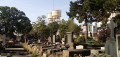
Start from Télégraphe metro station (line 11). Take exit 3, Cimetière de Belleville.
(S) Upon exiting the metro station, turn around and follow Rue du Télégraphe, which slopes slightly upwards. You will soon reach the cemetery entrance.
The route within the cemetery is indicative and can be adapted in various ways. In the description below, the names appearing on the graves may be highlighted for three different reasons:
1) Graves of notable figures, in which case a lower-case letter in brackets refers to a short entry in the ‘Sights’ section, where names are listed in the order they appear on the route.
2) Particularly original monuments.
3) Useful landmarks on the ground.
(1) Enter the cemetery and turn immediately right past the Maison de la Conservation. At the end, take a grassy path on the left along the wall. You will come out onto a grassy path, the Chemin de la Conservation, and follow it to the left. Note on the right, in the second row, the Vigneron family grave topped by a sort of vase.
(2) At the junction, note the grave of Jules Caillaux (a) opposite. Follow a wide tarmac path to the right, the Avenue Principale, and you will immediately find the grave of Armand Grébauval (b) on the right. Just after that, the grave of Léon Gaumont (c) and his family. Take the first grassy path on the right, leaving the Garabédian grave on your left (note the two water towers of the Belleville reservoir at the far end on the right). Pass by the foot of an obelisk erected in tribute to the Republican Guards, hostages of the Paris Commune executed on 26 May 1871.
At the end of the path, turn left onto a grassy track. Weave your way between a bush and the Uchlinger family grave. Then turn left onto a grassy path. On the left, note several graves adorned with photographs of the deceased. Still on the left, note the grave adorned with a bust of the Maury family, then that of Fernand Maillet (d).
Return to the Main Avenue and follow it to the right. Shortly afterwards, turn right between the Déglise grave (fenced off) and that of an aviator. Continue straight on to the grave of Gaston Cony (e), whose decoration and epitaph recall his profession. Then turn left and continue straight on to a wide grassy path, the Central Avenue.
(3) Follow this path to the right, at the corner of Michel Etcheverry’s grave (f). Go round the Bernie-Portes grave on the right, then turn right to find René Godart’s grave (g). Retrace your steps.
(3) Continue straight ahead along the grassy path. Cross a large tarmac square and continue along Avenue Centrale. At the foot of the post bearing the sign for this path, take a paved path to the right. At the next junction, turn left onto a tarmac path, Avenue Transversale No. 2, leaving the Prima-Zerr grave on your left.
Then take a path on the left, leaving Michel Patrice’s grave on your right. Note, on the right-hand side, the Bruneteau family grave, whose decoration is reminiscent of naïve art. Just before reaching a tarmac path again, turn right onto a path. Turn right shortly afterwards. Return to Avenue Transversale No. 2, follow it to the left and you will find, on the left-hand side, the grave of the Arduini family and Suzy Prim (h).
(4) Immediately afterwards, turn left onto a tarmac path. At the end, follow a wide tarmac path to the left, Avenue Transversale No. 1. Shortly afterwards, at a fountain, turn right onto Chemin de Belleville (whose location on the map is inaccurate). Note, on the right-hand side, the monumental grave of the Violet family.
At the end, turn left, passing the Drouard family tomb on your right. Note a large tomb overgrown with ivy and other perennials. At the junction, turn right onto a paved path, the Chemin du Télégraphe. Pass by the foot of the Queillé monument and ignore a path branching off to the left. Take the next path on the left, which alternates between flagstones and grass (benches).
(2) At the junction taken at the start of the tour, follow Avenue Principale to the right until you reach the cemetery exit.
(1) Two options here:
- Follow Rue du Télégraphe to the right and you’ll soon reach Télégraphe metro station (S).
- If you wish to extend the walk, as shown on the map, follow Rue du Télégraphe to the left and pass by the foot of the two water towers. At the junction, take Rue du Borrégo to the left. You will pass Villa du Borrégo on the left and Villa Amélie on the right.
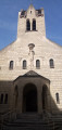
(5) At the end of the street, turn left into Rue Haxo and walk past the Church of Notre-Dame des Otages. Pass Rue des Tourelles on your right and take the next right, Villa Gagliardini. Then turn left into Villa Hortense Dury-Vasselon. At the end, follow Rue de Belleville to the right. At the end, you will find the Porte des Lilas metro station (line 11) on your right (E).
 Visorando Member
 Moderate