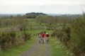
Tour of Lake Maury and the surroundings of Saint-Amans-des-Cots

A short mountain bike ride, avoiding roads as much as possible.

Details

n°63226455
Creation:
Last update:
Last review:
  • Mountain biking
    Activity: Mountain biking
  • ↔
    Distance: 19.01 mi
  • ◔
    Duration according to the author: 2 hrs 
  • ▲
    Difficulty: Moderate

  • ⚐
    Back to start: Yes
  • ↗
    Ascent: + 2,080 ft
  • ↘
    Descent: - 2,090 ft

  • ▲
    Highest point: 2,523 ft
  • ▼
    Lowest point: 1,736 ft
  • ⚐ Country: France
  • ⚐
  • ⚐ City: Saint-Amans-des-Cots (12460)
  • ⚑
    Start/End: N 44.689765° / E 2.657811°
  • ❏
    IGN map(s): Ref. 2438SB

  • ◶
    Type of surface:
  •  
     
     
    ■ 42% Road ■ 43% Byway ■ 15% Path
  • ⇧
    Bike carrying: Not specified
  • ▲
    Difficulty: Moderate
  • Hour-by-hour weather

Description of the route

The suggested starting point is the car park at Place de la Croix, except on Thursday mornings – market day – when you should park just next door at Place du Foirail.

(S/E) Turn right onto the D34 (Rue Principale) and head towards the three-way junction at No. 30.

(1) Turn right onto Route d’Entraygues, towards Campouriez. Follow the D34 until you reach Route de la Banide on the left.

(2) Take this road towards Bez-Bédène, then take thefirst road on the left.

(3) Take this, heading towards Courques, then, shortly afterwards, take the dirt track on the left. Continue along this forest track until you reach the Maury dam.

(4) Turn right onto the dam and follow the Route du Neyrac (D97) until you reach a dirt forest track on the left.

(5) Follow this track until you reach the road (D599).

(6) Continue along this road to the left, which goes round Lake Maury.

(7) Cross the bridge over the Selves and continue on the D599.

(8) Cross the bridge over the Selvet and take thefirst track on the right.

(9) Follow it to the Cromières farm.

(10) Carry on along the tarmac road and continue climbing up to the Puech de Cromières. Ignore Lavergne on the left and join a cross-road (D197).

(11) Turn left, then carry on along the D34 towards Saint-Amans-des-Cots. You’ll come to a path under the trees on the right, a few metres past kilometre marker no. 17.

(12) Take this path, cross three roads, continuing along the path opposite each time, and reach the hamlet of Le Sol.

(13) Ignore the tarmac road and take the path on the right. Walk along a gentle incline, pass under a high-voltage power line, then begin the descent to the stream and climb up to the hamlet of Espalivet.

(14) Walk through the farm, keep left at the following junctions, and arrive at the church in Montezic.

(15) Take the D97 towards Saint-Amans-des-Cots, leave the village and reach the bridge over the Gouzou.

(16) Immediately afterwards, turn right onto the road that runs alongside the stream. Walk past a house on your right, then reach the start of a path on the right, at the edge of the forest, in a hairpin bend to the left.

(17) Continue down this track until you rejoin a tarmac road.

(18) Turn left, ignoring the village of Cassou on your right, then the sign for La Borie Basse, and head for the next dirt track on the right.

(19) Follow this path as it climbs, and continue along it until you reach a road.

(20) Carry on to the left until you reach a small dirt track on the right, just before the junction marked by a ‘Give Way’ sign.

(21) Follow this small track and, in Saint-Amans-des-Cots, take thefirst street on the right (a dead end), then turn left at the next junction, and you’ll arrive at Place de la Croix (S/E).

Waypoints

  1. S/E : mi 0 - alt. 2,425 ft - Place de la Croix
  2. 1 : mi 0.16 - alt. 2,388 ft - Junction of the D34 and D97
  3. 2 : mi 1.24 - alt. 2,142 ft - Junction with the D34 towards Bes Bédène
  4. 3 : mi 1.55 - alt. 2,169 ft - Junction towards Courques
  5. 4 : mi 2.92 - alt. 1,939 ft - Maury Dams - Selves (rivière)
  6. 5 : mi 3.34 - alt. 2,051 ft - Junction of the D42 towards the forest track and the D599
  7. 6 : mi 5.38 - alt. 2,047 ft - Junction of the forest track and the D599
  8. 7 : mi 6.67 - alt. 1,942 ft - Bridge over the Selves - Selves (rivière)
  9. 8 : mi 9.02 - alt. 1,929 ft - Bridge over the Selvet
  10. 9 : mi 9.19 - alt. 2,008 ft - Start of the forest track towards Cromières
  11. 10 : mi 9.82 - alt. 2,162 ft - Cromières Farm
  12. 11 : mi 11 - alt. 2,513 ft - Junction of the D197 and D34
  13. 12 : mi 11.87 - alt. 2,484 ft - The route starts on a small path just before the stadium
  14. 13 : mi 12.7 - alt. 2,359 ft - Le Sol
  15. 14 : mi 13.62 - alt. 2,172 ft - Espalivet
  16. 15 : mi 14.28 - alt. 2,156 ft - Montezic
  17. 16 : mi 14.58 - alt. 2,090 ft - Starting point: Route de Cassou
  18. 17 : mi 15.36 - alt. 2,083 ft - Forest tracks
  19. 18 : mi 16.59 - alt. 1,739 ft - Junction of the Sarcenade road at Cassou
  20. 19 : mi 17.64 - alt. 2,165 ft - start of the dirt track
  21. 20 : mi 18.18 - alt. 2,310 ft - Route de la Borégie to St Amans
  22. 21 : mi 18.57 - alt. 2,316 ft - Start of the dirt track
  23. S/E : mi 19.01 - alt. 2,425 ft - Place de la Croix

Notes

Saint-Amans-des-Cots is a small village situated on the Viadène plateau in the Aubrac Regional Nature Park, an ideal starting point for numerous walking and cycling routes to: the Lot and Truyère valleys, and the Aubrac.
You’ll find all the amenities you need here: a hotel, restaurant, campsite, supermarket, bakery, butcher’s, bar and tobacconist, and a snack bar.

Worth a visit

Reviews and comments

4.7 / 5
Based on 1 review

Reliability of the description
5 / 5
Ease of following the route
5 / 5
Route interest
4 / 5
sherco123
sherco123

Overall rating : 4.7 / 5

Date of your route : Nov 18, 2024
Reliability of the description : ★★★★★ Very good
Ease of following the route : ★★★★★ Very good
Route interest : ★★★★☆ Good
Very busy route : No

A lovely route with some beautiful views, and very easy going from a technical point of view. If I had one criticism, it would be that there’s a lot of tarmac. But in November, the roads aren’t very busy.

Machine-translated

For more walks, use our search engine .

The GPS track and description are the property of this route's author. Please do not copy them without permission.