Tour du Chaussemine and return via the banks of the Var

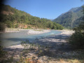
A lovely walk for those who enjoy wooded areas in a very quiet spot. Beautiful views of the Pointe de Chavanette and the Cime des Quatre Cantons. A very pleasant return journey along the banks of the Var.

Fiche technique

39839388
Creation:
Last update:
Last review:
  • trace_mode_pedestrian
    Activité: trace_mode_pedestrian
  • ↔
    label_distance: 6.85 mi
  • ◔
    Durée calculée: 5h 10 
  • ▲
    Difficulte: Difficile

  • ⚐
    Retour point de depart: Oui
  • ↗
    label_elevation_gain: + 2,320 ft
  • ↘
    label_elevation_loss: - 2,320 ft

  • ▲
    label_highest_point: 2,874 ft
  • ▼
    label_lowest_point: 876 ft
  • ⚐ Pays: France
  • ⚐
    Area: Alps
  • ⚐ Commune: Villars-sur-Var (06710)
  • ⚑
    Départ/Arrivée: N 43.935565° / E 7.068354°
  • ❏
    Carte(s) IGN: Ref. 3641ET, 3641OT, 3642ET
  • Météo détaillée heure par heure

Photos

Description of the walk

Park at the side of the D6202 next to marker 26, against the crash barrier: do not use the car parks belonging to the housing estate.

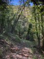
(S/E) From the car park and marker 26, you can see the Sainte-Pétronille footbridge below, your next destination. After a few steps, take the path leading down to the left. Take your time to cross the railway line safely ( there is no barrier) and continue along this lovely wooded path until you reach the footbridge, which you must cross to reach the path junction at marker 22.

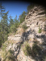
(1) Turn right towards Baraquin. A sign warns that the path has some tricky sections. Proceed with caution, though the start of the path is equipped with a safety lifeline for about 100 metres. Then, follow the single path as it winds its way through a few terraces and ruins, amongst oak and pine trees, as you climb up the Chambole ravine. You will reach the junction marked by signpost 29.

(2) Turn right towards Touët-sur-Var. From this point, the shaded path takes you back down to the Var plain via a series of hairpin bends, some wide and some tight.

(3) This sunny section, known as the Ravin du Mal d’Espinet, features a narrow path that requires caution. Continue to the path junction marked with signpost 28.

(4) Turn right onto the path with no signpost.

(5) At this point, the path becomes a dirt forest track suitable for vehicles. Continue to a track junction.

(6) Turn right and follow the banks of the Var.

(7) Look out for a lovely pebble beach on your left where you can get right up close to the Var, then continue along the forest track until you reach a junction marked by a ruin.

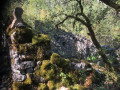
(8) Keep to the left. The track is overgrown with grass but clearly visible. Carry on until you reach the hairpin bend to the right.

(9) Take great care at this point: this is a distinctive area as trees have been planted here. A cairn situated opposite this bend marks the entrance to the path we took on the way there, located barely 10 metres from the plantation. Follow the route back in the opposite direction to the outward journey, and you’ll come across marker 22.

(1) Cross the footbridge and the railway line again with the same caution, and make your way back to the car park (S/E).


Points de passages

  1. D/A : mi 0 - alt. 971 ft - Side of the D6202, junction at marker 21
  2. 1 : mi 0.3 - alt. 896 ft - Marker 22 – Footbridge over the - Var (fleuve)
  3. 2 : mi 2.19 - alt. 2,874 ft - Trail junction, marker 29
  4. 3 : mi 3.84 - alt. 1,660 ft - Gorge
  5. 4 : mi 4.26 - alt. 1,342 ft - Trail junction, marker 28
  6. 5 : mi 4.6 - alt. 1,316 ft - Vehicle-accessible track
  7. 6 : mi 4.97 - alt. 1,010 ft - Crossroads of forest tracks
  8. 7 : mi 5.67 - alt. 909 ft - Pebble beach
  9. 8 : mi 5.96 - alt. 958 ft - Ruins
  10. 9 : mi 6.26 - alt. 912 ft - Lacet, cairn
  11. D/A : mi 6.85 - alt. 974 ft - Side of the D6202, junction at marker 21

Informations pratiques

Hiking boots and walking poles are recommended.
Avoid doing this walk after a spell of rain.
There is no water along the route.

A proximite

In summer, make the most of the Var ‘beach’ to cool off a bit.

Reviews and comments

4.5 / 5
Based on 2 reviews

Fiabilité de la description
5 / 5
Facilité à suivre l'itinéraire
5 / 5
Intérêt du circuit de randonnée
3.5 / 5
bernard bb
bernard bb

Thank you Nanou for this constructive feedback
best regards, B.

translation_auto

LES RANDOS DE NANOU
LES RANDOS DE NANOU

Note globale : 4.7 / 5

Date de la randonnée : Sep 04, 2025
Fiabilité de la description : ★★★★★ Tres bien
Facilité à suivre l'itinéraire : ★★★★★ Tres bien
Intérêt du circuit de randonnée : ★★★★☆ Bien
Circuit très fréquenté : Non

The first part of the climb isn't particularly interesting apart from the elevation gain. The tour is very enjoyable.
Access to the riverbanks to enjoy the refreshing water was pleasant.

translation_auto

MR06
MR06

Note globale : 4.3 / 5

Date de la randonnée : Oct 05, 2023
Fiabilité de la description : ★★★★★ Tres bien
Facilité à suivre l'itinéraire : ★★★★★ Tres bien
Intérêt du circuit de randonnée : ★★★☆☆ Moyen
Circuit très fréquenté : Non

A lovely walk, mainly through woodland. The route presents no difficulties: the section with a handrail is short and wide and will pose no problems for experienced walkers.

translation_auto

Other walks in the area

For more walks, use our search engine .

Les descriptions et la trace GPS de ce circuit restent la propriété de leur auteur. Ne pas les copier sans son autorisation.