Tour des Brègues d’Or

Starting from Aix-en-Provence, a pleasant walk south of the Arc with some lovely views

Details

34529178
Creation:
Last update:
Last review:
  • Walking
    Activity: Walking
  • ↔
    Distance: 6.63 mi
  • ◔
    Average duration: 3h 40 
  • ▲
    Difficulty: Moderate

  • ⚐
    Back to start: Yes
  • ↗
    Ascent: + 679 ft
  • ↘
    Descent: - 699 ft

  • ▲
    Highest point: 997 ft
  • ▼
    Lowest point: 420 ft
  • ⚐ Country: France
  • ⚐ City: Aix-en-Provence (13100|13090|13540)
  • ⚑
    Start/End: N 43.522919° / E 5.445747°
  • ❏
    IGN map(s): Ref. 3143ET, 3244ET
  • Hour-by-hour weather

Description of the walk

Start from Aix-en-Provence railway station.

(S/E) From the station, turn right onto Avenue Robert Schuman, go under the railway lines and head due south to the end of the avenue. Turn right onto Avenue de la Fourane and continue to the4th Air Region roundabout.

(1) Turn left onto Avenue Pierre Brosselette, which crosses the motorway; after another roundabout, you’ll reach the bridge over the Arc. Cross it and turn left onto Chemin du Viaduc, which heads eastwards to a junction 100 metres further on.

(2) Continue along Chemin du Viaduc to the left. After about 250 m, at a silo that has been converted into a residential block, take the road on the right heading due south, called Chemin de la Guiramande. Follow this road, which, after 300 m, curves south-west and becomes Avenue du Montaguet. It joins Chemin de la Plaine des Dés just before crossing the railway line.

(3) Continue left onto Chemin de la Plaine des Dés, which passes under the railway line and then gradually moves away from it for about 700 metres until it reaches a junction.

(4) Carry on straight ahead, still on the Chemin de la Plaine des Dés, then, at the next Fork in the road, take the Chemin du Bompart heading south-east. This is a well-defined dirt track that climbs steadily, following a rocky ridge on the left. At the top of the hill, the track meets the Chemin de la Reine Jeanne.

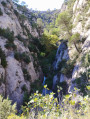
(5) Follow it to the left, which takes you round the rocky ridge, skirting the steep-sided Vallon encaissé du Coq on your right

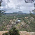
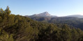
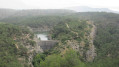
(6) The path passes an underground cistern (with a lovely view of Aix and Mont Sainte-Victoire) and rejoins the Chemin de la Plaine des Dés just before passing under the railway line

(4) Turn right and retrace your steps along the route you took on the way there.

(3) Leave the route you took on the way there. Turn left onto a small path to go round the sports grounds of the CREPS Domaine de la Madeleine. Walk past the Club Cynophile Aixois and reach a junction you passed on the way there.

(2) Turn left and follow the route you took on the way there in the opposite direction, until you reach the station (S/E).


Waypoints

  1. S/E : mi 0 - alt. 577 ft - Gare d'Aix-en-Provence
  2. 1 : mi 0.87 - alt. 479 ft - Roundabout at the 4th Air Region
  3. 2 : mi 1.11 - alt. 440 ft - Junction common to both the outward and return journeys - Arc (fleuve)
  4. 3 : mi 1.74 - alt. 522 ft - Junction common to both the outward and return journeys
  5. 4 : mi 2.06 - alt. 636 ft - Junction common to both the outward and return journeys
  6. 5 : mi 3.51 - alt. 991 ft - Chemin de la Reine Jeanne
  7. 6 : mi 3.85 - alt. 971 ft - Citerne
  8. S/E : mi 6.63 - alt. 577 ft - Gare d'Aix-en-Provence

Notes

No difficulty.

The first and last sections are on tarmac: this is unavoidable as the route starts in the city centre.

Worth a visit

On the plateau, there are lovely views of Sainte Victoire and the Aix metropolitan area.

Reviews and comments

4 / 5
Based on 4 reviews

Reliability of the description
4.3 / 5
Ease of following the route
4.3 / 5
Route interest
3.5 / 5
jolo07
jolo07

Overall rating : 4 / 5

Date of your route : Jan 16, 2026
Reliability of the description : ★★★★☆ Good
Ease of following the route : ★★★★☆ Good
Route interest : ★★★★☆ Good
Very busy route : No

A gentle little hike after the New Year celebrations with a 7-year-old child and a dog
Beautiful view of Sainte-Victoire, the Etoile massif and the city of Aix-en-Provence
No difficulties

Machine-translated

ozogiminy
ozogiminy

Overall rating : 3.7 / 5

Date of your route : Dec 03, 2024
Reliability of the description : ★★★★☆ Good
Ease of following the route : ★★★★☆ Good
Route interest : ★★★☆☆ Average
Very busy route : No

It gets interesting from point 3 and the circular loop 4–5–6
To avoid retracing my steps from the way there, at point 1 I walked straight up Avenue Brossolette
After the coach station on the left, you can head back down towards the railway station.

Machine-translated

barbbu
barbbu

Overall rating : 3.7 / 5

Date of your route : Apr 02, 2024
Reliability of the description : ★★★★☆ Good
Ease of following the route : ★★★★☆ Good
Route interest : ★★★☆☆ Average
Very busy route : No

Not bad, but too much city and tarmac.

Machine-translated

Tamara G.
Tamara G.

Overall rating : 4.7 / 5

Date of your route : Oct 08, 2023
Reliability of the description : ★★★★★ Very good
Ease of following the route : ★★★★★ Very good
Route interest : ★★★★☆ Good
Very busy route : No

We went on this hike in early October 2023.
The route is easy to follow using the map or app, but it doesn’t follow any specific ‘marked’ trail.
We completed it in 3 hours, including a 10-minute break, at a moderate to brisk pace. Suitable for children.
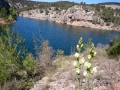
The route consists of an ‘urban’ section (which allows you to start and finish the circular route at Aix station, which is handy from a logistical point of view) and a very beautiful and picturesque ‘heath’ section.
It is possible to do just the southern circular route, starting from point 3 or point 4 by parking there.
The southern circular walk is a lovely walk through the heath; the climb up to point 5 (following the steep-sided Vallon du Coq) is well worth the effort.
I recommend this walk in spring or autumn; it’s accessible to anyone living in Aix and can be reached from the town centre. A great way to stretch your legs!

Machine-translated

Other walks in the area

For more walks, use our search engine .

The GPS track and description are the property of this route's author. Please do not copy them without permission.