In the footsteps of Cézanne, starting from the Bibémus quarries

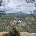
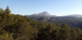
Starting from a spot long frequented by Paul Cézanne, this very short walk offers a pleasant route through the forest, culminating in a superb view of Montagne Sainte-Victoire, just like those the painter immortalised on canvas.

Details

n°43944921
Creation:
Last update:
Last review:
  • Walking
    Activity: Walking
  • ↔
    Distance: 1.64 mi
  • ◔
    Average duration: 0h 45 
  • ▲
    Difficulty: Easy

  • ⚐
    Back to start: Yes
  • ↗
    Ascent: + 39 ft
  • ↘
    Descent: - 39 ft

  • ▲
    Highest point: 1,161 ft
  • ▼
    Lowest point: 1,096 ft
  • ⚐ Country: France
  • ⚐ City: Aix-en-Provence (13100|13090|13540)
  • ⚑
    Start/End: N 43.53128° / E 5.500742°
  • ❏
    IGN map(s): Ref. 3143ET, 3244ET
  • Hour-by-hour weather

Photos

Description of the walk

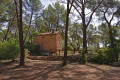
Park in the Carrières de Bibémus car park, at the end of a narrow road (the Chemin de Bibémus), which starts from the D10 in the Pont de Béraud neighbourhood.

The starting point is situated at the foot of an information board, near the entrance to the quarries’ eco-museum. The route is marked under the heading ‘Le Grand Belvédère’.

Signposting: Black on a white background + red and white + yellow

(S/E) Set off north-east, leaving the information board on your left. Ignore a path branching off to the left.

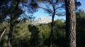
(1) At the next junction, carry on straight ahead towards the Bimont Dam and soon turn left onto the main signposted path. Walk gently downhill through the pine trees and, slightly to the right of the path, you’ll reach a superb viewpoint over Montagne Sainte-Victoire. Continue along the path and you’ll soon reach a three-way junction.

Black markings on a white background

(2) Turn left here and climb very gently. At a T-junction, turn left and you’ll soon reach a three-way junction.

(3) There are two options here:
- For a shorter route, turn left and follow the Black Circles on a white background. At the 346 mark, rejoin the path you took at the start and follow it to the right until you reach the car park.
- As shown on the map, head off to the right. Further on, ignore a path branching off to the right and descend gently.

(4) At the junction with a track coming from the right, turn left and, at the three-way junction that appears immediately, turn left again. At a fork in the road, keep left.

(5) At the next Fork in the road, veer to the left. Continue straight on (south-east) along the wide, signposted path. This will take you back to the starting point (S/E).

Waypoints

  1. S/E : mi 0 - alt. 1,122 ft - Car park - Carrières de Bibémus
  2. 1 : mi 0.16 - alt. 1,119 ft - Junction
  3. 2 : mi 0.55 - alt. 1,109 ft - Three-Way Junction
  4. 3 : mi 0.83 - alt. 1,148 ft - Three-Way Junction
  5. 4 : mi 1.06 - alt. 1,142 ft - Junction
  6. 5 : mi 1.29 - alt. 1,106 ft - Fork in the road
  7. S/E : mi 1.64 - alt. 1,122 ft - Car park - Carrières de Bibémus

Notes

A good pair of trainers is sufficient for this very short walk, which follows paths in very good condition.

No water sources were spotted along the route.

Hike proposed and signposted by the Concors-Sainte-Victoire tourist area. A detailed map is useful (at the very least, the one accompanying this description).

Hike completed by the author on 4 January 2024.

Worth a visit

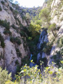
A pleasant walk through a beautiful pine forest.

Superb view of Montagne Sainte-Victoire shortly before reaching the summit (2).

Reviews and comments

3.8 / 5
Based on 2 reviews

Reliability of the description
3.5 / 5
Ease of following the route
3.5 / 5
Route interest
4.5 / 5
Paul&Jenni
Paul&Jenni
• Edited:

Overall rating : 2.7 / 5

Date of your route : May 26, 2024
Reliability of the description : ★★☆☆☆ Disappointing
Ease of following the route : ★★☆☆☆ Disappointing
Route interest : ★★★★☆ Good
Very busy route : No

A lovely, short walk with no difficulties. There weren’t many people out that day, and there were plenty of spaces in the car park – which is a good sign. We couldn’t make sense of the signposts, apart from the one for the viewpoint. So we walked around a bit at random, doing a circular route without knowing if we were on the right track, but we eventually found our way back to where we’d started.

Machine-translated

Joss04
Joss04

Overall rating : 5 / 5

Date of your route : Mar 07, 2024
Reliability of the description : ★★★★★ Very good
Ease of following the route : ★★★★★ Very good
Route interest : ★★★★★ Very good
Very busy route : Yes

Despite the crowds in the area that day, as the site is so vast, we didn’t come across many people and there are plenty of different walks to enjoy there. There are lovely, wide paths through the pine forest with views of Mont Sainte-Victoire, and they’re really easy to walk with a 7-year-old.

Machine-translated

Other walks in the area

For more walks, use our search engine .

The GPS track and description are the property of this route's author. Please do not copy them without permission.