Tour of the Haute Pointe

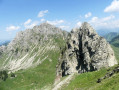
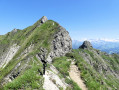
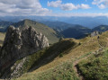
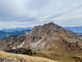
A very beautiful circular walk around the Haute-Pointe starting from Sommand, suitable for experienced walkers but without any major technical difficulties. As an option, the ascent of the Haute-Pointe is also possible.

Details

n°66285596
Creation:
Last update:
Last review:
  • Walking
    Activity: Walking
  • ↔
    Distance: 5.18 mi
  • ◔
    Average duration: 4h 05 
  • ▲
    Difficulty: Moderate

  • ⚐
    Back to start: Yes
  • ↗
    Ascent: + 1,913 ft
  • ↘
    Descent: - 1,900 ft

  • ▲
    Highest point: 5,945 ft
  • ▼
    Lowest point: 4,642 ft

Photos

Description of the walk

Access by car: On the road to Col de la Ramaz, in Sommand, drive past the Hôtel-Restaurant Les Roches 1500 and head towards the cross-country skiing centre to park on the large open area.

(S/E) Join the D308, follow it carefully to the right for about a hundred metres, then turn onto the small road on the left. At the first junction, ignore the dead-end on the left and continue along the track on the right until you reach the next

(1) Take the path on the left and follow it to the Col de Cordon.

(2) Continue downhill, straight ahead, until you reach a track.

(3) Turn right towards the Col de Chavannais. Pass two chalets and arrive at a bend in the track, taking a 90° left-hand turn.

(4) Leave the track, continue along the path opposite and reach the ridge.

(5) Turn right towards Col de Chavannais and head towards it.

(6) Leave the Col de Chavan path on your right and continue straight ahead towards Chalet de Chavan. The descent begins on a scree slope, then continues down into the valley until you reach a fork.

(7) Carry on to the right and reach the Col de Chavan.

(8) Ignore the path on the right leading to the Haute Pointe and head down the slope opposite (south), towards the Chalet du Coin.

(9) At the chalets, you’ll come out onto a track; follow it downwards (south-east). Pass the Ferme du Coin and continue down the track until you reach the tarmac road (D308).

(10) Cross carefully and take the small road leading down opposite. Pass the Ramaz chalets, then the Farquet chalets, and arrive at the base of the Col de Sommand chairlift. Continue along the track to the left and head for the Sommand cross-country skiing centre (S/E).

Waypoints

  1. S/E : mi 0 - alt. 4,656 ft - Sommand Cross-Country Ski Centre
  2. 1 : mi 0.39 - alt. 4,708 ft - Junction
  3. 2 : mi 1.3 - alt. 5,364 ft - Col de Cordon (1636m)
  4. 3 : mi 1.56 - alt. 5,118 ft - Les Charmettes mountain pasture
  5. 4 : mi 1.81 - alt. 5,266 ft - Junction
  6. 5 : mi 2.01 - alt. 5,420 ft - Col des Charmettes
  7. 6 : mi 2.36 - alt. 5,935 ft - Col de Chavannais (1851m)
  8. 7 : mi 2.95 - alt. 5,420 ft - Junction
  9. 8 : mi 3.3 - alt. 5,758 ft - Col de Chavan
  10. 9 : mi 3.47 - alt. 5,538 ft - Junction with the Le Coin track
  11. 10 : mi 4.52 - alt. 4,957 ft - Ramaz (D308)
  12. S/E : mi 5.18 - alt. 4,656 ft - Sommand Cross-Country Ski Centre

Notes

Equipment: Good walking shoes and walking poles.

Signposting: This walk presents no difficulty in finding your way, thanks to the numerous signposts. Yellow and red markings between (5) and (6), then between (7) and (8). Yellow markings between (6) and (7). Information on the markings is available on the French Hiking Federation’s website (https://www.ffrandonnee.fr/randonner/sen...).

Difficulty: A mountain walking route with no major technical difficulties, which may correspond to level 3 on the scale established by the French Hiking Federation
(https://www.ffrandonnee.fr/Media/Default...).
This walk passes through pastureland on several occasions. Please ensure you do not disturb the herds or the sheepdogs. Please ensure you follow the advice given on the information boards.

This route passes through a protected area, which may be subject to special regulations:

Worth a visit

(S/E) Hôtel Restaurant Spa Les Roches 1500 (https://www.lesroches1500.com/), just a few metres from the start point and close to the cross-country skiing centre.

(8) From the Col de Vésinaz, you can climb the Haute Pointe by following hiking route no. 66181662, a return walk between the (4) and the (5) points on this route.

(9) GAEC le Coin (https://www.facebook.com/p/GAEC-le-coin-...), direct sales of alpine meat.

Our hikes wouldn’t be nearly as rewarding without the contribution of the people who live in and look after the mountains. But they need us too – please do support local businesses!

Reviews and comments

5 / 5
Based on 1 review

Reliability of the description
5 / 5
Ease of following the route
5 / 5
Route interest
5 / 5
User 18415407

For your information, the Haute Pointe tour section is currently reported as closed; however, the Haute Pointe route from Col de Gordon <-> Haute Pointe <-> Col de Chavan is reported as open. Today, 4 August 26, there were no fenced-in areas with livestock to cross – a very pleasant walk.

Machine-translated

Denis du Praz
Denis du Praz

Thank you for your comment.
The main attraction of the stony trail is that it forms a loop, allowing you to return to your starting point. The only other option is the road, which is even less interesting...
Enjoy your walks in the magnificent Praz de Lys-Sommand region.

Machine-translated

Vieux débris toxique

Overall rating : 5 / 5

Date of your route : Aug 11, 2025
Reliability of the description : ★★★★★ Very good
Ease of following the route : ★★★★★ Very good
Route interest : ★★★★★ Very good
Very busy route : No

No particular difficulty but demanding in the sun. The end of the stony path is not very interesting, which is a shame

Machine-translated

Other walks in the area

For more walks, use our search engine .

The GPS track and description are the property of this route's author. Please do not copy them without permission.