The Haute Pointe circular route starting from Sommand

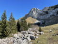
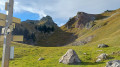
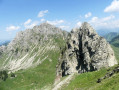
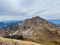
The ascent of a peak that is clearly visible from the region. As a bonus, there’s a panoramic view from the summit and a descent via a very wild and less-travelled route.

Details

66181862
Creation:
Last update:
Last review:
  • Walking
    Activity: Walking
  • ↔
    Distance: 4.21 mi
  • ◔
    Average duration: 3h 30 
  • ▲
    Difficulty: Moderate

  • ⚐
    Back to start: Yes
  • ↗
    Ascent: + 1,785 ft
  • ↘
    Descent: - 1,795 ft

  • ▲
    Highest point: 6,437 ft
  • ▼
    Lowest point: 4,642 ft

Photos

Description of the walk

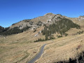
Access by car: on the Col de la Ramaz road in Sommand, drive past the Hôtel-Restaurant Les Roches 1500 and head towards the cross-country ski centre to park on the large open area.

(S/E) Continue along the track to the Col de Sommand chairlift departure station. Take the track on the right which runs between the chairlift departure station and a building. Pass the Farquet chalets and head towards the group of chalets at Ramaz, clearly visible further up. Turn right and reach the Col de la Ramaz road.

(1) Cross the road carefully and head straight ahead to reach the Chalet du Coin.

(2) Continue uphill along this road until you reach the farm (private property) at the end. After the farm, take the path on the right to reach the Col de Chavan.

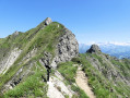
(3) Turn left towards Haute Pointe onto the path that climbs straight ahead. Leave the Col de Chavannais path on your right. Continue straight ahead towards Haute Pointe and the Col de Cordon. Ignore the paths branching off to the left and keep well to the right on the fairly steep path following the ridge. Pass the small chimney, then turn immediately right to reach the summit of Haute Pointe.

(4) Take the path veering to the left just below the ridge. After a few metres, this path branches off to the left via a hairpin bend and begins the descent, crossing a small rocky outcrop. Descend until you reach a crossroads of paths.

(5) Continue straight ahead to reach the multi-way junction at the Col de Cordon.

(6) Turn left towards Sommand. Walk alongside the woodland, then follow a circular route to the right to reach the Chalet de Vanne.

(7) Continue along the track and then onto a small road. Join the D308 and cross it carefully. At the Y-junction, turn left onto the Chemin de Farquet to return to the cross-country ski car park (S/E).

Waypoints

  1. S/E : mi 0 - alt. 4,652 ft - Car park at the Sommand Cross-Country Ski Centre
  2. 1 : mi 0.67 - alt. 4,964 ft - Ramaz
  3. 2 : mi 1.32 - alt. 5,220 ft - Le Coin
  4. 3 : mi 1.89 - alt. 5,778 ft - Col de Chavan
  5. 4 : mi 2.31 - alt. 6,394 ft - Haute-Pointe
  6. 5 : mi 2.71 - alt. 5,633 ft - Junction
  7. 6 : mi 2.92 - alt. 5,364 ft - Col de Cordon (1636m)
  8. 7 : mi 3.51 - alt. 4,872 ft - Vanne
  9. S/E : mi 4.21 - alt. 4,652 ft - Car park at the Sommand Cross-Country Ski Centre

Notes

IGN map 3429 ET Bonneville.

- Equipment: good walking boots and walking poles.
- Difficulty: a mountain hiking route for experienced hikers, generally rated as technical level 3 according to the scale established by the French Hiking Federation. Crossing the small chimney is made easier by using your hands (technical level 4).
Furthermore, certain sections may be daunting for those prone to vertigo, particularly just after leaving the summit of the Haute Pointe (4) to find the descent route.
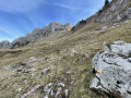
Potential difficulties with navigation should also be noted, and this hike is not recommended in poor visibility. The trail is barely visible in some places and/or several possible paths may co-exist, especially on the section between (4) and (6). In particular, just before (5), you must ignore the well-marked path you come across and cut across country to reach, by sight, a path below at (5). Although this section is shown as a dotted line on the map, the path currently appears to have disappeared beneath the vegetation.
Finally, between points (4) and (6), some sections of the descent are very steep.
Personal note: these hikes wouldn’t be nearly as rewarding without the contribution of the people who live in and look after the mountains. But they need us too. Please do support local businesses.

Worth a visit

(S/E) Hôtel Restaurant Spa Les Roches 1500, just a few metres from the start point and close to the cross-country skiing centre.
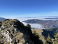
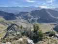
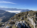
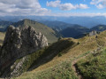
(4) Summit of the Haute Pointe: the view offers a 360-degree panorama of the Mont Blanc massif, Mont Ruan and the Tour Sallière, the Dents du Midi, glimpses of Lake Geneva with the Jura as a backdrop, the Genevois region, the Môle, as well as the Aravis range with the Pointe Percée.

Reviews and comments

4.4 / 5
Based on 3 reviews

Reliability of the description
4.7 / 5
Ease of following the route
4 / 5
Route interest
4.7 / 5
vero.geyer
vero.geyer

Overall rating : 4.3 / 5

Date of your route : Jun 20, 2026
Reliability of the description : ★★★★☆ Good
Ease of following the route : ★★★★☆ Good
Route interest : ★★★★★ Very good
Very busy route : No

A lovely walk with beautiful views all the way along and a magnificent view from the summit.
At the start, we were accompanied by the Patou dogs, who stayed quietly behind their fence.
The second part is a bit less clear, but with the app’s GPS we managed just fine.
Thank you for this lovely discovery

Machine-translated

User 3892492

Overall rating : 5 / 5

Date of your route : Oct 20, 2025
Reliability of the description : ★★★★★ Very good
Ease of following the route : ★★★★★ Very good
Route interest : ★★★★★ Very good
Very busy route : No

Quick and easy

Machine-translated

Denis du Praz
Denis du Praz

Thank you for your comment.
Indeed, on the descent from Haute-Pointe to Sommand, there are several paths, most of which are quite steep, and it is important to follow the hiking trail carefully. This is what makes this route particularly wild.
As you mention, dogs are prohibited in large areas. While most hikers comply with the regulations, too many do not. This does not make the work of shepherds, for whom this is their livelihood, any easier. It is this situation that has led to access restrictions in certain areas.

Machine-translated

Geugeu
Geugeu

Overall rating : 4 / 5

Date of your route : Aug 03, 2025
Reliability of the description : ★★★★★ Very good
Ease of following the route : ★★★☆☆ Average
Route interest : ★★★★☆ Good
Very busy route : No

It is best to check with the last farm or with hikers coming down if it is possible to do this route, as there is a flock of sheep guarded by Patous (who are doing their job) on either side of the mountain. However, you can still pass through the part not occupied by the flock. On the ridge, follow the path along the park, otherwise there are many side paths and no signposts! Dogs are not allowed in the area. Read the practical information in the description carefully, as the descent is steep (for those with knee problems, it may be preferable to do the walk in the opposite direction). Beautiful views from the summit.

Machine-translated

Other walks in the area

For more walks, use our search engine .

The GPS track and description are the property of this route's author. Please do not copy them without permission.