


The walk continues to the rock overlooking the pretty waterfalls of Rocky Valley... and then turns back to reach the centre of Tintagel, a small village with some architectural gems but also quite a lot of tourist businesses.
The route finally heads south through the countryside to join the coastal path, where you turn back to return to the magnificent church at the starting point.
Tintagel Castle and Rocky Valley


Does King Arthur ring a bell?
If not, look up and watch some of the Monty Python films and you will be convinced that the English legend is (not) just a legend!
Whether King Arthur was born here or not is not very important.
Whether Merlin lived in the caves carved out by the Atlantic Ocean at the foot of this medieval castle or not is not very important either.
The important thing is to enjoy the place and, if you wish, treat yourself to a (paid) tour of the peninsula, which is clearly visible from Barras Nose, the nearby rocky outcrop.
In short, the coastline here is very beautiful, as is the path running along the foot of this ancient fortress.
Details
Creation:
Last update:
Last review:
-
 Activity: Walking
-
 Distance: 6.10 mi
-
 Average duration: 3h 40
-
 Difficulty: Moderate
-
-
 Back to start: Yes
-
 Ascent: + 978 ft
-
 Descent: - 1,007 ft
-
-
 Highest point: 328 ft
-
 Lowest point: 23 ft
-
 Country:
United Kingdom
-
 City:
Tintagel
-
 Start/End: N 50.662678° / W 4.760358°
-


 Hour-by-hour weather
Photos

Description of the walk
Waypoints
- S/E : mi 0 - alt. 312 ft - Tintagel Church Hill
- 1 : mi 0.79 - alt. 79 ft - Barras Nose
- 2 : mi 1.84 - alt. 138 ft - Settlement
- 3 : mi 4.39 - alt. 289 ft - Tintagel
- 4 : mi 4.86 - alt. 328 ft - Trevellick Farm
- 5 : mi 5.28 - alt. 305 ft - Crossroads
- S/E : mi 6.1 - alt. 312 ft - Tintagel Church Hill
Notes
-Shortly after the 2, you can follow the off-trail route, which deviates slightly from the paths on the maps, or stay on the paths.
Reviews and comments
5 / 5
Based on 1 review
Ease of following the route
5 / 5
5 / 5
Route interest
5 / 5
5 / 5

User 18517074
Boscastle harbour is really charming.
To avoid what could be a long round trip, we left the car in Boscastle and took the bus to Tintagel to start the walk.
Machine-translated

jacques.nys
It’s a brilliant idea to extend this route as far as Boscastle. Thank you for suggesting it!
Machine-translated
User 18517074
Overall rating : 5 / 5
Date of your route : Oct 19, 2026
Ease of following the route : ★★★★★ Very good
Route interest : ★★★★★ Very good
Very busy route : No
An extraordinary walk, made all the more special by Arthurian legend, encounters with ponies roaming free and a coastline that looks as though it has been hewn with an axe. Apart from the immediate vicinity of Tintagel and Boscastle, there are few walkers on the route. However, the path is not suitable for walkers who are poorly equipped – a good pair of trainers is recommended as a minimum – or who are not in good physical shape: there are numerous steep ascents and descents. You do not offer this Tintagel–Boscastle route, but the Visorando base map enabled us to find our way without any problems. Approximately 8 km.
Machine-translated
Other walks in the area
Glebe cliff, Willapark and the Rocky Valley from Tintagel
 Visorando Member
 5.35 mi
+892 ft
-869 ft
3h 15
 Easy
 Departure from Tintagel (Cornwall)
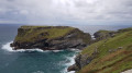
This circular walk explores the stunning cliffs using the coastal path close to Tintagel Head and goes back to Tintagel by the gorgeous Rocky Valley using paths inland.
Dennis Point and Backways Cove from Trebarwith Strand
 1.71 mi
+446 ft
-469 ft
1h 10
Easy
Departure from Tintagel (Cornwall)
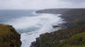
This short circular walk from Trebarwith Strand provides a good way to admire Penhallic Point, Hole beach, Backways and Lill Coves from the coastal path.
Boscatle Harbour, Penally point and Pentargon Cliff from Boscatle
 4.24 mi
+614 ft
-584 ft
2h 30
Moderate
Departure from Forrabury and Minster (Cornwall)
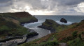
This circular walk mostly using the South West Coast path explores Forrabury Stitches, Willapark and Penally Point which overlooks Boscastle Harbour. Then you will walk Pentargon Cliff and will take a panoramic path going back to Boscastle.
Port Isaac and Trewetha from Port Gaverne
 3.03 mi
+459 ft
-446 ft
1h 50
Easy
Departure from St. Endellion (Cornwall)
This short circular walk provides a good way to visit the famous fishing villages, Port Isaac and Port Gaverne using the coastal path, typical lanes in Port Isaac and paths inland during the return way.
Rough Tor, Brown Willy, and King Arthur's Hall
10.35 mi
+1,276 ft
-1,306 ft
5h 50
Moderate
Departure from Advent (Cornwall)
Myth or legend, King Arthur, has many deep-seated roots here in Cornwall, from nearby Tintagel Castle, Excalibur's Sword in Dozmary Pool. King Arthur's Hall, high up on Bodmin Moor, adds more to the legend of the King.
The route pays homage to the Wessex memorial, climbs the highest point in Cornwall, and then onto King Arthur's Hall, a neolithic enclosure; however, recent research has suggested that the whole area could be hundreds of years earlier.
Showery and Rough Tors
 2.31 mi
+446 ft
-472 ft
1h 25
Easy
Departure from Advent (Cornwall)
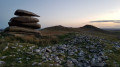
It's an easy family walk in Bodmin Moor leading to stunning 360° viewpoints from Showery and Rough Tors. It's a lovely place to enjoy the colors of sunset as well!
Brown Willy and Fernacre Stone Circle
 5.30 mi
+909 ft
-938 ft
3h 15
Easy
Departure from Advent (Cornwall)
This nice walk explores Bodmin Moor using paths next to Little Rough Tor until you reach Brown Willy summit (420m) with spectacular views. The return way uses mainly pretty flat paths around Rough Tor and goes past Fernacre Stone Circle.
For more walks, use our search engine .
The GPS track and description are the property of this route's author. Please do not copy them without permission.

