


 Country:
 City:
City:


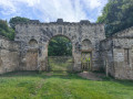
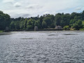
Park at the Studley Park car park which is owned by the National Trust, Grid Ref SE 27857 69132. £7 for 4 hours or £10 per day payable at the machines via cash or the Pay by Phone parking App. National Trust Members are free. For other options, see the Notes below.
(S/E) From the car park, head down to the road which runs beside the lake and follow the edge of the road around to a ford and wooden bridge (take care as this is a road which cars drive along to get to the car park). Cross the bridge and follow the path to where it splits at a prominent wooden marker post.
(1) Turn left and follow the Seven Bridges walk up the valley and over the rustic stone bridges. Pass through a gate to enter the Chinese Wood and follow the path which ascends and leaves the woodland with great views over to Ripon on your right. Follow the track past Plumpton Hall and to the southern end of Studley Roger, where you can turn left and walk down to the ornate gate leading into Studley Park.
(2) Return to Studley Roger and turn left to walk through the delightful village, looking out for a finger post on your right.
(3) Turn right and walk to a second finger post for "Ripon" and a small wooden gate.
(4) Go through the gate and follow the path to a crossroads with a wooden signpost.
(5) Turn right and follow the path to Hell Wath, passing over a lovely bridge (Rose Bridge).
(6) Continue following the path to a bridge and ford (just before Hell Wath Cottage, go through a gate (information Board) and walk past the cottage and onto a road. Follow the road to pass the parking for the playing fields.
(7) Keep following the road to the T junction on a bend.
(8) Turn right and walk along the pavement to where the road bends left. There is a junction with a minor road on the right.
(9) At the junction, turn right and walk along the minor road passing telephone masts and on to Whitcliffe Hall (farm).
(10) At the entrance to the farmyard, go straight on to follow a stone track and after a short distance look out for a large metal gate and a small wooden gate on your right.
(11) Turn right and go through the small gate. Follow the path across fields to a second small gate leading into woodland.
(12) Go through and into the woods, at the first split in the path go left, and at the second split go straight on (turning right at either of these will take you down to the Seven Bridges path). Shortly after the second split, follow the obvious track rightwards to follow the boundary of the wood to a ruined gatehouse.
(13) Turn right and go through the gate to follow the path across the pasture and downhill. Pick up a track with a tall deer-proof fence on the right and follow it down to a large wooden deer-proof fence.
(14) Go through (remember to close it behind you) and follow the track down to the prominent wooden marker post you saw at the beginning.
(1) Now follow the track to the wooden bridge/ford and follow the side of the road back to the parking and/or the super cafe on the edge of the lake. (S/E)
 Visorando Member
 Moderate
 Association / Club / Walk leader
