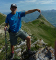
The ridges of the Petites and Grandes Dentelles de Montmirail

A short loop to discover these two characteristic rock formations as well as Saint-Christophe's Chapel, which protects the site, taking a less conventional route.

Technical sheet

176111
Creation:
Last update:
Last review:
  • Walking
    Activity: Walking
  • ↔
    Distance: 7.35 km
  • ◔
    Average duration: 4h 10 
  • ▲
    Difficulty: Difficult

  • ⚐
    Return to departure point: Yes
  • ↗
    Vertical gain: + 722 m
  • ↘
    Vertical drop: - 715 m

  • ▲
    Highest point: 604 m
  • ▼
    Lowest point: 192 m

Photos

Description of the walk

Make your way to the village of Lafare and then take the road to the left towards the Dentelles de Montmirail.
Park at the Saint-Christophe signpost on one of the spaces on the roadside on the left.

Yellow Waymarks
(S/E) From the Saint-Christophe signpost, with your back to Mont Ventoux, take the tarmacked road opposite you (northwest) towards Col du Cayron. Walk downhill, cross Cassan and continue until you reach the crossing where the tarmac ends.
Leave the paths off to the right and continue left on the path uphill. During the climb, ignore any paths off to the left or right: many of them are just access tracks for reaching the vineyards. Keep going until you reach Col du Cayron pass and the car park.
Ignore the path down to the right towards Gigondas and continue for a few more metres along the car park.

Blue dot waymarks
(1) Take the path to the left, just after the signpost. Despite a blue cross, a sign indicates the way to the Dentelles following the blue waymarks. The path climbs up quite steeply through the forest and then reaches a crossing just before the foot of the cliffs.

Turn left towards the rock face, and then walk alongside the cliffs for a few metres. Ignore a steep passage marked with a blue cross and keep going until you reach another passage up the rocks a few metres further on.
Turn right, go up this rocky section, which isn't too difficult, and then you will reach a kind of small mountain pass in the middle of the Dentelles ridges.

(2) Turn right and follow the waymarks along the south face of the cliffs. From time to time you will need to use your hands or a tree branch to help you past small obstacles. Ignore all the paths down to the left and keep following the footpath. After about 600m, the path goes sharply down and joins a track at Col d'Alsau.

(3) Turn left onto the track and then turn left again 50m further on. Continue straight on opposite you, taking the log steps. The path bears left and then continues along the hillside.
At a fork in the forest, continue on the right-hand path which carries on along the flat. When you reach an open area where the Dentelles are in line with Mont Ventoux, take the footpath that goes downhill slightly to the left and ends at a new crossing about 50m further on.

(4) Turn left onto the path that takes you uphill again, and continue closely around the rocky outcrop, leaving the blue waymarks which now lead down to the right. The path will continue on the left of the rock face, gradually bearing away from it until you reach a crossing.

No waymarks, a few cairns
(5) Ignore the path that goes downhill to the left at a right-angle and instead take the right-hand path, which is less visible, and which continues along on the flat. The vegetation is very dense in places and the path disappears at times. When the path bears right at the start of the climb, it becomes more visible but also becomes very steep, to the point that you will need to use tree branches to help you up the path.
When you reach the foot of the cliff, climb up the rock face using your hands to help you until you reach the pass.
Make your way back down the south slope over the rock face using the technique that works best for you.
Keep going down a few metres until you reach a path.

Blue dot waymarks
(6) Turn left onto the path along the south face of the cliff. At times you will need to use your hands to help you past small obstacles. The path then goes sharply down over some stony terrain where you will need to be careful not to slip.
When you reach the top of a small vineyard, turn left onto a path down through the boxwood until you reach the road at the car park for the waterfall.
Take the road to the left for a few metres until you reach the bend (there are some parking spaces here), and then continue along the path to the left which reaches a fork a few metres further on.

(7) At the fork, make a return journey down the path to the left, still following blue waymarks, to climb up the left bank of the stream and see the waterfall from closer by (it is possible to cross the stream and carry on a bit by crossing over some rocks).

Come back to the fork just before the road (7) and turn left to climb back up. After a short but steep section where you will need to use your hands again, the footpath takes you over towards the road and then bears left.
One last effort and then the path comes out onto the road. Cross the road and take the wider path opposite you, which climbs up to the chapel. Ignore all the paths off to the left and keep going until you reach Saint-Christophe's Chapel (8).

Come back down to the road along the same path and then turn right to get back to your car (S/E).

Waypoints

  1. S/E : km 0 - alt. 290 m - Car park below the Chapelle Saint-Christophe
  2. 1 : km 2.25 - alt. 400 m - To the left behind the signpost
  3. 2 : km 2.8 - alt. 544 m - To the right, along the cliffs
  4. 3 : km 3.63 - alt. 450 m - Left on the runway
  5. 4 : km 4.54 - alt. 431 m - Turn left onto the path
  6. 5 : km 5.21 - alt. 344 m - Take the faint right-hand track
  7. 6 : km 5.46 - alt. 420 m - Turn left along the cliffs
  8. 7 : km 6.66 - alt. 203 m - Fork just past the car park
  9. 8 : km 7.04 - alt. 332 m - Chapelle Saint-Christophe
  10. S/E : km 7.35 - alt. 290 m - Car park below the Chapelle Saint-Christophe

Practical information

N.B. This walk is only for experienced hikers; the climbs are short but intense and you will need to use your hands in many places. The descents are often steep and take you over stony or slippery terrain.

Good shoes are essential.

In the nearby area

Saint-Christophe's chapel stands alone among the pine trees on the southern flank of the Dentelles de Montmirail, to the north of the village of Lafare.
This Romanesque chapel was built in the twelfth century, and its revenues were collected by the abbey of Saint-André de Villeneuve-lès-Avignon.

Reviews and comments

4.5 / 5
Based on 45 reviews

Reliability of the description
4.2 / 5
Clarity of route map
4.3 / 5
Route interest
4.9 / 5
User 22715444

Overall rating : 4.7 / 5

Date of walk : Jun 01, 2025
Reliability of the description : ★★★★★ Very good
Clarity of route map : ★★★★★ Very good
Route interest : ★★★★☆ Good
Busy trail : No

We followed the direction indicated by the trail (and not the other way round). Be careful, there is an "off the beaten track" shortcut between (5) and (6) towards the end of the hike, which is pretty hardcore! First there's a steep climb up a pebble slope; you have to dig deep to get up the slope and use the branches to help you - Then you have to climb the last few metres up a rock face, using a climbing rope! - From here, you have a magnificent view... but the changeover is almost like rock-climbing on a rocky slab with a few hand and foot holds... just like the climbing exercises. After this passage, we return to the blue markings and descend more gently. It says a 4h10 hike, which we took 4h. So perfect timing.

Automatically translated

Olivier-L
Olivier-L

Overall rating : 5 / 5

Date of walk : Mar 14, 2024
Reliability of the description : N/A
Clarity of route map : N/A
Route interest : ★★★★★ Very good
Busy trail : No

I only hiked part of it with my dogs.
Lack of time meant we didn't do the whole circuit, but what we did see was superb. The charm of the chapel of Saint-Christophe in the light of a sunny late winter afternoon, the rather grandiose site of the waterfalls and a little loop in the lace.
We set off in the opposite direction to the one indicated. After the waterfalls we reached the pas de la chèvre (point no. 6). It's a steep climb to get there, but the view from the path along the cliff is well worth the effort.
From here, we only descended into the bed of the Valat de l'Aiguille to join the path on the left bank heading east to the car park.
We'll come back to this area if we allow more time.

Apart from a few people making their way to the waterfalls from the dedicated car park, we didn't come across anyone.

A short video of the outing can be seen here: https://www.youtube.com/watch?v=avSWBZg5...

Automatically translated

c.berangere
c.berangere

Overall rating : 2.7 / 5

Date of walk : Mar 13, 2024
Reliability of the description : ★☆☆☆☆ Very disappointing
Clarity of route map : ★★☆☆☆ Disappointing
Route interest : ★★★★★ Very good
Busy trail : No

Thank you to the previous hikers who indicated that it was better to do the loop in reverse! The section from 7 to 6 is clearly easier to climb than to descend; you often need to use one or even two hands, which is why I strongly advise against carrying poles. If you walk in the opposite direction to that recommended, the climb is very steep, but not vertiginous. It took us around 45 minutes in climbing mode to reach the foot of the cliff (it would have been a nightmare to descend). We saw blue dots from time to time on this 1st section, but it was impossible to follow them: gps is compulsory (load the route before setting off as it doesn't pick up everywhere) to avoid getting too lost. Then you follow the cliff, where the path is more marked. There is a slight difficulty at the pas de la Chèvre (pass between 2 cliffs), you need 2 hands but fortunately there are small holes in the rock to hold on to. Once on the other side, you descend a little on your bottom from time to time, but there are plenty of shrubs to hold on to. It's a long side section with lots of different viewpoints. For the next climb up the other cliff, the blue dot markers are very present and very useful. After flanking the cliff, you come to the Turc rock. Then you cross the cliff and if you follow the route of the hike you go straight down to find yourself on the track; I preferred to veer to the right just after the pass (dotted line on the geoportail) to stay on the side of the cliffs, you find the blue point again and you can stay on the side almost to the end.
A magnificent hike, but not for everyone! Clearly not for children, or at the very least for sporty but cautious teenagers... And indeed it takes almost 4 hours, not counting the breaks.

Automatically translated

Angella Darliing
Angella Darliing
• Last modified:

Overall rating : 5 / 5

Date of walk : Feb 20, 2024
Reliability of the description : ★★★★★ Very good
Clarity of route map : ★★★★★ Very good
Route interest : ★★★★★ Very good
Busy trail : Yes

A very aerial loop walk of around 10 km, crossing the two rocky bars of the Dentelles from north to south, via the Rocher du Turc (a small natural excavation that cuts right through the cliff, via a passage known as the "Chatière"), which will take you to the other side in just a few minutes!
Born from the sea 200 million years ago, the Dentelles de Montmirail, 630 m high at the Rocher du Turc, present a landscape strongly marked by geology. Their highest point is the crest of Saint-Amand at 722 metres. The massif, which is around eight kilometres long, is world-famous for its climbing walls. The name "lace" comes from the shape created by the erosion of the rock. Montmirail comes from the Latin "mons mirabilis", meaning "admirable mountain". There are three Dentelles. They run parallel to each other: Grand Montmirail, Les Dentelles Sarrasines, Grande Montagne or the Grand Travers range.
The route starts from the magnificent Lafare waterfalls, of which there are three significant ones. In this lush green hollow, a ray of light hits the first beautiful waterfall, offering colours ranging from emerald green to orange on the rocks. A visit to the Chapelle Saint Christophe in the early hours of the morning is a must - its position at the top of a rocky promontory is enhanced by the light of the rising sun. The view of the Dentelles from the terrace overlooking the chapel is truly marvellous!
Heading for the Cayron car park, the ascent to the Turc-Pousterle gap will take us to the other side, in the sunshine! From here, the walk becomes very aerial, and in places erosion has carved out "windows" from which you can admire the view of the other side. You walk along the rock face, dozens of metres high, looking up to spot the Florets-Turc breach and the famous chambre du Turc, the highlight of the hike! In the Middle Ages, the Saracens occupied Provence, and this high hiding place gave them an unobstructed view of any invasion and warned the inhabitants of a potential attack. Hence the name Chambre du Turc, a natural room fortified by man!
First variant: a partially walled-in cavity, which crosses the wall in a gut and ends in a "cat flap" leading to a platform with a breathtaking 360° view.
We descend along a fairly visible, wooded path to the Col d'Alsau. Take a picnic break and set off again without wasting a minute for the second option.
The second option is the Saracen tower, set high on a rocky promontory with a view over the whole department and beyond. Partly rebuilt, it overlooks the entire valley from east to west.
The second part of the walk is a single track along the steep cliffs on one side and the "grandes dentelles" on the other - it's up to you, depending on the time of year, to choose whether you want more or less shade. We chose to walk in the sunshine and along the cliffs, following the aerial paths used by mountaineers. There are almost always some on these walls, which are famous in the climbing world.
The panorama is magnificent, and this hike is well worth doing for all levels of climber, but you need to allow a bit more time, as there are plenty of photos to be taken and plenty of opportunities to stop and admire the scenery
For information, I've used this route as my inspiration, but with a few variations: Start from the waterfalls, visit the chapel, Chambre du Turc, Tour sarrasine and return via the climbers' path... And thank you for publishing this route, it's magnificent!

Automatically translated

AqualiJu
AqualiJu
• Last modified:

Overall rating : 4 / 5

Date of walk : Apr 22, 2023
Reliability of the description : N/A
Clarity of route map : ★★★☆☆ Average
Route interest : ★★★★★ Very good
Busy trail : Yes

I did it in the opposite direction (given the previous comments) to pass the section (6) and (7) on the way up.
Be careful though, point 6 remains tricky, fortunately there is still a blue trace to confirm the "path"; the route is less obvious to find in some places.

With a few involuntary detours, the GPS watches indicate more like 9km.
Avoid wet weather/wet ground

Automatically translated

Ouichaoui
Ouichaoui

Overall rating : 3.7 / 5

Date of walk : Feb 19, 2023
Reliability of the description : ★★★☆☆ Average
Clarity of route map : ★★★☆☆ Average
Route interest : ★★★★★ Very good
Busy trail : No

Beautiful hike, superb views, but the passage between 6 and 7 is very complicated and dangerous for experienced hikers.

Automatically translated

jpb93
jpb93

Overall rating : 5 / 5

Date of walk : Mar 20, 2022
Reliability of the description : N/A
Clarity of route map : ★★★★★ Very good
Route interest : ★★★★★ Very good
Busy trail : No

I did this route from the Les Florets car park. The climb up to the Dentelles Sarrasines is a little steep, but the progress along the ridge is beautiful. You can come back down via the Rocher du Midi and enjoy a beautiful panorama. At every point along the way, you can see the Dentelles from different angles, which is what makes this walk so interesting.

Automatically translated

boulet03170
boulet03170
• Last modified:

Overall rating : 4.7 / 5

Date of walk : Aug 15, 2021
Reliability of the description : ★★★★☆ Good
Clarity of route map : ★★★★★ Very good
Route interest : ★★★★★ Very good
Busy trail : No

A fine, rather sporty hike with a tricky section over rock where you have to be careful. Deserves to be classed as difficult. It's better to do it the other way round, as it's easier to pass the smooth rock on the way up to point 6, and it's also easier to descend the steep path in the gravel than to climb it.

Automatically translated

LE BRESSAN
LE BRESSAN

Overall rating : 3.7 / 5

Date of walk : Aug 04, 2021
Reliability of the description : ★★★☆☆ Average
Clarity of route map : ★★★★☆ Good
Route interest : ★★★★☆ Good
Busy trail : Yes

Hello,
This hike is classified as difficult and could be very difficult.
Just before point 6, you have to cross the cliff, the climb is almost like rock-climbing, and the descent on the other side is on extremely slippery rock.
The 500m descent from the rocky slab is extremely dangerous and should be approached with appropriate equipment.
In view of the above, this hike should be reserved for experienced hikers who know how to handle rock.

Automatically translated

Mich-26
Mich-26

Overall rating : 3.7 / 5

Date of walk : May 08, 2021
Reliability of the description : ★★★★☆ Good
Clarity of route map : ★★★☆☆ Average
Route interest : ★★★★☆ Good
Busy trail : Yes

On the whole, the trail matches the paths, except for the last part, where the last crossing of the rock face is not easy to find without GPS.
Mich26

Automatically translated

pkergall
pkergall

Overall rating : 5 / 5

Date of walk : May 08, 2021
Reliability of the description : N/A
Clarity of route map : ★★★★★ Very good
Route interest : ★★★★★ Very good
Busy trail : No

I did the route in the opposite direction, I didn't go and see the waterfall (initially in the direction I was going) for fear of running out of time, but in the end I completed the loop in 2 hours 50 minutes, including the breaks (and as a bonus a small orientation error at the start of the climb which cost me around ten minutes) without having a particularly fast pace.
I only used the GPS track, except for a mistake at the start of the climb between points 7 and 6, which was no problem. The unmarked section between points 6 and 5 is fairly obvious. Between points 3 and 1, there are plenty of blue markings, so there's no risk of making a mistake.
The route is very pretty and not very busy (but the loop was done in the afternoon, perhaps after the "big" crowd. The reverse direction allows you to pass the rocky slab on the way up just before point 6, and the descents are no problem at all. The climb between points 7 and 6 is in the sun, while the descent between 2 and 1 is shaded.

Automatically translated

adrien2vil
adrien2vil

Overall rating : 5 / 5

Date of walk : Mar 22, 2021
Reliability of the description : ★★★★★ Very good
Clarity of route map : ★★★★★ Very good
Route interest : ★★★★★ Very good
Busy trail : No

Great route with breathtaking scenery! The passage by the waterfall at the end of the route is very pleasant. There are a few tricky sections on the downhill sections. The description is clear, no need for a GPS.

Automatically translated

Franck D
Franck D
• Last modified:

Overall rating : 5 / 5

Date of walk : Feb 27, 2021
Reliability of the description : ★★★★★ Very good
Clarity of route map : ★★★★★ Very good
Route interest : ★★★★★ Very good
Busy trail : Yes

Another way to discover the Dentelles, but needless to say you'll need to allow 6 hours to enjoy it, given the number of breaks you'll have to make
We set off from the Col de Cayron and hiked in the other direction.
This has the advantage of passing the waterfall with plenty of sunshine, passing the Clapis and climbing the rocky slab (much cooler) ... but the big disadvantage is passing the Rocher du Turc in the middle of the afternoon ... in terms of crowds and peace and quiet: difficult to do worse (although it was the last weekend in February). To find some peace and quiet, we didn't go straight back down, but headed for the Rocher du Midi.

Automatically translated

grandin
grandin ★

Vaboha, if you have connection problems, it's a good idea to download the map before you leave.

Automatically translated

Vaboha
Vaboha

Overall rating : 3.3 / 5

Date of walk : Sep 26, 2020
Reliability of the description : ★★★☆☆ Average
Clarity of route map : ★★★☆☆ Average
Route interest : ★★★★☆ Good
Busy trail : No

It's an interesting loop if you don't have much time, and it allows you to see both the large and small laces. However, we got lost at point (5) because the GPS had lost reception and there was no signpost in sight! So we ended up in the bed of the Aiguille and joined the path opposite, which is also very nice.
So pay attention to the description, which is not easy to find.

Automatically translated

Other walks in the area

For more walks, use our search engine .

The GPS track and description are the property of the author. Do not copy them without permission.