Leave your car at the paid car park, between the bakery and André Clément Hall.
Red and White Waymarks
(S/E) At the car park, turn left along 'Avenue du Pont', then continue down 'Rue de la mairie' on the left. Carry on along 'Rue de la Republique' until you reach the sign 'Collias - Le Portalet'.
Take 'Grand Rue' on the right, which goes through the village and comes out onto the D112 (Route de Sanilhac).
(1) Turn immediately left down 'Rue du Barry'. 200 m further down the hill, before passing by a porch, the waymark turns right by the orangery along a path which runs alongside some properties for about 300m.
Near a white gate, the waymarks turn right onto a paved road. At the next crossing, turn left onto the 'Chemin du camp Grec'. After a further 20m, at the fork, continue straight ahead, then alongside the last property, the waymarks lead you up a trail to the left.
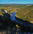
This trail climbs up through some shrubbery to the top of the gorges. You will reach a lone pine tree.
(2) Fork right (after taking a few steps to your left to admire the first view of the gorges). The trail (GR) continues on the ridge, then turns right at a fork offering view of Uzes on your right. You will come out onto a trail 50m further along (sign DFCI-B127)
(3) Turn left on this trail and continue for 900 m until you reach the sign forMenude.
(4) Follow the yellow waymarks to your left, leading to Sanilhac et Sagriès and La Grande Terre (ignore the tracks off to the right and ahead). Further on, you'll see a cairn indicating the starting point of another trail on the left-hand side, ignore it. 20 m further at a fork, follow the trail (GR) to the right. This trail will cross another path: continue straight ahead and at the signGrande Terre, the trail will eventually join the track.
(5) Take the track which bears slightly left towards Sanilhac et Sagriès and Les Condamines for about 300m.
Yellow Waymarks'
(6) At the sign for Les Condamines,turn left onto the trail leading to La Baume. The path takes you through oaks and boxwoods. After leaving this tunnel of vegetation, ignore the path to the left and continue straight ahead.
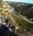
The path heads up to the top of the gorges and turns left. The descent, which is steep in some areas, is equipped with metallic steps. Lower down, depending on the time of year, it is possible to take a path to the right to reach a cave where there are bats. The cave is closed from November 15th to March 15th (hibernation period) and from May 1st to August 15th (breeding period). Continue on to the foot of the Gardon river near the ruins of an old mill (sign for 'La Baume').
(7) From this sign you can make a return journey to Saint-Vérédème Chapel and the cave by walking back up the Gardon river for about 100 m, then continuing up the access track on the right along the cliff.
(7) When back at the 'La Baume' crossing, walk down the Gardon River, still on the left bank towards 'Collias'. The trail winds between areas of forest and the river banks for 5 or 6 km leading to 'Collias'.
Take care when you cross the stony parts, as the path is sometimes hard to see, however the waymarks are still present and you need to follow the river in any case.
(8) After a small section equipped with a metal cable, the track leads past the foot of a 'Via Ferrata' and eventually gets closer to 'Collias'.
(9)At the sign for Saint Vincent, continue straight ahead towards 'Collias', go past a restaurant and walk towards the bridge.
Turn left, just before the bridge, then climb the stairs to the right, leading you to the D3 (Avenue du pont). Turn left towards the car park (S/E).


 un régal super rando avec un peu de route mais rien de méchant 🙂👍
