Tête de Grouvelin and Chaume Francis

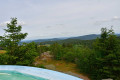
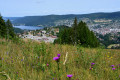
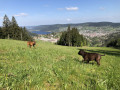
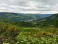
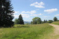
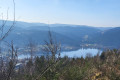
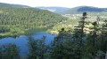
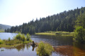
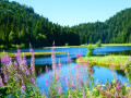
A short hike without too much difficulty, with some steep climbs and descents at times, but easily managed by amateur hikers like us. Beautiful views at the start over the town and Lake Gérardmer, as well as from the Tête du Grouvelin orientation point: a 360° view of the Vosges mountains and, on a clear day, a view of the Swiss Alps. A little surprise at La Chaume Francis, where paragliders were practising on the training slope.

Details

34002986
Creation:
Last update:
Last review:
  • Walking
    Activity: Walking
  • ↔
    Distance: 2.45 mi
  • ◔
    Average duration: 1h 40 
  • ▲
    Difficulty: Easy

  • ⚐
    Back to start: Yes
  • ↗
    Ascent: + 653 ft
  • ↘
    Descent: - 646 ft

  • ▲
    Highest point: 3,734 ft
  • ▼
    Lowest point: 3,087 ft

Photos

Description of the walk

Start from the small car park on the edge of the Route Forestière des Dix-Sept Kilomètres, a road accessible by car or van.

(S/E) Follow the forest road uphill until you reach a three-way junction.

(1) After this short warm-up, turn right onto the Chemin Forestier de la Casevaille; the climb gets steeper. Continue along the Piste Verte de l’Écureuil.

At the car park (with the electricity substation on your right), leave the tarmac and turn left, continuing to follow the Piste Verte de l’Écureuil along the edge of the forest. Further on, leave the track to enter the undergrowth on the right and continue along the path to the Tête de Grouvelin viewpoint/orientation table.

(2) Head down to the left along the Piste Rouge de l’Aigle towards La Chaume Francis. Cross a road (Route Forestière des Dix-Sept Kilomètres) and continue straight ahead down a fairly steep grassy slope. You’ll reach the base of the Tête de Grouvelin chairlift.

(3) Turn left, follow the edge of the forest on your right, then turn right onto the path to enter the woodland.

(4) At the bend, follow the path into the forest on the right and continue uphill along the red trail to rejoin the forest road; the finish line is on the right (S/E).

Waypoints

  1. S/E : mi 0 - alt. 3,251 ft - Car park
  2. 1 : mi 0.27 - alt. 3,320 ft - Three-way junction, on the right
  3. 2 : mi 1.13 - alt. 3,734 ft - Tête de Grouvelin
  4. 3 : mi 1.9 - alt. 3,091 ft - Chairlift departure point, on the left
  5. 4 : mi 2.25 - alt. 3,192 ft - Bend, path on the right
  6. S/E : mi 2.45 - alt. 3,251 ft - Car park

Notes

In winter, the access road to the start is likely to be closed as it leads directly onto the ski runs.

Reviews and comments

3.8 / 5
Based on 4 reviews

Reliability of the description
3.8 / 5
Ease of following the route
3.8 / 5
Route interest
4 / 5
SebMasson
SebMasson

Overall rating : 4.3 / 5

Date of your route : Aug 14, 2024
Reliability of the description : ★★★★★ Very good
Ease of following the route : ★★★★★ Very good
Route interest : ★★★☆☆ Average
Very busy route : No

If you have 20 minutes to spare, start at the bottom of the car park next to the ESF. The climb is steep (about 75 m elevation gain in addition to the hike) then follow the path.
The descent from the top of Grouvelin is steep and uninteresting unless, like us, you have children who want to race down it. Another option after arriving at the chairlift is to continue straight ahead and after 300 metres you will find a very easy trail. Follow it for 700-800 metres downhill. You will arrive at a crossroads with a sign for "chemin raquette" (snowshoe trail). Take this trail and it will take you back to the starting point through the trees and the forest.

Machine-translated

kikidu88
kikidu88

Hello and thank you, pchaffin, for your feedback on the hike. You're right, there are some steep climbs as mentioned, but also a good descent! I had included an alternative route via the blue trail, but unfortunately deleted it when I published the post. I hope to see you on the trail soon.

Hello muesli62, I don't understand why you had trouble finding the start of the hike! It's probably just a lack of experience with the app, because you can get the GPS coordinates by simply tapping on the S/E button. I wouldn't want to go orienteering with you 😂. If the trails aren't marked, that's normal, as it's to discourage tourists, because we've had too many in recent years 😜. Have a great walk!

Machine-translated

Pchaffin
Pchaffin

Overall rating : 4 / 5

Date of your route : Oct 16, 2023
Reliability of the description : ★★★★☆ Good
Ease of following the route : ★★★★☆ Good
Route interest : ★★★★☆ Good
Very busy route : No

We really enjoyed this hike, but it wasn't really that easy. We're young, but I can see how some people might find the descent down the red trail quite tricky, as well as the climb up the Loup before reaching the small path. But we'll definitely be back.

Machine-translated

Muesli62
Muesli62

Overall rating : 3.3 / 5

Date of your route : Jul 20, 2023
Reliability of the description : ★★☆☆☆ Disappointing
Ease of following the route : ★★★☆☆ Average
Route interest : ★★★★★ Very good
Very busy route : No

The orientation table at the head of Le Grouvelin is definitely worth a look!
However, it's not easy to find the start of the route from Gérardmer!
"Small car park on the edge of the 17 km forest road"... Pff... given the length of this road and the big loop it makes... Not all hikers are necessarily from the area!
Then, and this is a criticism, not of Visorando, but of the ski resorts in the Vosges: there's more to the Vosges than skiing! There are also hikers, all year round, but for them, there are absolutely no signs... it's 'find your own way'! There are names for all the ski slopes, of course, but not a single sign to tell hikers where to find the 'tête du Grouvelin'... Really disappointing!

Machine-translated

kikidu88
kikidu88

Hello, thank you for your feedback. I had included option n*2 via the blue trail, which also leads to Chaume Francis (much less steep), but it was removed by Visorando when the map was published! That's a shame. Enjoy your walks and see you on the trails.

Machine-translated

Ray48
Ray48

Overall rating : 3.7 / 5

Date of your route : Jun 27, 2023
Reliability of the description : ★★★★☆ Good
Ease of following the route : ★★★☆☆ Average
Route interest : ★★★★☆ Good
Very busy route : No

Nice route, but the descent via the red trail from Tête de Grouvelin is too steep if you're not very agile. It's better to stick to the marked trails (red circle and green rectangle).

Machine-translated

Other walks in the area

For more walks, use our search engine .

The GPS track and description are the property of this route's author. Please do not copy them without permission.